


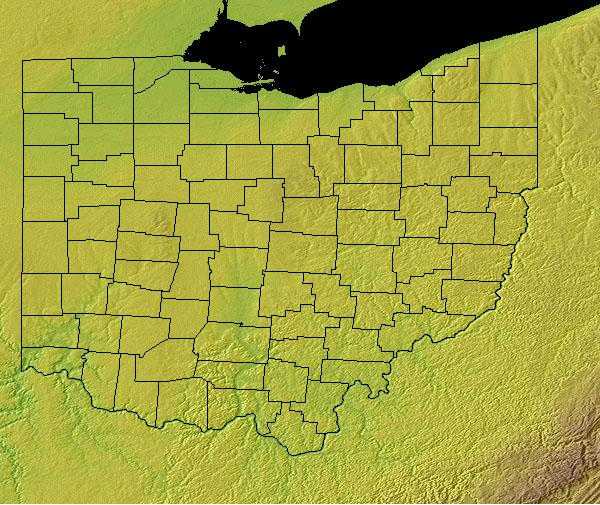
Ohio Geography: The Land
Geography and Landforms of Ohio
 Find
an overview of Ohio geography, topography, geographic land regions, land areas, and major rivers.
Find
an overview of Ohio geography, topography, geographic land regions, land areas, and major rivers.
Access Ohio almanac furnishing more details on the state geography, geographical and land regions, climate and weather, elevation, land areas, bordering states, and other statistical data.
During the past two million years, glaciers have
shaped and reshaped the surface of Ohio several times. These continental masses of ice affected as much as two-thirds of the state. Moving from the
north and northwest, glaciers have scraped and flattened the landscape. Often more than a mile thick, they smoothed existing hills and filled valleys
with enormous amounts of rocks, gravel, and smaller particles.
Through these actions, glaciers have had a very important impact on the agriculture of Ohio. Their activity has been felt in two noticeable ways: shaping
the ground upon which people work and build, and forming the soils that cover that ground. One of the most dramatic remains of glaciers in Ohio can
be seen at the Glacial Grooves State Memorial on Kelley's Island in Lake Erie. Rocks and gravel embedded in the glacial ice ground away rock leaving
scratches and grooves in the bedrock. The part of Ohio that was covered by glaciers includes about two-thirds of the northern and western parts of
the state. Most of southeastern Ohio was not covered by glaciers. In glaciated Ohio, the surface of the land usually is fairly level or gently rolling.
On the other hand, steep ridges, hills and shaded valleys, characterize un-glaciated Ohio.
Ohio Highest, Lowest, & Mean Elevations |
|
|---|---|
| Mean Elevation | 850 ft. |
| Highest Point | Campbell Hill 1,549 ft. |
| Lowest Point | Ohio River 455 ft. |
Ohio Land Area (Square Miles) |
|
| Geographic Center | In Delaware County, 25 mi. NNE of Columbus Longitude: 82° 44.5'W Latitude: 40° 21.7'N |
| Total Area | 44,824.90 sq. mi. 34th |
| Land Area | 40,948.38 sq. mi. 91.36% |
| Water Area | 3,876.53 sq. mi. 8.64% |
| Forested Land Area | 30% |
| Dimensions (Length - Width) |
220 miles - 220 miles |
Ohio: Physiographic Regions
The physiographic features of Ohio have strongly influenced its patterns of human settlement and land use. In most of the state, the topography, river systems, groundwater, and soils are the products of glacial activity. Ohio's topography consists of rolling plains for the most part. In the north, Ohio borders Lake Erie.
- The Great Lakes Plains .
- The Till Plains .
- The Appalachian Plateau
- The Bluegrass Region
- Lake Erie Shoreline
Great Lakes Plains
This region runs along the Great Lakes from Wisconsin to Ohio. The area along Lake Erie is referred to as the Lake Erie Plains. It expands about ten miles south into Ohio from the banks of the lake. This fertile lowland widens as it rolls west until it is more than fifty miles wide in the Maumee Valley.
The Upper Great Lakes Plain covers the southern half of Michigan, northwest Ohio, northern Indiana, northern Illinois, southern Wisconsin, and small
portions of southwest Minnesota and northwest Iowa. Glacial moraines and dissected plateaus are characteristic of the topography. Broadleaf forests,
oak savannahs, and a variety of prairie communities are the natural vegetation types. A "Driftless Area" was not glaciated during the late
Pleistocene and emerged as a unique area of great biological diversity.
The Lower Peninsula is fairly level but some low rolling hills can be found in the south. To the north this changes to a northern tableland of hilly
belts. The lowest point in Michigan, along the shore of Lake Erie is found in the Lower Peninsula.
Till Plains
The Till Plains are located south of the Lake Erie Plains in western Ohio. It is a gently rolling landscape and is one of the most fertile farming regions in the United States. The Till Plains is the beginning of the Corn Belt. The highest point in Ohio is Campbell Hill (1,550 feet above sea level) is in Logan County. The land slopes downward to the southwestern corner of the state to the lowest point of Ohio, the Ohio River.
Appalachian Plateau
This area is south of the Lake Erie Plains and covers the eastern half of Ohio. This part of Ohio is abundant with mineral deposits. The north part of the Appalachian Plateau is rolling hills and valleys and the south part is made up of steep hills and valleys and is the most rugged part of the state.
The Allegheny Plateau covers much of west-central Pennsylvania, the southern tier of New York to the base of the Adirondack Mt., and a portion of northeast Ohio. This area consists primarily of extensively forested uplands, including the Catskill Mountains in NY, Pocono Mountains in PA, and Allegheny National Forest in both states. This is a transitional area dominated by oak-hickory forests towards the south and beech-maple forests towards the north. White pine and hemlocks also are an important component of the forests, more so historically. Small but important patches of spruce-fir forest occur on the Catskill High Peaks and at a few sites in northeastern PA. Several major river valleys dissect the highlands, and the Finger Lakes of central NY drain the northern portion of the physiographic area towards Lake Ontario. Roughly 70% of this area is forested today, with agriculture dominating primarily at lower elevations in western New York, the Susquehanna River valley, and in Ohio.
Bluegrass Region
The Bluegrass Region consists of hilly and gently rolling land. It is a small, triangular area of land in the south of Ohio. The land is not fertile.
Lake Erie Shoreline
The Lake Erie Shoreline is 312 miles. The eastern shoreline consists of ten to eighteen foot clay bluffs. The western shoreline consists of beaches of clay and sand.
Ohio Landscape and Landforms:
Interior Low Plateaus
The Interior Low Plateaus constitute a diverse landscape that extends from north Alabama across central Tennessee and Kentucky into southern Illinois, Indiana, and Ohio. It consists of six distinct subregions: the Shawnee Hills, Bluegrass region, Western Highland Rim, Central Basin, Eastern Highland Rim, and Tennessee Valley. Its hilly topography sets it apart from the Coastal Plain to the south and Prairie Peninsula to the north. To the west, the valley of the Mississippi River separates the Interior Low Plateaus from the Ozark Highlands, the two of which share many similarities. Western mesophytic, oak-hickory, and beech-maple forests were historically the most abundant cover types. There were also tallgrass prairie elements in the north and northwest, oak savannahs in the Bluegrass and other northern sections, barrens and glades in central regions, and forested wetlands along major waterways
Ohio Hills
Landforms within the Ohio Hills consist primarily of dissected, unglaciated plateaus ranging in elevation from 150 m to 450 m, with some valleys as low as 100 m and some mountainous areas reaching 1,100 m. A majority of the planning unit was dominated historically by oak-hickory forests; today these cover roughly 4.3 million ha (10.7 million ac), or 54% of the physiographic area. Numerous patches of northern hardwood forest occur on north-facing hillsides, particularly near the edges of the Allegheny Mountains in West Virginia and Allegheny Plateau in Ohio. Historically, oak-hickory and oak-pine regeneration was dependent on fire, and recent policies of fires suppression in the southern Appalachians has had major (primarily negative) effects on native forest composition and structure. Human populations are relatively sparse through most the physiographic area and are largely confined to the larger valleys; Pittsburgh, PA and Morgantown, WV are the largest cities. Roughly 40% of the physiographic area is in agricultural production or urban development, mostly in the northern half. Timber extraction has been a major activity throughout the history of this region, and it continues to be important on both public (10% of area) and privately owned forest lands. Extraction of minerals, oil and gas, and coal are also important land uses throughout this region, with a new wave of mining underway in the form of highly destructive mountaintop removal.
Prairie Peninsula
The Prairie Peninsula stretches from northeastern Missouri, across much of Illinois and through the middle of Indiana into Ohio. It is a gently rolling glacial plain in the west, but becomes flatter to the east, where prairie and oak openings were embedded in beech-maple forest. Tallgrass prairie, savannah, and forest habitats were interspersed throughout the Prairie Peninsula, although the percentage of prairie declined from west to east. Savannah occurred in transition zones between grasslands and forest, although the extent of savannah varied temporally and spatially with climatic conditions and other ecological influences. Vegetation patterns were influenced primarily by fire, many of which in recent centuries apparently were set by Amerindians.

