


Click Image to Enlarge
Ohio Counties
There is eighty-eight counties in the state of Ohio. Washington County the oldest in the state established on July 27, 1788. Noble County was formed on March 11, 1851 from portions of Guernsey, Morgan, Monroe and Washington counties. It was the last county to be formed in Ohio and, therefore, represents the youngest county in the state.Fulton County, Ohio
Fulton County Education, Geography, and History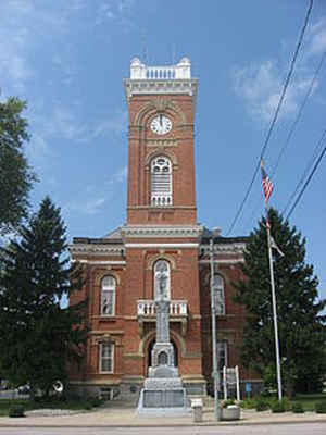
Fulton County is a county located in the state of Ohio. Based on the 2010 census, the population was 42,698. Its county seat is Wauseon.
The county was created in 1850 with land from Henry, Lucas, and Williams counties and is named for Robert Fulton, inventor of the steamboat.
Fulton County is part of the Toledo, OH Metropolitan Statistical Area.
Etymology - Origin of Fulton County Name
Residents chose the name Fulton in honor of Robert Fulton, the inventor of the first economically-viable, commercial steamboat.
Demographics:
County QuickFacts: CensusBureau Quick Facts
Fulton County History
On February 20, 1850, the Ohio government established Fulton County. Residents chose the name Fulton in honor of Robert Fulton, the inventor of the first economically-viable, commercial steamboat. Fulton County was part of the territory that came under dispute between Ohio and Michigan during the
"Toledo War."
Fulton County is located in the northeastern portion of Ohio. The county's northern border helps form Ohio's boundary with Michigan. The county seat is Wauseon. Wauseon is the county's largest population center, with 7,091 residents in 2000. The county's next largest community is Swan Creek
Township, with a population of approximately 6,300 people in 2000. The county experienced just over a nine percent increase in population between 1990 and 2000, raising the total population to 42,084 residents. This increase was primarily due to the close proximity to Toledo - fifteen miles east of
Fulton County. Many Toledo residents migrated out of the city to live to escape the city's busyness. On average, 103 people live in each of Fulton County's 407 square miles.
Fulton County is heavily rural, with urban areas comprising less than one percent of the county's land mass. Most residents find employment in manufacturing establishments, with sales and service-oriented positions falling a distant second and third. The main products manufactured in the county are
steel, aluminum, office furniture, and flashlights. Interestingly, an Archbold plant claims to process the most canned Chinese food of any single location in the entire world. The county's average income was approximately twenty-five thousand dollars per person in 1999, with less than six percent of
the population living in poverty.
Most voters in Fulton County claim to be independents, yet in recent years, they have overwhelmingly supported Republican candidates at the national level.
Sources
Fulton County, Ohio History Central, July 23, 2008,
http://www.ohiohistorycentral.org/entry.php?rec=1930&nm=Fulton-County
Geography: Land and Water
As reported by the Census Bureau, the county has a total area of 407 square miles (1,050 km2), of which 405 square miles (1,050 km2) is
land and 1.8 square miles (4.7 km2) (0.4%) is water
Neighboring Counties
Bordering counties are as follows:
- Lenawee County, Michigan (north)
- Lucas County (east)
- Henry County (south)
- Williams County (west)
Hillsdale County, Michigan (northwest)
Education


Click Image to Enlarge
