


Click Image to Enlarge
Ohio Counties
There is eighty-eight counties in the state of Ohio. Washington County the oldest in the state established on July 27, 1788. Noble County was formed on March 11, 1851 from portions of Guernsey, Morgan, Monroe and Washington counties. It was the last county to be formed in Ohio and, therefore, represents the youngest county in the state.Medina County, Ohio
Medina County Education, Geography, and History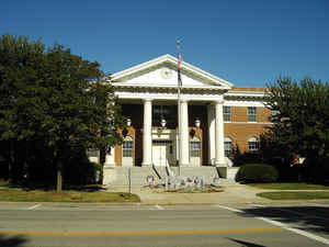
Medina County is a county in the state of Ohio. Based on the 2010 census, the population was 172,332. Its county seat is Medina. The
county was created in 1812 and later organized in 1818. It is named for Medina in Saudi Arabia, though the "I" in it is pronounced as in
"dine."
Medina County is part of the Cleveland-Elyria, OH Metropolitan Statistical Area, although some sections have closer ties to the Akron area.
Etymology - Origin of Medina County Name
The county was named for the Arabian city of Medina, the former home of the Islamic faith's prophet Mohammed.
Demographics:
County QuickFacts: CensusBureau Quick Facts
Medina County History
On February 12, 1812, the Ohio government authorized the creation of Medina County. It originally was a portion of the Connecticut Western Reserve. The county was named for the Arabian city of Medina, the former home of the Islamic faith's prophet Mohammed. Due to a large number of wild animals,
in 1818, county residents participated in what became known as the "Great Hinckley Hunt."Six hundred men spent Christmas day hunting the local wildlife. The men consumed many of the animals that they killed. The rest froze, and once Spring arrived, the thawing animals attracted buzzards. Since
1819, buzzards return to Hinckley exactly upon March 15.
Medina County is located in northern Ohio and covers 422 square miles. The county has grown in recent years, as residents of nearby Cleveland in Cuyahoga County have moved to Medina and surrounding counties to escape the busyness of the city. Between 1990 and 2000, Medina County's population
increased by 23.5 percent to a total of 151,095 residents in 2000. Medina is the county seat and the largest community in the county, with 33,388 residents in 2000. The county averages 358 residents per square mile.
Medina County is overwhelmingly rural, with only five percent of the county deemed to be urban, but most residents earn their livings by working in sales, service, or manufacturing positions. Farming ranks fifth. Beginning in the late 1860s, bee-keeping became a major industry in the county. The
county's average income was almost twenty-nine thousand dollars per person in 1999, with 4.9 percent of the population living in poverty.
Most voters in Medina County claim to be independents, yet in recent years, they have overwhelmingly supported Republican candidates at the national level.
Michigan Governor Russell A. Alger and poet Edith Thomas were both residents of the county.
Sources
Medina County, Ohio History Central, July 24, 2008,
http://www.ohiohistorycentral.org/entry.php?rec=1974&nm=Medina-County
Geography: Land and Water
As reported by the Census Bureau, the county has a total area of 423 square miles (1,100 km2), of which 421 square miles (1,090 km2) is land and 1.7 square miles (4.4 km2) (0.4%) is water.
Neighboring Counties
Bordering counties are as follows:
- Cuyahoga County (northeast)
- Summit County (east)
- Wayne County (south)
- Ashland County (southwest)
- Lorain County (northwest)
Education


Click Image to Enlarge
