


Click Image to Enlarge
Virginia Counties
The Commonwealth of Virginia is divided into ninety-five counties and thirty-eight independent cities, which are considered county-equivalents for census purposes.City of Falls Church, Virginia
City of Falls Church Education, Geography, and History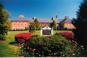
Falls Church, officially the City of Falls Church, is an independent city in the state of Virginia. Based on the 2010 census,
the population was 12,332.
Taking its name from The Falls Church, an 18th-century Anglican parish, Falls Church gained township status within Fairfax County in 1875.
In 1948, it was incorporated as the City of Falls Church, an independent city with county-level governance status.It is also referred to
as Falls Church City.
Falls Church is included in the Washington-Arlington-Alexandria, DC-VA-MD-WV Metropolitan Statistical Area.
Etymology - Origin of City of Falls Church Name
The church from which the city takes its name was first built in 1734 of wood to serve Truro Parish, which had been formed two years earlier from a larger parish centered in Quantico. George Washington was one of the churchwardens. By 1757, the building was commonly known as "The Falls Church", as it was along the main north-south road to the Great Falls on the Potomac.
Demographics:
County QuickFacts: City of Falls Church
Falls Church City History
Falls Church dates back to the late 1600s as an early Colonial settlement shared with Native Americans. The community was established around The Falls Church (Episcopal) that was founded in 1734. Falls Church became a township in 1875 and an independent city in 1948, when parents successfully obtained its separation from Fairfax County in an effort to establish a highly acclaimed school system. More information about the City's storied past is available at the Mary Riley Styles Public Library Local History Room.
Falls Church, Virginia established in 1850. [Virginia Genealogy, Sources & Resources, by Carol McGinnis, Genealogical Publishing Inc., Baltimore, MD, 1993.]
Falls Church, Virginia was incorporated as a town in 1875 and incorporated as a city in 1948. Located in Fairfax County, Virginia. Established in 1850. [Virginia Genealogy, Sources & Resources, by Carol McGinnis, Genealogical Publishing Inc., Baltimore, MD, 1993.]
For thousands of years, up to about 1667, Native Americans inhabited the area in and around present-day Falls
Church. Today's Broad Street and Great Falls Street follow their prehistoric footpaths.
In the late 17th century, settlers from the Tidewater region of Virginia began to migrate to the area. The former
"Big Chimneys" house, located on Annandale Road about a block west of Maple Ave., was built in 1699. Thus 1699 is
generally accepted as the founding date of Falls Church.
The church from which the city takes its name was first built in 1734 of wood to serve Truro Parish, which had been
formed two years earlier from a larger parish centered in Quantico. George Washington was one of the churchwardens.
By 1757, the building was commonly known as "The Falls Church", as it was along the main north-south road to the
Great Falls on the Potomac. The present-day brick church, designed by James Wren replaced the wooden one in 1769, at
which point it became the seat of the newly-formed Fairfax Parish.
By the start of the American Civil War, Falls Church had seen an influx of Northerners seeking land and better
weather. Thus the township's vote for Virginian secession was about 75% for, 25% against. The town changed hands
several times during the early years of the war. Confederate General James Longstreet was headquartered at Home Hill
(now the Lawton House on Lawton Street) following the First Battle of Manassas. The world's first wartime aerial
reconnaissance was carried out from Taylor's Tavern (near Seven Corners) by Thaddeus Lowe and his hot-air balloon.
Falls Church later became the world's first target of an aerially-directed bombardment, courtesy of Lowe and his
balloon.
Following Reconstruction, Falls Church was a sleepy rural community. It gained township status in 1875. Its first
mayor after this status was Dr. John Joseph Moran, known as the attending physician when Edgar Allan Poe died. A
1915 law passed by Commonwealth allowing segregation led to the establishment of the NAACP's first rural chapter,
which successfully prevented the measure from being enforced in the area. In 1948, Falls Church became an
independent city in order to control its own school system.
Geography: Land and Water
As reported by the Census Bureau, the city has a total area of 2.2 square miles (5.2 km2), all of it land.
The City is part of the Washington, D.C. Metropolitan Statistical Area, and is located only six miles from the
Nation's Capital and inside the Capital Beltway. The City's downtown is situated at the intersection of Virginia
Route 7 and US Route 29. The City is served by Interstate 66, the East Falls Church and West Falls Church Metro
stations, and by several convenient bus routes.
Falls Church is the smallest county-level political subdivision in the United States by area and the smallest by
size in Virginia. The smallest independent city by population in Virginia is the City of Norton.
Neighboring Counties
Bordering counties are as follows:
- While parts of neighboring Fairfax County share the Falls Church mailing address, the city remains an independent city. Falls Church also borders Arlington County.
Education
The city is served by Falls Church City Public Schools


Click Image to Enlarge
