


Click Image to Enlarge
Virginia Counties
The Commonwealth of Virginia is divided into ninety-five counties and thirty-eight independent cities, which are considered county-equivalents for census purposes.City of Waynesboro, Virginia
City of Waynesboro Education, Geography, and History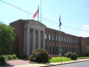
Waynesboro (formerly Flack), is an independent city in the state of Virginia. Based on the 2010 census, the population was 21,006.
The city is surrounded by Augusta County and is named for General Anthony Wayne.
Waynesboro is a principal city of the Staunton-Waynesboro Metropolitan Statistical Area, which includes all of Augusta County and the
independent cities of Staunton and Waynesboro.
Etymology - Origin of City of Waynesboro Name
The City of Waynesboro, in Augusta County, was named for Anthony Wayne, an American general during the Revolution. James Flack and Samuel Estill laid out the town in 1797.
Demographics:
County QuickFacts: City of Waynesboro
Waynesboro City History
Waynesboro, deriving its name from General Anthony Wayne or possibly Wayne's family home, is an independent city located within the confines of Augusta County in the US state of Virginia.
Located in the British Colony of Virginia, before the American Revolution and shortly thereafter independence and
statehood for the Commonwealth of Virginia, the areas west of the Appalachian and Blue Ridge Mountains were known as
the frontier. Travel over the mountains in a wagon was near impossible, except where nature afforded some gap
between them. One such wind gap, Rockfish Gap, is located near Waynesboro, making the area a convenient location for
a stop for many who wished to venture west.
The area was commonly referred to as Teasville (or Teesville) early on. There are a couple of theories of why it was
called that. First, it was named after the tavern owned by Jacob Teas and his wife. It is believed that many stayed
the night at the Teas' tavern, including George Washington, Thomas Jefferson, and the Marquee de Chastellux. (It is
only fair to point out that there are few taverns of this period in which Washington and Jefferson are not claimed
to have visited). In a letter from the Marquee de Chastellux, the Marquee describes the tavern as one of the worst
in America and affirms that Jefferson had stayed there and told him of the place. Second, it was names after the
Tees brothers.
Shortly after US Army General Anthony Wayne's important victory at Battle of Fallen Timbers in 1794 during the
Northwest Indian War, the area began to be called Waynesborough. Since many settlers to the area were from
Pennsylvania, it is no small wonder that they would want their new land named after a hero from their home. Sometime
after, it was called Waynesboro.
As early as 1798, the current downtown area was plotted and sold. On January 8, 1801, the town Waynesborough was
officially recognized by the state of Virginia, and was incorporated by 1834.
Since 1924, Waynesboro has made numerous territorial acquisitions from areas of Augusta County through annexation and officially became an independent city in 1948. In 2005, Waynesboro established a new charter, repealing one in place since 1948.
Waynesboro, Virginia laid out in 1797. [Virginia Genealogy, Sources & Resources, by Carol McGinnis, Genealogical Publishing Inc., Baltimore, MD, 1993.]
Waynesboro, Virginia established as a town on 8 January 1801. [Virginia Genealogy, Sources & Resources, by Carol McGinnis, Genealogical Publishing Inc., Baltimore, MD, 1993.]
Waynesboro, Virginia was incorporated as a town 1834. Established on 8 January 1801. Incorporated as a city on 31 December 1947. Merged with Basic City in 1923. Also called Teasville and Waynesborough in its early days. [Virginia Genealogy, Sources & Resources, by Carol McGinnis, Genealogical Publishing Inc., Baltimore, MD, 1993.]
Geography: Land and Water
The City of Waynesboro is centrally located in the eastern portion of Virginia's scenic and historic Shenandoah Valley, just 90 miles northwest of the state capital of Richmond and 125 miles southwest of the nation's capital Washington DC. The City covers an area of approximately 15 square miles.
Waynesboro is 1,305 feet above sea level.
As reported by the Census Bureau, the city has a total area of 15.4 square miles (39.8 km2), of which,
15.4 square miles (39.8 km2) of it is land and 0.04 square miles (0.1 km2) of it (0.13%) is water.
Neighboring Counties
Bordering counties are as follows:
- Lcated within the confines of Augusta County
Education
Waynesboro is the home of Fishburne Military School, an all-male military boarding school for grades 8-12. It sits on a hill
overlooking the downtown area.
The Waynesboro City Public Schools system serves the area.


Click Image to Enlarge
