


Click Image to Enlarge
Virginia Counties
The Commonwealth of Virginia is divided into ninety-five counties and thirty-eight independent cities, which are considered county-equivalents for census purposes.Nottoway County, Virginia
Nottoway County Education, Geography, and History
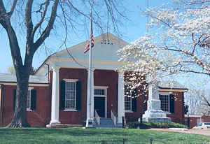
Nottoway County is a county located in the Commonwealth of Virginia. Based on the 2010 census, the population was 15,853. Its county seat is Nottoway. It is situated south of the James River, thus making it a part of the Southside Virginia Region.
Etymology - Origin of Nottoway County Name
Prior to the arrival of European settlers, the land that would become Nottoway County was inhabited by American Indians of the Nadowa tribe, an Iroquoian people. They lived along the county's only river, the Nadowa, an Algonquian word meaning rattlesnake, and became associated with the area they inhabited. The name was anglicized to ‘Nottoway', and from this the name of the county was derived. The people of this "Nottoway Tribe", now numbering between 400 and 500, call themselves Cheroenhaka, meaning "People At The Fork Of The Stream".
Demographics:
County QuickFacts: CensusBureau Quick Facts
Nottoway County History
Nottoway County, Virginia formed from Amelia County. Legislative enactment in 1788. Organized in 1789. [Virginia Counties: Those Resulting from Virginia Legislation, by Morgan Poitiaux Robinson, originally published as Bulletin of the Virginia State Library, Volume 9, January, April, July 1916, reprinted 1992 by Genealogical Publishing Co., Inc., Baltimore, MD.]
Nottoway County was named for the Nadowa Indian tribe. The word nadowa, anglicized to nottoway, means snake, or enemy. The county was formed from Amelia County in 1788. Its area is 308 square miles, and the county seat is Nottoway.
Geography: Land and Water
As reported by the Census Bureau, the county has a total area of 316 square miles (819 km2), of which, 315
square miles (815 km2) of it is land and 1 square miles (4 km2) of it (0.46%) is water.
Neighboring Counties
Bordering counties are as follows:
- Amelia County, VA to the north
- Brunswick County, VA to the south
- Dinwiddie County, VA to the east
- Lunenburg County, VA to the south
- Prince Edward County, VA to the west
Education


Click Image to Enlarge
