

Click Image to Enlarge
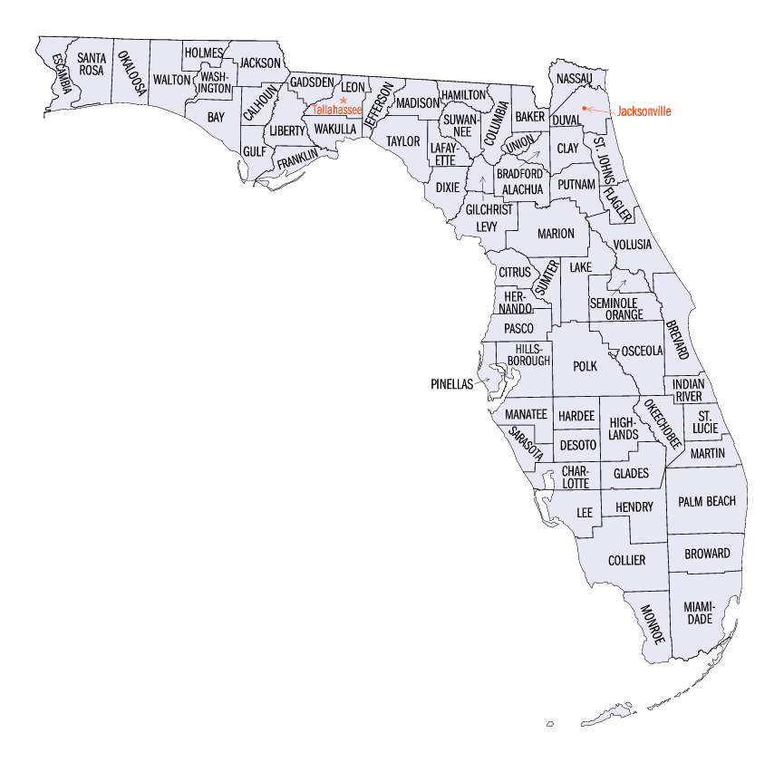
Florida Counties
There are sixty-seven counties in the state of Florida. In 1821, there were only two Counties in Florida: Escambia to the west and St. Johns to the east. From these two Counties were formed 67 today. Its last county was created in 1925 with the formation of Gilchrist County from a segment of Alachua County.Brevard County, Florida
Brevard County Education, Geography, and History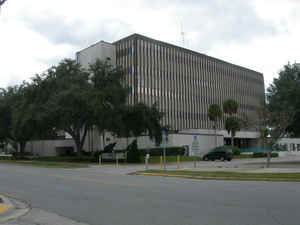
Brevard County is a county in the state of Florida. Based on the 2010 census, the population was 543,376. Brevard County was created on January 6, 1844 from Mosquito County (originally named Formerly St. Lucie County until January 6, 1855). The official county seat has been located in Titusville since 1894. This county is named for Theodore Washington Brevard, early settler and later state comptroller from 1853 to 1861.
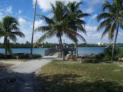
Brevard County comprises the Palm Bay-Melbourne-Titusville, FL Metropolitan Statistical Area. It is located along the east Florida coast along the Atlantic Ocean.
Etymology - Origin of Brevard County Name
Brevard county is named for Doctor Ephriam Brevard, writer of the so-called Mecklenberg (N.C.) Declaration of Independence, or Theodore Washington Brevard, state comptroller, 1854, 1855-1860. This county was St. Lucia county from 1844 to 1855.
Demographics:
County QuickFacts: CensusBureau Quick Facts
Brevard County History
Brevard County was established by an act of the Florida Legislature in 1854, actually signed into law by the Governor
early in 1855. The initial boundaries of the new county incorporated all of what had been St. Lucie County. At that
time, Brevard extended southward along the state's Atlantic east coast all the way down to present day Miami-Dade County
in south Florida. The origin of the county's name is widely attributed to Theodore W. Brevard, Florida Comptroller at
the time of the county's creation. In the decades after it was first established, the boundaries of Brevard County were
amended several times. It took on its current shape in 1905.
The earliest inhabitants of the Indian River region now called Brevard County were Native Americans who ventured into
the area perhaps as long as 12,000 years ago. The descendants of these people became more settled, and began societies
based on living off the resources of the Indian River Lagoon, the St. Johns River, and the surrounding coastal highlands
and high points within the river basins. Known collectively as the archaic people, these are the humans who inhabited
the Windover Archeological site in north Brevard County. Still later, their descendants became diversified into distinct
tribes, the Ais and the Timucuans, which lived along the shores of the Indian River lagoon and left behind huge mounds
of discarded shellfish, animal bones, and fractured pottery. These were the native peoples who were encountered by the
first Europeans. Many sites evidencing these first inhabitants remain scattered through our county and some have been
well preserved on public lands.
Early Spanish explorers sailed along the Brevard County coastline and gave Cape Canaveral its name. There are
well-documented accounts of European shipwreck survivors traveling among the native tribes in this region, and the well
known adventure of Jonathon Dickinson, who kept a journal.
The area would remain largely unsettled, except for a failed attempt by Andrew Turnbull to establish an
agricultural colony, until after the US Army and Florida Militia established supply posts and routes through the
county during the Second Seminole War. As this conflict unfolded in 1835, the only known inhabitants of the present-day
Brevard County area were Seminole Indians.
Fort Ann was established late in 1837 as an important supply depot on the east shore of the Indian River near the boat
haul over point on a narrow strip of Merritt Island. Florida militia commander General Joseph Hernandez and his force
encamped in the general vicinity of Mims and constructed a wagon road southward to Fort Capron and Fort Pierce that
became known as the "Hernandez Trail."
As armed conflict with the Seminoles slowly dwindled to a stalemate, with remaining holdouts of the tribe hidden but
considered harmless in the vast Everglades to the south, adventuring pioneers like Douglas Dummitt and Mills Burnham
began to establish new lives and homes on the Indian River frontier. A colony of settler families seeking land grants
under the armed occupation act held home sites in the southern portion of our region until a sudden Indian scare
prompted their hasty abandonment for fear of a massacre.
Gradually, pioneers trickled in and in the 1850s a small community was emerging in the vicinity of Sand Point, then a
part of Volusia County and now the site of Titusville. By 1860, families were also settling the area around what would
become Eau Gallie. The region remained very sparsely settled throughout the Civil War, though some of its men were
recruited into Confederate service and died for the Southern cause.
The Indian River region really began to open up to settlement immediate following the Civil War, when defeated Southern
soldiers and northern veterans as well moved their families to the unoccupied frontier to seek new lives and
opportunity.
The towns of Titusville, Rockledge, and soon Melbourne, began to emerge and grow as trading, fishing, and agricultural
centers along the Indian River. Primary transportation between the communities was by water. In 1877, Captain Lund
brought the steamboat Pioneer to the Indian River to commence an era of commercial steamboat transportation that would
extend into the early 20th century. By the mid 1880s, railroad transportation had arrived in Titusville, and soon the
Flagler line extended the rail line southward through the entire county. Improved transportation brought still more
settlers, and thousands of winter tourists.
Commercial fishing, citrus agriculture, resort tourism, and a variety of smaller industries continued to fuel the area's
economy and growth until World War II. In the years immediately following the end of the war, the undeveloped coastal
scrub of Cape Canaveral became the home to America's missile testing program, and by the 1960s, the home of America's
human space flight program and the launch site for the first US astronauts. Soon, the nation's investment in a major
launch complex at the Kennedy Space Center to meet the challenge of sending American's to the moon, coupled with the
continuing role of Cape Canaveral in America's missile development effort, produced a boom in population growth and
development that continues to influence the region today.
Geography: Land and Water
As reported by the Census Bureau, the county has a total area of 1,557 square miles (4,032 km2), of which, 1,018 square miles (2,637 km2) of it is land and 539 square miles (1,395 km2) of it (34.60%) is water, primarily the Atlantic Ocean, the St. John's River and the Indian River Lagoon.
Brevard county is located close to the center of Florida. Marshes in
the western part of this county are the source of the St. Johns River.
The county is unofficially divided into three sections: North County,
Central Brevard, and South County.
Neighboring Counties
Bordering counties are as follows:
- North: Volusia County
- East: North Atlantic Ocean
- South: Indian River County
- West: Osceola County; Orange County
- Northwest: Seminole County
Education
Higher education is provided by Eastern Florida State College (EFSC) and Florida Institute of Technology. There are satellite campuses for
the University of Central Florida, Barry University, Embryâ?#8218;??#8364;œRiddle Aeronautical University, Keiser University, and Webster University.
Elementary and secondary education is provided by the Brevard Public Schools and private schools.
In 2011, six public schools were ranked by the state in the top ten schools in the state, out of 2,800 There was one list each for primary and
secondary schools


Click Image to Enlarge
