


Florida Geography: The Land
Geography and Landforms of Florida
Find an overview of Florida geography, topography, geographic land regions, land areas, and major rivers.
Access Florida almanac, furnishing more details on the state geography, geographical and land regions, climate and weather, elevation, land areas, bordering states, and other statistical data.
Florida is 22nd largest of the 50 states, but contains 11,761 square miles covered by water, making it the 3rd "wettest" state behind Alaska and Michigan. Major rivers include the St. Johns, the St. Mary's and the Suwannee River, and major lakes are Lake Okeechobee and Lake George.
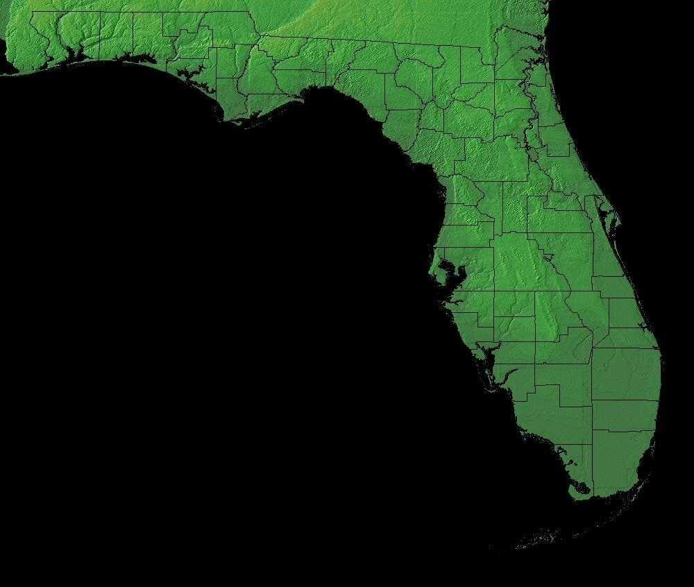
Florida is made up of four geographic land areas:
- The Atlantic Coastal Plain, which stretches from Cape Cod, Massachusetts south and around the Florida Peninsula and the Gulf of Mexico.
- The East Gulf Coastal Plain, a sub-section of the Atlantic Plain, like the Atlantic Coastal Plain, presents itself in two sections of Florida.
- Florida Uplands - The Florida Uplands running about 275 miles west to east, along the northern edge of the Florida Panhandle and then extends south into the central area of the Florida peninsula.
Florida Highest, Lowest, & Mean Elevations |
|
|---|---|
| Mean Elevation | 100 ft. |
| Highest Point | Sec. 30, T6N, R20W, Walton County 4 345 ft |
| Lowest Point | Atlantic Ocean Sea level |
Florida Land Area (Square Miles) |
|
| Geographic Center | In Hernando County, 12 mi. NNW of Brooksville Longitude: 81?#8218;° 37.9'W Latitude: 28?#8218;° 8.0'N |
| Total Area | 65,754.59 sq. mi. 22nd |
| Land Area | 53,926.82 sq. mi. 82.02% |
| Water Area | 11,827.77 sq. mi. 17.98% |
| Forested Land Area | 47% |
| Dimensions (Length - Width) |
500 miles - 160 miles |
Florida: Physiographic Regions
Most of Florida is low-lying plains. The northwestern regions are higher in elevation than the rest of the state. The landscape of Florida comprises four geographical land areas:
- the Atlantic Coastal Plain,
- the East Gulf Coastal Plain
- South Atlantic Coastal Plain
- and the Florida Uplands.
The Atlantic Coastal Plain
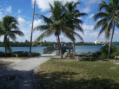
This Plain stretches from Cape Cod, Massachusetts south and around the Florida Peninsula and the Gulf of Mexico. A part of the Atlantic Plain, the Atlantic Coastal Plain completely covers the entire eastern part of Florida. The landscape is low and level and varies from about 30 to 90 miles wide. Off the mainland is a narrow strip of sand bars, coral reefs and barrier islands. Most of southern Florida, 2,746 square miles, is covered by the Big Cypress Swamp and the Florida Everglades. This area is saturated with water, especially during the rainy months. To the south of the mainland, lie the Florida Keys curving out to sea about 150 miles in a southwesterly direction. The largest island of this chain of islands is Key Largo.
The South Atlantic Coastal Plain covers northeastern Florida, the southern half of Georgia and the eastern halves of South Carolina and North Carolina. Its western boundary is the fall line that marks the beginning of the hilly Piedmont and its eastern boundary is the Atlantic Ocean. As part of a continuous Coastal Plain that extends from New York to Texas, it has arbitrary boundaries at the Alabama-Georgia border and at the North Carolina-Virginia border, extending into the southeast corner of Virginia only to capture the very Southeastern Great Dismal Swamp. The southeastern boundary marks a broad transitional zone into Peninsular Florida. The Atlantic coast is lined with barrier islands that support sand dune and maritime forest habitats and are backed by marshland. Estuaries are less saline marsh nearest the coast, and river valleys become increasingly wooded farther inland, supporting significant areas of bottomland hardwood forest. Pocosins and Carolina bays are non-alluvial forested wetlands unique to this physiographic area. Uplands were historically dominated by fire-maintained pine forests, with longleaf nearer the coast and on sandy soils inland and a mixture of shortleaf, loblolly, and hardwoods elsewhere.
East Gulf Coastal Plain
The East Gulf Coastal Plain extends from the Florida Parishes of Louisiana over most of Mississippi, some of western Tennessee and Kentucky, the southwestern 2/3 of Alabama, and the western panhandle of Florida. Its southern boundary is the Gulf of Mexico and its western boundary the drop into the Mississippi Alluvial Valley. On the north it extends to the highlands of the Interior Low Plateaus and southern Appalachians. To the east, there is an arbitrary break with the South Atlantic Coastal Plain at the Alabama-Georgia border south through Florida along the Apalachicola River. The flat to rolling topography is broken by numerous streams and river bottoms. Uplands are dominated by pine, originally longleaf and slash in the south and shortleaf mixed with hardwoods in the north. These are fire-maintained systems that give way to loblolly pine and hardwoods in damper areas and bottomland hardwood forest in extensive lowland drainages.
The East Gulf Coastal Plain, a sub-section of the Atlantic Plain, like the Atlantic Coastal Plain, presents itself in two sections of Florida. The sections are divided by a portion of the Florida Uplands. In southwestern Florida, the East Gulf Coastal Plain extends inland to cover parts of the Big Cypress Swamp and the Everglades. The East Gulf Coastal Plain is similar to the Atlantic Coastal Plain on the other side of the Florida peninsula. Barrier islands run along the west coast of Florida and coastal swampland extends inland. The northern section of the East Gulf Coastal Plain curves around the upper edge of the northeastern Gulf of Mexico at Apalachee Bay and extends west across the Florida panhandle to Florida's western border.
Florida Uplands
The Florida Uplands run about 275 miles west to east, along the northern edge of the Florida Panhandle and then extends south into the central area of the Florida peninsula. The width of the northern Florida Uplands varies from around 30 to 50 miles and is characterized by low rolling hills of red clay. Hard and softwood forests are plentiful. The section of the Florida Uplands that extends south into the peninsula, covers an area about 100 miles wide and 160 miles long. This area extends from the north, south and to the east, to separate the two sections of the East Gulf Coastal Plain and to separate the East Gulf Coastal Plain from the Atlantic Coastal Plain. The landscape in the southern Florida Uplands is characterized by low hills and many lakes. Though the Florida Uplands are only 200-300 feet above sea level, they are still higher than the regions of the Atlantic Coastal Plain and the East Gulf Coastal Plain. The highest point in Florida is found in the Florida Uplands that run along the northern edge of the panhandle. Just south of the Alabama border, west of Paxton, Britton Hill is 345 feet above sea level and is the lowest state high point in the nation.
Florida Landscape and Landforms:
Subtropical Florida
This physiographic area is entirely contained within Florida, and extends from the northern edge of Lake Okeechobee south through the Florida Keys. The region has very little topographic relief, but slight changes in elevation have important consequences for vegetation and the diversity of habitat types. The highest points of elevation are less than 2 meters and correspond with fairly recent shorelines (less than 5,000 years before present). Underlying sediments consist of freshwater marl, peat, freshwater lake and marine sediments, and to a lesser extent, sand deposited during the Pleistocene and Holocene.
The subtropical Florida region can be divided into four smaller sub-regions: 1) the Everglades, 2) Big Cypress, 3) Miami Ridge and Atlantic Coastal
Strip, and 4) Southern Coasts and Islands. The Everglades is the most extensive of these areas, followed by the Big Cypress, Miami Ridge and Southern
Coasts. Across all subregions, much of the physical and ecological characteristics of the region resemble tropical ecosystems where seasonal changes
are reflected by changing rainfall patterns rather than by dramatic temperature changes. Distinctive dry (winter/spring) and wet (summer) seasons occur
annually, and the nesting cycles of many birds are tied to these changes.
At least two major forms of disturbance play key roles in the ecology of the region. Fire is an important feature in many pine dominated communities
and many marsh and prairie communities. Frequent fires are essential in pine-dominated stands and prairies if understory conditions suitable to many
nesting birds are to be maintained. However, the ideal fire frequency in some pine communities is not known. Hurricanes are a second form of disturbance
that less frequently but predictably provide early successional habitats or open forest cover.
Peninsular Florida
This physiographic area is entirely contained within Florida. The area extends from the northern edge of Lake Okeechobee north to the Coastal Plain transitional zone around the Suwanee River in northern Florida. Most of the area is xeric upland on the Central Florida ridge. Habitats there include sandhill, scrub, and xeric hammock communities. Sandhill communities are dependent on frequent fires, and are dominated by longleaf pine and/or turkey oak, with an understory of wiregrass. Scrub communities are temperate or subtropical, with a less frequent occurrence of fire. Dominant vegetation includes sand pine and/or scrub oak. Xeric hammocks are dominated by live oak, sand live oak, laurel oak, and other oaks, with an understory of sparkleberry and saw palmetto. Other upland communities include mesic uplands, dominated by upland hardwoods or mixed hardwood pine forests. Wetlands and mangroves are also locally common to abundant in the physiographic area. Wetlands can include wet flatwoods, wet prairie, and hydric hammocks, as well as floodplain bottomland hardwood forests. Coastal uplands, such as beach dune, coastal berm, coastal grassland, and maritime hammock, are influenced by erosion, deposition, salt spray, and storms.

