


Click Image to Enlarge
Georgia Counties
Georgia is divided into one hundred and fifty-nine counties. The original eight counties of the State of Georgia were Burke, Camden, Chatham, Effingham, Glynn, Liberty, Richmond and Wilkes all created on February 5, 1777. The last new county to be established in Georgia was Peach County, established in 1924.Dawson County, Georgia
Dawson County Education, Geography, and History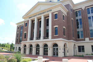
Dawson County is a county located in the state of Georgia. Based on the 2010 census, the
population was 22,330. Dawson County was
created on December 3, 1857 from Gilmer County and Lumpkin
County. The county seat is
Dawsonville. The county is named in honor of William
Crosby Dawson (1798 -1857), a U.S. Senator (1849-1855), and a state
legislator.
Dawson County is included in the Atlanta-Sandy Springs-Roswell, GA Metropolitan Statistical Area.
Etymology - Origin of Dawson County Name
The county is named for Judge William C. Dawson, a compiler of the laws of Georgia and commander of a brigade in the Creek Indian War of 1836.
Demographics:
County QuickFacts: CensusBureau Quick Facts
Dawson County History
Dawson County was created from parts of Lumpkin, Gilmer, and Forsyth counties. Georgia's 118th county, and the county seat of Dawsonville, were named for Judge William C. Dawson, a compiler of the laws of Georgia and commander of a brigade in the Creek
Indian War of 1836. Dawson also served in both houses of the state legislature and in Congress before the Civil War.
Built in 1857, the historic Dawson County Courthouse has been the focus of recent renovation and preservation efforts. A coalition of interested parties, ranging from the local Women's Club to a local builder, have worked on the building.
Points of Interest
Dawson County is home to 729-foot Amicalola Falls, the highest waterfall east of the Rocky Mountains. Amicalola Falls State Park surrounds the falls, and the Amicalola Falls Lodge is located at the top of the falls. The approach trail to the start of the Appalachian Trail on Springer Mountain is
also located in the park.
The Dawson Forest Wildlife Management Area is maintained in Dawson County and provides more than 23,000 acres of hunting, hiking, bird watching, camping and fishing opportunities. The state purchased 2,031 acres along Wildcat Creek at the northwestern end of the wildlife area in 1993 as part of the
Preservation 2000 program.
Lake Sidney Lanier forms Dawson County's southeastern border, providing recreational and economic opportunities for local residents. The completion of Lake Lanier and development of Georgia Highway 400 has spurred growth and development in the county during the past 30 years.
Notable Citizens
NASCAR driver and former Winston Cup Champion Bill Elliott is a native of Dawson County. "Awesome Bill from Dawsonville" has many fans throughout the county, as evidenced by the many shops and storefronts in Dawsonville filled with Bill Elliott and other racing memorabilia.
Geography: Land and Water
As reported by the Census Bureau, the county has a total area of 214 square miles (550 km2), of which 211 square miles (550 km2) is land
and 3.6 square miles (9.3 km2) (1.7%) is water.
Dawson county is located in north Georgia.
Part of Lake Lanier is in the southeastern part of the county and the boundary line with neighboring counties pass through the lake. The
729-foot (222 m) Amicalola Falls, are located in the county. The Amicalola Falls are the highest in Georgia, the tallest cascading waterfall
east of the Mississippi River and are one of the Seven Natural Wonders of Georgia. The highest point in the county is Black Mountain, with an
elevation of 3,600 feet (1,100 m). 6,760 acres (27.4 km2), which is located in the Chattahoochee National Forest. The Chestatee and Etowah
rivers flow through Dawson County.
Most of Dawson is in the Coosa River basin, with the southeastern portion of Dawson in the Chattahoochee River basin.
Neighboring Counties
Bordering counties are as follows:
- Northeast: Lumpkin County
- Southeast: Hall County
- South: Forsyth County
- Southwest: Cherokee County
- West: Pickens County
- Northwest: Gilmer County; Fannin County
Education


Click Image to Enlarge
