


Click Image to Enlarge
Georgia Counties
Georgia is divided into one hundred and fifty-nine counties. The original eight counties of the State of Georgia were Burke, Camden, Chatham, Effingham, Glynn, Liberty, Richmond and Wilkes all created on February 5, 1777. The last new county to be established in Georgia was Peach County, established in 1924.Douglas County, Georgia
Douglas County Education, Geography, and History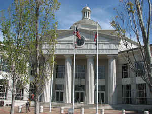
Douglas County is a county located in the state of Georgia. Based on the 2010 census, the
population was 132,403. Douglas County was
created on October 17, 1870 from Campbell County and Carroll
County. The county seat is
Douglasville. The county is named in honor of Stephen
Arnold Douglas (1813-1861), an Illinois Democratic Congressman who ran
against Abraham Lincoln in the United States presidential election, 1860
and lost.
Douglas County is included in the Atlanta-Sandy Springs-Roswell, GA Metropolitan Statistical Area.
Etymology - Origin of Douglas County Name
The county is named after Stephen A. Douglas, a US Congressman and rival of Abraham Lincoln for the presidency.
Demographics: County QuickFacts: CensusBureau Quick Facts
Douglas County History
Douglas County was formed in from parts of Carroll and old Campbell counties plus a small section of the original Cherokee County.
The county was named after Stephen A. Douglas, a US Congressman and rival of Abraham Lincoln for the presidency. Douglasville, the county seat, was named after the county in 1875.
The area around Douglas County was settled in 1848 by Abe, Reuben and Young Vansant, three brothers from South Carolina.
Around the turn of the century, Lithia Springs was the site of a prestigious resort hotel for the nation's rich and famous. Visitors were attracted to the therapeutic mineral waters of Lithia Springs until fire destroyed the hotel in 1911.
Ceremonial mounds of the Mississippian Indians are located in the county. Other Indian artifacts and remains, such as pottery, tools, and weapons, can be found within Douglas County.
Points of Interest
Within the boundaries of Douglas County lies Sweetwater Creek State Conservation Park. Offering fishing, boating, and hiking, the park is the third most visited facility in the state park system.
Douglas County is home to several Civil War battle sites. The ruins of the New Manchester Manufacturing Company's cotton factory lie on the banks of Sweetwater Creek. The factory was destroyed by Union troops during Sherman's March to the Sea.
Geography: Land and Water
As reported by the Census Bureau, the county has a total area of 201 square miles (520 km2), of which 200 square miles (520 km2) is land
and 1.0 square mile (2.6 km2) (0.5%) is water.
Douglas county is located close to the center of Colorado.
Douglas County's elevation above sea level ranges as low as 740 feet (230 m) at the Chattahoochee River to as high as 1,340 feet (410 m); one
of the county's highest elevation points lies inside the city of Douglasville. Andy Mountain, between Villa Rica and Winston - west of
Douglasville along Bankhead Highway, has the highest elevation in Douglas County. Two other elevated summits are located in the county, known
as Cedar Mountain at 1,257 feet (383 m)), and Pine Mountain at 1,180 feet (360 m).
Douglas County sits in Georgia's Piedmont region, which makes its elevation vary due to many rolling hills that Douglas County sits on near
the tail end of the Appalachian Mountains. There are no high mountain peaks in Douglas County, just a range of ridges, hills and valleys.
Douglas is in the Chattahoochee River basin.
Neighboring Counties
Bordering counties are as follows:
- Northeast: Cobb County; Fulton County
- Southwest: Carroll County
- Northwest: Paulding County
Education


Click Image to Enlarge
