


Click Image to Enlarge
Georgia Counties
Georgia is divided into one hundred and fifty-nine counties. The original eight counties of the State of Georgia were Burke, Camden, Chatham, Effingham, Glynn, Liberty, Richmond and Wilkes all created on February 5, 1777. The last new county to be established in Georgia was Peach County, established in 1924.Emanuel County, Georgia
Emanuel County Education, Geography, and History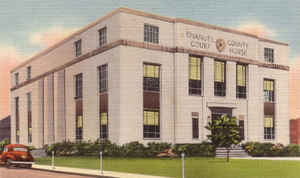
Emanuel County is a county located in the state of Georgia. Based on the 2010 census, the population was 22,598. Emanuel County was created on December 10, 1812 from Bulloch County and Montgomery County. The county seat is Swainsboro. The county is named in honor of Colonel David Emanuel (1744-1808), who became the governor of Georgia in 1801.
Etymology - Origin of Emanuel County Name
Emanuel County was named for one of Georgia's most obscure and least known Governors, David Emanuel. The son of John Emanuel, the family came to Georgia from Lunenburg County, Virginia around 1756.
Demographics:
County QuickFacts: CensusBureau Quick Facts
Emanuel County History
From Emanuel Memories, 1776-1976. . .
Some 250 years ago the Lower Creek Indians lived in the territory of Georgia now known as Emanuel County. They hunted deer and other wild game for food and pelts; held their War and Green Corn dances: fished the Ohoopee and the Cannoochee rivers; roamed the forest; loved, hated and passed on,
leaving evidence of their arrowheads and other relics still found today.
Located in the Northeast portion of Emanuel County, the oldest man-made structure in Emanuel County is believed to be the long, low dam at McKinney's Pond. There is no record of the erection of McKinney's Pond Dam. Tradition has it that the stream was dammed by beavers first and that the Indians
hauled dirt to the site to strengthen and improve the structure. Later white men did the same.
When all this occurred no one knows, but specialists with the State of Georgia have estimated the ages of the trees now growing on the dam to be over 300 years old.
Eventually, white men arrived in the area seeking furs, gold, adventure or a place to settle. Drawn by the prospect of land of their own and beneficial fur trade, early settlers from Savannah and the Carolinas began to move westward and southward primarily along water routes.
By 1741 it was deemed in the interest of good government to divided the Georgia Colony at Savannah into two counties: Frederica and Savannah. The latter included all settlements on the Savannah River and on both banks of the Great Ogeechee River. This two counties were subdivided into districts.
Still later these districts were divided into parishes for establishment of religious worship according to the rites and ceremonies of the Church of England.
In 1777 the parishes were replaced by counties, this being ratified by the first State Constitutional Convention in Savannah. The section of Georgia now known as Emanuel County became a part of Washington County. From Washington County, at a later date, was formed Montgomery County with its county
seat at one time located within five miles of Swainsboro.
Official creation of Emanuel County was in 1812, when the Georgia Legislature authorized it to be cut from territory that was part of Bulloch and Montgomery counties. The idea for forming the county is attributed to Stephen Swain, who had been elected in 1812 to represent Montgomery County in the
Georgia Senate.
Swain was the youngest son of Stephen Swain Sr., a veteran of the Revolutionary War who had moved to Georgia in 1790. The elder Swain received a grant of 200 acres of land on the Ohoopee River in old Washington County.
In November 1812, Swain introduced a bill to create the new county. The bill passed with no opposition.
Emanuel County was named for one of Georgia's most obscure and least known Governors, David Emanuel. The son of John Emanuel, the family came to Georgia from Lunenburg County, Virginia around 1756.
The City of Swainsboro is the county seat and is named for Stephen Swain.
Points of Interest
The George L. Smith, II, State Park is in Emanuel County. It is best known for the newly refurbished Parrish Mill, a combination grist mill, saw mill, covered bridge and dam built in 1880. The park offers 11 miles of hiking trails, fishing, canoeing and boating.
Geography: Land and Water
As reported by the Census Bureau, the county has a total area of 690 square miles (1,800 km2), of which 681 square miles (1,760 km2) is land and 9.6 square miles (25 km2) (1.4%) is water.
Emanuel county is located close to the center of Georgia. The county is in the Altamaha River basin and the Ogeechee River basin.
Neighboring Counties
Bordering counties are as follows:
- North: Jefferson County
- Northeast: Burke County; Jenkins County
- Southeast: Bulloch County; Candler County; Tattnall County
- South: Toombs County
- Southwest: Montgomery County; Treutlen County
- West: Laurens County
- Northwest: Johnson County
Education
Higher Education
East Georgia College and Swainsboro Technical Institute


Click Image to Enlarge
