


Click Image to Enlarge
Georgia Counties
Georgia is divided into one hundred and fifty-nine counties. The original eight counties of the State of Georgia were Burke, Camden, Chatham, Effingham, Glynn, Liberty, Richmond and Wilkes all created on February 5, 1777. The last new county to be established in Georgia was Peach County, established in 1924.Gilmer County, Georgia
Gilmer County Education, Geography, and History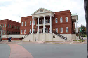
Gilmer County is a county located in the state of Georgia. Based on the 2010 census, the population was 28,292. The county was created on December 3, 1832. The county seat is Ellijay. Gilmer county is named for George Rockingham Gilmer.
Etymology - Origin of Gilmer County Name
Named for George Rockingham Gilmer, a State Legislator, member of Congress, and Georgia Governor from 1829 to 1831 and from 1837 to 1839.
Demographics:
County QuickFacts: CensusBureau Quick Facts
Gilmer County History
Gilmer County was created in 1832 from part of Cherokee County. Georgia's 84th county was named for George Rockingham Gilmer, a State Legislator, member of Congress, and Georgia Governor from 1829 to 1831 and from 1837 to 1839.
Ellijay was the site of an Indian village and bears an Indian name meaning "earth green there." Cherokee Indians lived in this area until their removal in 1838 to Oklahoma via the "Trail of Tears."
Points of Interest
Nearly half the territory of Gilmer County is within the Chattahoochee National Forest and is protected from development by the Federal Government.
Carters Lake provides a major recreational area in the county. Carters Lake is formed from the Coosawatee River, which is formed from the Cartecay and Ellijay Rivers. The rivers were formerly used for timber operations in the area.
Gilmer County boast to be the "Apple Capital of Georgia". Over 600,000 bushels of apples in 25 varieties are produced annually and sold at numerous roadside stands throughout the county.
Geography: Land and Water
As reported by the Census Bureau, the county has a total area of 431 square miles (1,120 km2), of which 427 square miles (1,110 km2) is land and 4.7 square miles (12 km2) (1.1%) is water.
Gilmer county is located in north Georgia. Gilmer is mostly in the Coosa River basin, with small portions of northern and eastern Gilmer in the Tennessee River basin.
Neighboring Counties
Bordering counties are as follows:
- Northeast: Fannin County
- Southeast: Dawson County
- South: Pickens County
- Southwest: Gordon County
- Northwest: Murray County
Education


Click Image to Enlarge
