


Click Image to Enlarge
Georgia Counties
Georgia is divided into one hundred and fifty-nine counties. The original eight counties of the State of Georgia were Burke, Camden, Chatham, Effingham, Glynn, Liberty, Richmond and Wilkes all created on February 5, 1777. The last new county to be established in Georgia was Peach County, established in 1924.Long County, Georgia
Long County Education, Geography, and History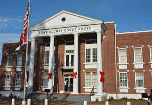
Long County is a county located in
the state of Georgia. Based on the 2010 census, the population
was 14,464.
The constitutional amendment to create the county was proposed August 14, 1920, and ratified November 2, 1920.
The county seat is Ludowici. The
county is named in honor of Dr. Crawford Williamson
Long (1815-1878), in 1842 the first man to use diethyl ether as an
anesthetic for dental surgery.
Long County is part of the Hinesville, GA Metropolitan Statistical Area.
Etymology - Origin of Long County Name
The county is named for Dr. Crawford W. Long, the Georgian responsible for introducing anesthesia to modern medical practice.
Demographics:
County QuickFacts: CensusBureau Quick Facts
Long County History
Long County was created in 1920 from parts of Liberty County. Georgia's 157th county was named for Dr. Crawford W. Long, the Georgian responsible for introducing anesthesia to modern medical practice.
The county seat, and sole incorporated municipality, is Ludowici. Ludowici was named to honor a German immigrant, William Ludowici, who contributed substantially to the construction of the county high school.
Some sites of historical significance are the Ludowici Well Pavilion (1907), the Jones Creek Baptist Church (1856), and the Walthourville Presbyterian Church (1884).
Originally a trail used by Indians, Old Barrington Road became an important trade route between the Carolinas and Florida in the early 1700s. It also was critical during the Revolutionary War for the troop movements.
Points of Interest
The northeastern tip of Long County is occupied by part of the sprawling US Army installation, Fort Stewart, which also occupies significant portions of the neighboring counties.
The Altamaha River forms the boundary between Long and its southern neighbor, Wayne County.
Geography: Land and Water
As reported by the Census Bureau, the county has a total area of 404 square miles (1,050 km2), of which 400 square miles (1,000 km2) is land and 3.5 square miles (9.1 km2) (0.9%) is water.
Long county is located in southeast Georgia. The county is in the Altamaha River basin and the Ogeechee River basin.
Neighboring Counties
Bordering counties are as follows:
- East: Liberty County
- Southeast: McIntosh County
- Southwest: Wayne County
- Northwest: Tattnall County
Education


Click Image to Enlarge
