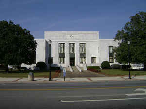
Georgia Counties
Georgia is divided into one hundred and fifty-nine counties. The original eight counties of the State of Georgia were Burke, Camden, Chatham, Effingham, Glynn, Liberty, Richmond and Wilkes all created on February 5, 1777. The last new county to be established in Georgia was Peach County, established in 1924.Mitchell County, Georgia
Mitchell County Education, Geography, and History
Mitchell County is a county in the state of Georgia. Based on the 2010 census, the population was 23,498. The county was created on December 21, 1857. The county seat is Camilla. Mitchell county is named in honor of General Henry Mitchell (1760-1839), a hero of the Revolutionary War.
Etymology - Origin of Mitchell County Name
The Act creating the county noted that it was named after General Henry Mitchell. He had been a state senator from Warren County, president of the Senate, a presidential elector, and commander of the Georgia troops after the Revolutionary War. The widely held view among historians, however, was that the county was named for General David B. Mitchell, who was twice governor of Georgia.
Demographics:
County QuickFacts: CensusBureau Quick Facts
Mitchell County History
Mitchell County was created from Baker County in 1857. The Act creating the county noted that it was named after General Henry Mitchell. He had been a state senator from Warren County, president of the Senate, a presidential elector, and commander of the Georgia troops after the Revolutionary
War. The widely held view among historians, however, was that the county was named for General David B. Mitchell, who was twice governor of Georgia.
Camilla, the county seat, is named for General David Mitchell's daughter. Pelham was named for Major John Pelham, the "boy artillerist" who was mortally wounded at the Battle of Kelly's Ford in 1863.
Sites listed on the National Register of Historic Places include the downtown districts of Camilla and Pelham, as well as the residential historic district in Baconton.
Points of Interest
The western border of the county is defined by the Flint River.
Landmark buildings in the county include the Bacon Family Homestead (1913), the James Price McRae House (1907) and Mt. Emon Church and Cemetery (1889).
Geography: Land and Water
As reported by the Census Bureau, the county has a total area of 514 square miles (1,330 km2), of which 512 square miles (1,330 km2) is land and 1.7 square miles (4.4 km2) (0.3%) is water.
Mitchell county is located in south Georgia. The county is in the Flint River basin and the Ochlockonee River basin
Neighboring Counties
Bordering counties are as follows:
- North: Dougherty County
- Northeast: Worth County
- East: Colquitt County
- Southeast: Thomas County
- South: Grady County
- Southwest: Decatur County
- Northwest: Baker County
Education


