


Click Image to Enlarge
Georgia Counties
Georgia is divided into one hundred and fifty-nine counties. The original eight counties of the State of Georgia were Burke, Camden, Chatham, Effingham, Glynn, Liberty, Richmond and Wilkes all created on February 5, 1777. The last new county to be established in Georgia was Peach County, established in 1924.Rabun County, Georgia
Rabun County Education, Geography, and History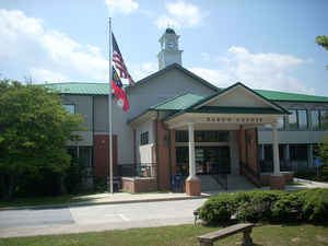
Rabun County is the northeastern most county in the state of Georgia. Based on the 2010 census, the
population was 16,276. Rabun County was created
on December 21, 1819. The county seat
is Clayton. The county is named in honor of William
Rabun (1771-1819), Governor of Georgia (1817-1819).
With an average annual rainfall of over 70 inches (1,800 mm), Rabun County has the title of the rainiest county in Georgia and one of the
rainiest counties east of the Mississippi River
Etymology - Origin of Rabun County Name
The county is named for Governor William Rabun, the state's 11th governor.
Demographics:
County QuickFacts: CensusBureau Quick Facts
Rabun County History
Rabun County was created in 1819 from the cession of Cherokee Indian territory. Georgia's 47th county was named for Governor William Rabun, the state's 11th governor.
The county seat of Clayton was named for Judge Augustin S. Clayton, a prominent jurist and congressman.
According to Indian legend, Rabun Bald Mountain is inhabited by fire-breathing demon people. Campers and other visitors often report hearing strange sounds throughout the night.
Points of Interest
Tallulah Gorge is located in Rabun County and is 1,000 feet deep. The river feeding its waterfall was diverted through a tunnel in the 1930s, when a power plant was built there. The waterfall was recently reactivated, and is the highest in the state.
Rabun County is bounded on the west by the mountain ridges of the Appalachian Trail. The Tallulah River, which flows through Lakes Burton, Seed and Rabun to join the Tugaloo River, forms a central pass through the mountains. This, and surrounding areas, were ruled by Chief Attakullakulla, "Little
Carpenter," who mediated early conflicts between the Cherokee Indians and the white settlers.
Sky Valley, now incorporated, was formerly a resort development. To get to this city, visitors must first drive to North Carolina and enter from the north.
Mountain City is known for Black Rock Mountain State Park.
Geography: Land and Water
As reported by the Census Bureau, the county has a total area of 377 square miles (980 km2), of which 370 square miles (960 km2) is land and 6.9 square miles (18 km2) (1.8%) is water.
Rabun county is located in north Georgia. Approximately, 60% of the land is in National Forests and State Parks, approximately 20% is held by Georgia Power and the rest is in private hands. With 148,684 acres (601.70 km2) of the Chattahoochee National Forest, a national protected area, located within its boundaries, Rabun County hosts the largest portion of the Chattahoochee National Forest of any of the 18 counties with land included in the Forest. Rabun is in the Savannah River basin and the Tennessee River basin.
Neighboring Counties
Bordering counties are as follows:
- North: Macon County, N.C.
- Southeast: Oconee County, S.C.
- Southwest: Habersham County
- West: Towns County
- Northwest: Clay County, N.C.
Education


Click Image to Enlarge
