


Click Image to Enlarge
Georgia Counties
Georgia is divided into one hundred and fifty-nine counties. The original eight counties of the State of Georgia were Burke, Camden, Chatham, Effingham, Glynn, Liberty, Richmond and Wilkes all created on February 5, 1777. The last new county to be established in Georgia was Peach County, established in 1924.Stewart County, Georgia
Stewart County Education, Geography, and History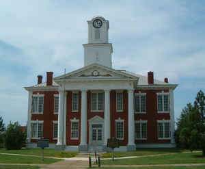
Stewart County is a county located in the state of Georgia. Based on the 2010 census, the population was 6,058. The county was created on December 23, 1830. The county seat is Lumpkin. Stewart county is named in honor of General Daniel Stewart (1759-1829), a hero of the Revolutionary War and the War of 1812.
Etymology - Origin of Stewart County Name
Stewart County was named for General Daniel Stewart, an officer in the Revolutionary War and War of 1812, and grandfather of President Theodore Roosevelt.
Demographics:
County QuickFacts: CensusBureau Quick Facts
Stewart County History
Stewart County was named for General Daniel Stewart, an officer in the Revolutionary War and War of 1812, and grandfather of President Theodore Roosevelt.
The Woodland, Mississippian, and Creek Indians were all inhabitants of Stewart County at one time or another. Two of the six largest Indian mounds in Georgia are located in the county.
The historic community of Westville is also located in the county. This was never actually a town, but is made up of more than 25 historic homes, shops and public buildings moved to the site from the surrounding counties. It is an example of 1850's pre-industrial West Georgia life, and is open to
the public.
Lumpkin was named for Wilson Lumpkin, a two-term governor of Georgia, US Congressman and Senator. He was a leading advocate of state rights and "Indian Removal."
Points of Interest
Providence Canyon State Park is located in Stewart County. Nicknamed "Georgia's Little Grand Canyon" this park is a collection of canyons and gullies. These gullies were caused by the erosion from the poor farming practices previously used in the area. The 1,061-acre park also has the largest
natural collection of the rare "Plumleaf Azalea" in the world.
The historic community of Westville is also located in the county. This was never actually a town, but is made up of more than 25 historic homes, shops and public buildings moved to the site from the surrounding counties. It is an example of pre-industrial West Georgia life, and is open to the
public.
Geography: Land and Water
As reported by the Census Bureau, the county has a total area of 464 square miles (1,200 km2), of which 459 square miles (1,190 km2) is land and 4.9 square miles (13 km2) (1.1%) is water.
Stewart county is located in southwest Georgia. The county is in the Flint River basin and the Chattahoochee River basin.
Neighboring Counties
Bordering counties are as follows:
- North: Chattahoochee County
- Northeast: Marion County
- East: Webster County
- South: Randolph County
- Southwest: Quitman County; Barbour County, Ala.
- Northwest: Russell County, Ala.
Education


Click Image to Enlarge
