


Click Image to Enlarge
Georgia Counties
Georgia is divided into one hundred and fifty-nine counties. The original eight counties of the State of Georgia were Burke, Camden, Chatham, Effingham, Glynn, Liberty, Richmond and Wilkes all created on February 5, 1777. The last new county to be established in Georgia was Peach County, established in 1924.Tattnall County, Georgia
Tattnall County Education, Geography, and History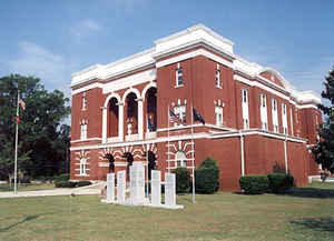
Tattnall County is a county located in the southeast portion of the state of Georgia. Based on the 2010 census, the population was 25,520. The county was created on December 5, 1801 from part of Montgomery County. The county seat is Reidsville. The county is named in honor of Josiah Tattnall (1764-1803), a U.S. Senator and the Governor of Georgia.
Etymology - Origin of Tattnall County Name
The county is named for Josiah Tattnall, the governor who signed the legislation creating it.
Demographics:
County QuickFacts: CensusBureau Quick Facts
Tattnall County History
Tattnall County was created in 1801 from parts of Montgomery and New Georgia's 26th county was named for Josiah Tattnall, the governor who signed the legislation creating it.
The county is located within the Magnolia Midlands, a part of the Historic South region.
Points of Interest
The Tattnall Museum, located in Glennville, displays art, science and local history.
The Georgia State Penitentiary, the state's central holding facility, is located just south of Reidsville. This is Georgia's oldest state prison, and was constructed of marble in 1936. The prison, which was designed to hold 2,000 inmates, cost $1.5 million to build.
The Wiregrass Trail, a historic route through southeastern Georgia, runs through Tattnall County.
Fishing is abundant in the Ohoopee and Altamaha Rivers as well as the 12-acre recreational lake at the Gordonia-Alatamaha State Park. The park, inside the city limits of Reidsville, includes year-round camping, fishing, regulation golf, tennis, a picnic area and a playground.
Geography: Land and Water
As reported by the Census Bureau, the county has a total area of 488 square miles (1,260 km2), of which 479 square miles (1,240 km2) is land and 8.9 square miles (23 km2) (1.8%) is water.
Tattnall county is located in southeast Georgia. The county is in the Altamaha River basin and the Ogeechee River basin
Neighboring Counties
Bordering counties are as follows:
- North: Candler County
- Northeast: Evans County
- Southeast: Liberty County; Long County; Wayne County
- Southwest: Appling County
- Northwest: Toombs County; Emanuel County
Education
Higher Education
Southeastern Technical College


Click Image to Enlarge
