


Click Image to Enlarge
Georgia Counties
Georgia is divided into one hundred and fifty-nine counties. The original eight counties of the State of Georgia were Burke, Camden, Chatham, Effingham, Glynn, Liberty, Richmond and Wilkes all created on February 5, 1777. The last new county to be established in Georgia was Peach County, established in 1924.Towns County, Georgia
Towns County Education, Geography, and History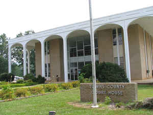
Towns County is a county located in the state of Georgia. Based on the 2010 census, the population was 10,471. The county was created on March 6, 1856. The county seat is Hiawassee. Towns county is named for United States lawyer, legislator, and politician George W. Towns.
Etymology - Origin of Towns County Name
The county is named for George Washington Bonaparte Towns, who was governor of Georgia from 1847 to 1851.
Demographics:
County QuickFacts: CensusBureau Quick Facts
Towns County History
Towns County, the 117th county formed in Georgia, was created in 1856 from parts of Union and Rabun counties. It was named for George Washington Bonaparte Towns, who was governor of Georgia from 1847 to 1851.
Young Harris was originally named Young Harris College in honor of Judge Young Loftin Gerdine Harris of Athens. It was soon shortened to Young Harris, although there is still a Young Harris College located there.
Hiawassee is a Cherokee word meaning "meadow."
Points of Interest
Chatuge Lake is located in the northern part of the county and reaches into North Carolina. It is a storage facility for the Tennessee Valley Authority, and is also a public preserve.
Notable Citizens
Towns County and Young Harris are the home of former Georgia Governor Zell Miller.
Geography: Land and Water
As reported by the Census Bureau, the county has a total area of 172 square miles (450 km2), of which 167 square miles (430 km2) is land
and 5.4 square miles (14 km2) (3.2%) is water. Towns is mostly in the Tennessee River basin with small portions in the Savannah River basin
and the Chattahoochee River basin.
Towns county is located in north Georgia.
The county is located amidst the Blue Ridge Mountains, (part of the Appalachian Mountains), some of which are protected by the Chattahoochee
National Forest. Brasstown Bald, the highest mountain in Georgia, rises in southwest Towns County, straddling the Union County line. The
source of the Hiwassee River is located in eastern Towns County, from which it flows northward into North Carolina. Chatuge Lake, an
artificial reservoir created by the completion of Chatuge Dam by the Tennessee Valley Authority in the 1940s, dominates the northeastern
section of Towns County. State Route 515 from north of Atlanta ends here at the North Carolina state line near Young Harris. An important
facet of early life in Towns County was a road built upon a Cherokee trading path running north to south through the county and passing
through Unicoi Gap. It served as a line between settlers and the Cherokees until after the Indian cessions, when it fell solely into the hands
of the whites. When the Cherokees were expelled from their villages, they were forced into "removal forts," one of which was located in what
is now Hiawassee, the county seat.
Neighboring Counties
Bordering counties are as follows:
- North: Clay County, N.C.
- East: Rabun County
- Southeast: Habersham County
- South: White County
- Southwest: Union County
Education
Higher Education
Young Harris College.


Click Image to Enlarge
