


Click Image to Enlarge
Georgia Counties
Georgia is divided into one hundred and fifty-nine counties. The original eight counties of the State of Georgia were Burke, Camden, Chatham, Effingham, Glynn, Liberty, Richmond and Wilkes all created on February 5, 1777. The last new county to be established in Georgia was Peach County, established in 1924.Upson County, Georgia
Upson County Education, Geography, and History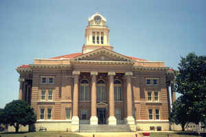
Upson County is a county located in the state of Georgia. Based on the 2010 census, the
population was 27,153. The county was created
on December 15, 1824. The county seat
is Thomaston. The county is named in honor of Stephen
Upson (1786-1824), a noted state legislator.
Upson County comprises the Thomaston, GA Micropolitan Statistical Area, which is also included in the Atlanta-Athens-Clarke County-Sandy
Springs, GA Combined Statistical Area.
Etymology - Origin of Upson County Name
Georgia's 59th county was named for Stephen Upson, a well-known lawyer and legislator of the time.
Demographics:
County QuickFacts: CensusBureau Quick Facts
Upson County History
Upson County was created from parts of Pike and Crawford counties in 1824. Georgia's 59th county was named for Stephen Upson, a well-known lawyer and legislator of the time.
Until losing its charter in 1995 due to its inactive status, The Rock was the county's third municipality. The Rock is located on a rock, hence the name. It is said that the mail used to be deposited in a secret hole in the rock, and that stage drivers were told to "take the mail to the rock."
Thomaston was named for General Jett Thomas, the leader of the state militia in 1812 and the builder of the state capitol in Milledgeville.
Points of Interest
Upson County is home to the Thundering Springs, which once made a sounds like rolling thunder. The sound ceased after vandals threw rocks into it. The spring, located 20 miles from Thomaston, was once a boiling column of water and sand, but is now only 12 inches in diameter and merely warm. No
bottom to the spring has ever been found.
Some other tourist attractions include Auchumpkee Covered Bridge and the Pettigrew-White-Stamps House. The Auchumpkee Covered Bridge was originally built in 1892 and was destroyed by the floods of 1994. The bridge was later rebuilt by Arnold Graton and Son Bridge builders.
"Fairy Stone," a world famous good luck charm, can be found near Thomaston. This is actually the mineral Staurolite which is made of two individual crystals that intersect and form geometric angles.
The Sprewell Bluff State Park, located in Upson County, is an 1,500 acre facility featuring hiking trails, picnic areas, and river access for canoers and kayakers. Other facilities geared toward outdoor activities include the Thunder Scout Reservation and the Gerald I. Lawhorn Canoe Base and
Training Center.
Geography: Land and Water
As reported by the Census Bureau, the county has a total area of 328 square miles (850 km2), of which 323 square miles (840 km2) is land and 4.1 square miles (11 km2) (1.3%) is water.
Upson county is located close to the center of Georgia. The county boasts the lowest average summer humidity in the state. Upson is mostly in the Flint River basin. A tiny part of northeastern Upson is in the Ocmulgee River basin.
Neighboring Counties
Bordering counties are as follows:
- Northeast: Lamar County; Monroe County
- Southeast: Crawford County
- South: Taylor County
- Southwest: Talbot County
- Northwest: Meriwether County; Pike County
Education
Higher Education
Flint River Technical College


Click Image to Enlarge
