


Click Image to Enlarge
Georgia Counties
Georgia is divided into one hundred and fifty-nine counties. The original eight counties of the State of Georgia were Burke, Camden, Chatham, Effingham, Glynn, Liberty, Richmond and Wilkes all created on February 5, 1777. The last new county to be established in Georgia was Peach County, established in 1924.Ware County, Georgia
Ware County Education, Geography, and History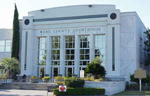
Ware County is a county located in the southeast of the state of Georgia. Based on the 2010 census, the
population was 36,312. Ware County was
created on December 15, 1824. The county
seat is Waycross. The county is named
in honor of Nicholas Ware (1769-1824), a U.S. Senator (1821-1824).
Ware County is part of the Waycross, Georgia Micropolitan Statistical Area.
Etymology - Origin of Ware County Name
Georgia's 60th county is named for Nicholas Ware, who served as mayor of Augusta and a US Senator.
Demographics:
County QuickFacts: CensusBureau Quick Facts
Ware County History
Ware County was created in 1824 from a part of the original landlot county of Appling. Georgia's 60th county is named for Nicholas Ware, who served as mayor of Augusta and a US Senator.
The county seat, and only municipality in the county, is Waycross, an employment and commercial center for the region. Originally known as Tebeauville, the city's current name derives from its location at a key railroad junction. Lines from six directions meet at the city.
Points of Interest
Ware County is the largest county, in area, in Georgia. Waycross is often referred to as the largest city, in the largest county, in the largest state east of the Mississippi.
Laura S. Walker State Park, located near Waycross, is one of the few state parks in Georgia named for a woman. She was a Georgia writer, teacher, civic leader and naturalist who worked diligently to preserve the trees and habitats around her.
Geography
As reported by the Census Bureau, the county has a total area of 908 square miles (2,350 km2), of which 892 square miles (2,310 km2) is
land and 16 square miles (41 km2) (1.7%) is water.
Ware county is located in southeast Georgia. The county is the largest county in Georgia by area. A large portion of the county lies within the Okefenokee Swamp and its federally protected areas.
More than half of Ware County, made up by the western half of the southern portion of the county, the land bridge to the northern portion of
the county, and the southern and western portion of the northern section of the county, is located in the Upper Suwannee River sub-basin of
the Suwannee River basin. The eastern half of the southern portion of Ware County is located in the St. Marys River sub-basin of the St. Marys-Satilla
River basin. The rest of the county, from just southeast to north and west of Waycross, is located in the Satilla River sub-basin of the same
St. Marys-Satilla River basin.
Neighboring Counties
Bordering counties are as follows:
- North: Bacon County
- Northeast: Pierce County; Brantley County
- Southeast: Charlton County
- South: Baker County, Fla.; Columbia County, Fla.
- Southwest: Clinch County
- Northwest: Atkinson County; Coffee County
Education
Higher Education
Waycross College


Click Image to Enlarge
