


Click Image to Enlarge
Georgia Counties
Georgia is divided into one hundred and fifty-nine counties. The original eight counties of the State of Georgia were Burke, Camden, Chatham, Effingham, Glynn, Liberty, Richmond and Wilkes all created on February 5, 1777. The last new county to be established in Georgia was Peach County, established in 1924.White County, Georgia
White County Education, Geography, and History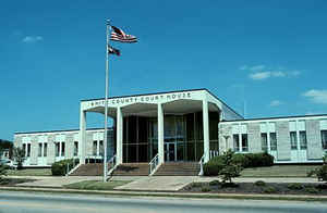
White County is a county located in the northeast corner of the state of Georgia. Based on the 2010 census, the population was 27,144. The county was created on December 22, 1857. The county seat is Cleveland. White county is named for Newton County Representative David T. White, who helped a Habersham representative successfully attain passage of an act creating the new county.
Etymology - Origin of White County Name
The county was named for Newton County Representative David T. White, who helped a Habersham representative successfully attain passage of an act creating the new county.
Demographics:
County QuickFacts: CensusBureau Quick Facts
White County History
White County, the 123rd county formed in Georgia, was created in 1857 from a part of the original landlot county of Habersham. The county was named for Newton County Representative David T. White, who helped a Habersham representative successfully attain passage of an act creating the new county.
Gold was found in White County in the late 1820s on the Nacoochee River, then known as Duke's Creek. This area originally belonged to the Cherokee Indians. However, miners and settlers pressured the US government to such a degree that eventually the Cherokee were totally removed from North Georgia
to a reservation in Oklahoma.
During the gold mining years, nine gold mines operated in the county. Commercial gold operations remained profitable until as late as 1940.
Points of Interest
Helen, in the northern part of the county, had formerly been a summer resort but was destroyed by fire. Later, the town was rebuilt and transformed into an alpine village. It has become a major North Georgia tourist attraction and thriving community.
Cleveland is the site of Babyland General Hospital where all of the Cabbage Patch Kids baby dolls are "born."
Geography: Land and Water
As reported by the Census Bureau, the county has a total area of 242 square miles (630 km2), of which 241 square miles (620 km2) is land
and 1.5 square miles (3.9 km2) (0.6%) is water.
White county is located in north Georgia.
The highest point in White County is 4,430-foot (1,350 m) Tray Mountain, shared with Towns County to the north. Tray is the 6th-highest
mountain peak in Georgia. Another very prominent White County peak is Yonah Mountain, also known as Mount Yonah. This 3,143-foot (958 m) peak,
located between Helen and Cleveland, is rimmed by sheer cliffs and is the highest point on Georgia's Piedmont Plateau.
White is in the Chattahoochee River basin.
Neighboring Counties
Bordering counties are as follows:
- North: Towns County
- East: Habersham County
- South: Hall County
- Southwest: Lumpkin County
- Northwest: Union County
Education
Higher Education
Truett-McConnell College


Click Image to Enlarge
