


Click Image to Enlarge
Indiana Counties
Indiana is divided into ninety-two counties. The oldest and newest Counties in Indiana are Knox County (created 1790) and Newton County (created 1857).Many Indiana counties are named for the US Founding Fathers and personalities of the American Revolutionary War, the War of 1812 and Battle of Tippecanoe; early leaders of Indiana Territory and Indiana, as well as surrounding states like Michigan and Kentucky; plus Native American tribes and geographical features.Daviess County, Indiana
Daviess County Education, Geography, and History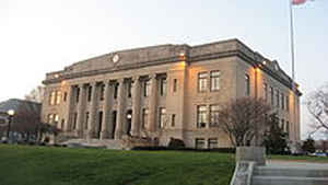
Daviess County is a county located in the state of Indiana. As of 2010, the population was 31,648. Daviess County was created on February 15, 1817. The county seat is Washington. The county is named for Major Joseph H. Daviess, hero of the Battle of Tippecanoe.
Etymology - Origin of Daviess County Name
The county is named for Major Joseph Hamilton Daviess, United States District Attorney for Kentucky, killed at the Battle of Tippecanoe in 1811.
Demographics:
County QuickFacts: CensusBureau Quick Facts
Daviess County History
Daviess County was a part of Knox County until February 15, 1817, at which time it was organized as a separate unit. Formerly it constituted much of what is now Martin, all of Greene, east of the west fork of White River, and all of Owen County, east of the west fork of the White River. It was named for Major Joseph Hamilton Daviess, US District Attorney for Kentucky, killed at the Battle of Tippecanoe in 1811. The settlement of the county began along the White River that afforded farmers a convenient means to transport their crops for sale. The county was originally heavily forested in the northeast leading to a thriving timber industry during the first half of the 1800s
Daviess County is divided into 10 Civil Townships as follows: Barr, Bogard, Elmore, Harrison, Madison, Reeve, Steele, Van Buren, Veale and Washington.
Geography: Land and Water
As reported by the Census Bureau, the county has a total area of 437 square miles (1,131 km2), of which 431 square miles (1,115 km2) is land and 6 square miles (16 km2) (1.42%) is water.
Daviess county is located in southwest Indiana. East Side Park and West Boggs Park are located in this county.
Neighboring Counties
Bordering counties are as follows:
- Northeast: Greene County
- East: Martin County
- Southeast: Dubois County
- Southwest: Pike County
- West: Knox County
Education


Click Image to Enlarge
