


Indiana Geography: The Land
Geography and Landforms of Indiana
Find an overview of Indiana geography, topography, geographic land regions, land areas, and major rivers.
Access Indiana almanac, furnishing more details on the state geography, geographical and land regions, climate and weather, elevation, land areas, bordering states, and other statistical data.
Due to its central location, Indiana has been called the "Crossroads of America."
Indiana's highest point - 1,257 feet above sea level - is located in the Till Plains and so is its capital and largest city - Indianapolis.
The state has a diverse topography, which includes rolling forests and prairie, rivers, and lakes.
Indiana Highest, Lowest, and Mean Elevations |
|
|---|---|
| Mean Elevation | 700 feet |
| Highest Point | Franklin Township, Wayne County 1,257 feet |
| Lowest Point | Ohio River 320 feet |
Indiana Land Area (Square Miles) |
|
| Geographic Center | In Boone County, 14 mi. NNW of Indianapolis Longitude: 86° 16.0'W Latitude: 39° 53.7'N |
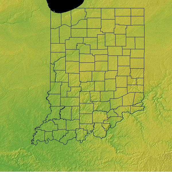
| Total Area | 36,417.73 sq. mi. 38th |
| Land Area | 35,866.90 sq. mi. 98.49% |
| Water Area | 550.83 sq. mi. 1.51% |
| Forested Land Area | 19.6% |
| Dimensions (Length - Width) |
270 miles - 140 miles |
Indiana: Physiographic Regions
The topography of the state can be divided into three major regions:
- Great Lakes Plains
- Till Plains
- Southern Plains and Lowlands
Great Lakes Plains
This area is a fertile lowland. It runs from Wisconsin through Illinois and Indiana to Ohio along the Great Lakes and is made up of large sand dunes. The soil south of the sand dunes is rich , black , fertile farmland. The area south of the sand dunes is an area sometimes called the Northern Lake and Moraine Region and has many small lakes and low hills. Moraines are low hills of earth and rocks left behind by melting glaciers at the end of the ice age.
The Upper Great Lakes Plain covers the southern half of Michigan, northwest Ohio, northern Indiana, northern Illinois, southern Wisconsin, and small portions of southwest Minnesota and northwest Iowa. Glacial moraines and dissected plateaus are characteristic of the topography. Broadleaf forests, oak savannahs, and a variety of prairie communities are the natural vegetation types. A "Driftless Area" was not glaciated during the late Pleistocene and emerged as a unique area of great biological diversity.
The Lower Peninsula is fairly level but some low rolling hills can be found in the south. To the north this changes to a northern tableland of hilly belts. The lowest point in Michigan, along the shore of Lake Erie is found in the Lower Peninsula.
The Prairie Peninsula stretches from northeastern Missouri, across much of Illinois and through the middle of Indiana into Ohio. It is a gently rolling glacial plain in the west, but becomes flatter to the east, where prairie and oak openings were embedded in beech-maple forest. Tallgrass prairie, savannah, and forest habitats were interspersed throughout the Prairie Peninsula, although the percentage of prairie declined from west to east. Savannah occurred in transition zones between grasslands and forest, although the extent of savannah varied temporally and spatially with climatic conditions and other ecological influences. Vegetation patterns were influenced primarily by fire, many of which in recent centuries apparently were set by Amerindians.
Till Plains
This area run through the center of the state and lie to the south of the Great Lakes Plains. It is a part of the great Midwestern Corn Belt and are broad fertile plains. The Till Plains is an area of low hills and valleys.
Southern Plains and Lowlands
This is the hilliest part of the state because the ice glaciers did not advance to this southerly section of Indiana. This land is characterized by a series of knobs (steep hills) divided by lowlands. Caverns have been carved in the limestone by underground streams. Marengo and Wyandotte caves are located in the Southern Plains and Lowlands.
The Interior Low Plateaus constitute a diverse landscape that extends from north Alabama across central Tennessee and Kentucky into southern Illinois, Indiana, and Ohio. It consists of six distinct sub-regions: the Shawnee Hills, Bluegrass region, Western Highland Rim, Central Basin, Eastern Highland Rim, and Tennessee Valley. Its hilly topography sets it apart from the Coastal Plain to the south and Prairie Peninsula to the north. To the west, the valley of the Mississippi River separates the Interior Low Plateaus from the Ozark Highlands, the two of which share many similarities. Western mesophytic, oak-hickory, and beech-maple forests were historically the most abundant cover types. There were also tallgrass prairie elements in the north and northwest, oak savannahs in the Bluegrass and other northern sections, barrens and glades in central regions, and forested wetlands along major waterways

