


Click Image to Enlarge
Indiana Counties
Indiana is divided into ninety-two counties. The oldest and newest Counties in Indiana are Knox County (created 1790) and Newton County (created 1857).Many Indiana counties are named for the US Founding Fathers and personalities of the American Revolutionary War, the War of 1812 and Battle of Tippecanoe; early leaders of Indiana Territory and Indiana, as well as surrounding states like Michigan and Kentucky; plus Native American tribes and geographical features.Indiana Counties: History and Information
Find a brief history of Indiana Counties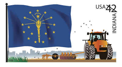
The State of Indiana was the 19th US state admitted into the union. It is located in the northeastern region of the United States of America. With about 6.3 million residents, it is ranked 15th in population and 17th in population density. Indiana is ranked 38th in land area and is the smallest contiguous state west of the Appalachian Mountains. Its capital and largest city is Indianapolis.
Indiana has 92 counties. Each county serves as the local level of government within its borders. Although Indiana was organized into the United States since the Northwest Ordinance in 1787, its land was not always available for settlement. Eventually, land was purchased from Native Americans by treaties and Indian removals. The oldest counties are generally in the south near the Ohio River, whereas newer ones were in the north in territory acquired later. The oldest and newest counties in Indiana are Knox County, created in 1790, and Newton County, created in 1859.
County government in Indiana consists of two bodies, the county council and the commissioners.
Many Indiana counties are named for United States Founding Fathers and personalities of the American Revolutionary War, the War of 1812 and Battle of Tippecanoe; early leaders of Indiana Territory and Indiana, as well as surrounding states like Michigan and Kentucky; plus Native American tribes and geographical features.
| Find a brief history of Indiana Counties | ||||
|---|---|---|---|---|
| County | 2000 Population |
Square Miles |
County Seat | Created |
| Adams County | 33,625 | 339 | Decatur | 1835 |
| Allen County | 331,849 | 657 | Fort Wayne | 1823 |
| Bartholomew County | 71,435 | 407 | Columbus | 1821 |
| Benton County | 9,421 | 406 | Fowler | 1840 |
| Blackford County | 14,048 | 165 | Hartford City | 1838 |
| Boone County | 46,107 | 423 | Lebanon | 1830 |
| Brown County | 14,957 | 312 | Nashville | 1836 |
| Carroll County | 20,165 | 372 | Delphi | 1828 |
| Cass County | 40,930 | 413 | Logansport | 1828 |
| Clark County | 96,472 | 375 | Jeffersonville | 1801 |
| Clay County | 26,556 | 358 | Brazil | 1825 |
| Clinton County | 33,866 | 405 | Frankfort | 1830 |
| Crawford County | 10,743 | 306 | English | |
| Daviess County | 29,820 | 431 | Washington | 1816 |
| Dearborn County | 46,109 | 305 | Lawrenceburg | 1803 |
| Decatur County | 24,555 | 373 | Greensburg | 1821 |
| DeKalb County | 40,285 | 363 | Auburn | 1835 |
| Delaware County | 118,769 | 393 | Muncie | 1827 |
| Dubois County | 39,674 | 430 | Jasper | 1817 |
| Elkhart County | 182,791 | 464 | Goshen | 1830 |
| Fayette County | 25,588 | 215 | Connersville | |
| Floyd County | 70,823 | 148 | New Albany | 1819 |
| Fountain County | 17,954 | 396 | Covington | 1825 |
| Franklin County | 22,151 | 386 | Brookville | 1810 |
| Fulton County | 20,511 | 368 | Rochester | 1835 |
| Gibson County | 32,500 | 489 | Princeton | 1813 |
| Grant County | 73,403 | 414 | Marion | 1831 |
| Greene County | 33,157 | 542 | Bloomfield | 1821 |
| Hamilton County | 182,740 | 398 | Noblesville | 1823 |
| Hancock County | 55,391 | 306 | Greenfield | 1827 |
| Harrison County | 34,325 | 485 | Corydon | 1808 |
| Hendricks County | 104,093 | 408 | Danville | 1823 |
| Henry County | 48,508 | 393 | New Castle | 1821 |
| Howard County | 84,964 | 293 | Kokomo | 1844 |
| Huntington County | 38,075 | 383 | Huntington | 1832 |
| Jackson County | 41,335 | 509 | Brownstown | 1815 |
| Jasper County | 30,043 | 560 | Rensselaer | 1835 |
| Jay County | 21,806 | 384 | Portland | 1835 |
| Jefferson County | 31,705 | 361 | Madison | 1810 |
| Jennings County | 27,554 | 377 | Vernon | 1816 |
| Johnson County | 115,209 | 320 | Franklin | 1822 |
| Knox County | 39,256 | 516 | Vincennes | 1790 |
| Kosciusko County | 74,057 | 538 | Warsaw | 1835 |
| La Porte County | 110,106 | 598 | La Porte | 1832 |
| LaGrange County | 34,909 | 380 | LaGrange | 1832 |
| Lake County | 484,564 | 497 | Crown Point | 1836 |
| Lawrence County | 45,922 | 449 | Bedford | 1819 |
| Madison County | 133,358 | 452 | Anderson | 1823 |
| Marion County | 860,454 | 396 | Indianapolis | 1821 |
| Marshall County | 45,128 | 444 | Plymouth | 1835 |
| Martin County | 10,369 | 336 | Shoals | 1820 |
| Miami County | 36,082 | 376 | Peru | 1832 |
| Monroe County | 120,563 | 394 | Bloomington | |
| Montgomery County | 37,629 | 505 | Crawfordsville | 1823 |
| Morgan County | 66,689 | 406 | Martinsville | 1821 |
| Newton County | 14,566 | 402 | Kentland | 1857 |
| Noble County | 46,275 | 411 | Albion | 1835 |
| Ohio County | 5,623 | 87 | Rising Sun | 1844 |
| Orange County | 19,306 | 400 | Paoli | 1815 |
| Owen County | 21,786 | 385 | Spencer | |
| Parke County | 17,241 | 445 | Rockville | 1821 |
| Perry County | 18,899 | 381 | Tell City | 1814 |
| Pike County | 12,837 | 336 | Petersburg | 1816 |
| Porter County | 146,798 | 418 | Valparaiso | 1835 |
| Posey County | 27,061 | 408 | Mount Vernon | 1814 |
| Pulaski County | 13,755 | 434 | Winamac | 1835 |
| Putnam County | 36,019 | 480 | Greencastle | 1821 |
| Randolph County | 27,401 | 453 | Winchester | |
| Ripley County | 26,523 | 446 | Versailles | 1816 |
| Rush County | 18,261 | 408 | Rushville | 1821 |
| Scott County | 22,960 | 190 | Scottsburg | 1820 |
| Shelby County | 43,445 | 413 | Shelbyville | 1821 |
| Spencer County | 20,391 | 399 | Rockport | |
| St. Joseph County | 265,559 | 457 | South Bend | 1830 |
| Starke County | 23,556 | 309 | Knox | 1835 |
| Steuben County | 33,214 | 309 | Angola | 1835 |
| Sullivan County | 21,751 | 447 | Sullivan | 1816 |
| Switzerland County | 9,065 | 221 | Vevay | 1814 |
| Tippecanoe County | 148,955 | 500 | Lafayette | 1826 |
| Tipton County | 16,577 | 260 | Tipton | 1844 |
| Union County | 7,349 | 162 | Liberty | 1821 |
| Vanderburgh County | 171,922 | 235 | Evansville | |
| Vermillion County | 16,788 | 257 | Newport | 1824 |
| Vigo County | 105,848 | 403 | Terre Haute | |
| Wabash County | 34,960 | 413 | Wabash | 1832 |
| Warren County | 8,419 | 365 | Williamsport | 1827 |
| Warrick County | 52,383 | 384 | Boonville | 1813 |
| Washington County | 27,223 | 514 | Salem | 1813 |
| Wayne County | 71,097 | 404 | Richmond | 1810 |
| Wells County | 27,600 | 370 | Bluffton | 1835 |
| White County | 25,267 | 505 | Monticello | 1834 |
| Whitley County | 30,707 | 336 | Columbia City | 1835 |

Click Image to Enlarge
