


Indiana State Almanac: Facts and Figures
Quick Facts, Figures, and Overview of the State of Indiana
Indiana is one of the East North Central states of the US. The state of IN covers a total area of 36,418 sq. miles. The bordering states of Indiana are Kentucky, Ohio, Michigan, and Illinois. Indiana was the name given to the Indiana Territory by the United States Congress when Indiana was created from the Northwest Territory in 1800. It means "Land of Indians."
Manufacturing became the chief economic activity of Indiana in the early 20th century, but at the start of the 1990s the state was also a major producer of farm commodities, especially corn, soybeans, and hogs. Indianapolis, the capital, and Gary were big industrial centers. Indiana's 41-mile Lake Michigan waterfront- one of the world's great industrial centers- turns out iron, steel, and oil products. Products include automobile parts and accessories, mobile homes and recreational vehicles, truck and bus bodies, aircraft engines, farm machinery, and fabricated structural steel. Wood office furniture and pharmaceuticals are also manufactured.
Much of the building limestone used in the US is quarried in Indiana, which is also a large producer of coal. Other mineral commodities include crushed stone, cement, and sand and gravel.
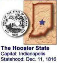
Indiana Almanac: Facts and Figures on Indiana |
|
|---|---|
| Official Name | Indiana |
| Capital | Indianapolis |
| Nicknames | Hoosier State ...and more |
| Motto | The crossroads of America (1937) |
| Location Region |
39.77640 N, 086.14619 W Midwest Northeastern |
| Constitution Ratified | 1851 |
| Statehood | December 11, 1816 19th state |
| Population | 6,483,802 (2010) 169.51sq. mi. 16th |
| Largest City (by population) |
10 largest cities (2010): Indianapolis, 820,445; Fort Wayne, 253,691; Evansville, 117,429; South Bend, 101,168; Hammond, 80,830; Bloomington, 80,405; Gary, 80,294; Carmel, 79,191; Fishers, 76,794; Muncie, 70,085 |
| Bordering States | North: Illinois and Michigan (Lake Michigan forms
part of the North West boundary) East: Ohio South: Kentucky (Ohio River forms the Southern boundary) West: Illinois (Wabash River forms part of the Western boundary) |
| Major Industry | agriculture (corn, soybeans, wheat), manufacturing, mining (coal, limestone), steel-making |
| Major Rivers | Ohio River, Wabash River, White River, Tippecanoe River |
| Major Lakes | Mississinewa Lake, Lake Michigan |
| Indiana Counties | 92 Counties in Indiana |
| Largest County (by population) |
Marion County 903,393 (2010) 396 sq. mi. |
| Largest County (by area) |
Allen County 657 sq./ mi. |
| State parks | 23 (56,409 ac.) |
| State historic sites | 17( 2,007 ac.) |
| Electoral Votes | 11 (as of the 2004 Presidential Election) |
| US Congress | 2 Senators; 10 Representatives (9 Representatives as of the 2002 election) |
| Time Zone | Eastern Standard Time (Primarily) |
| Zip Codes | NANPA |
| State Quick Facts | Census Bureau Quick Facts |
Indiana Climate and Weather |
|
|---|---|
| Indiana has hot summers and cold winters, with fairly high humidity. The combination of warm temperatures and high humidity can make July and early August a bit uncomfortable, particularly in the southern parts of the state. Temperatures can climb to the high 90s F/mid 30s C. Expect late spring and fall temperatures to range from a low of 40 F/4 C to a high of 65 F/19 C. A sweater or jacket will be needed in the evenings. Those visiting in winter will find plenty of snow - as much as 40 in/102 cm falls near Lake Michigan. January temperatures average 16 to 41 F/-14 to 5 C. | |
| Highest Temperature | 116 degree July 14, 1936 - Collegeville |
| Lowest Temperature | -36 degrees January 19, 1994 - New Whiteland |
| Avg. Temp: High - Low |
88.8 degrees 15.8 degrees |
Indiana Points of Interest |
|
| Some of Indiana's most popular attractions include Amish Country, College Football Hall of Fame, Lincoln's Boyhood Log Cabin home, Indiana Dunes, Indianapolis Motor Speedway and museum, the southern Indiana caves and waterfalls, West Baden and French Lick are well known for their mineral springs, and Tippecanoe Battlefield Memorial Park. | |
Indiana Highest, Lowest, and Mean Elevations (Feet) |
|
| Mean Elevation: 700 feet | |
| Highest Point: Hoosier Hill: Franklin Township, Wayne County: 1,257 feet
|
|
| Lowest Point: | Ohio River 320 feet |
Indiana Land Area (Square Miles) |
|
| Geographic Center | In Boone County, 14 mi. NNW of Indianapolis Longitude: 86°16.0'W Latitude: 39°53.7'N |
| Total Area | 36,417.73 sq. mi. 38th |
| Land Area | 35,866.90 sq. mi. 98.49% |
| Water Area | 550.83 sq. mi. 1.51% |
| Forested Land Area | 19.6% |
| Dimensions (Length - Width) |
270 miles - 140 miles |
 The
highest point in Indiana is Hoosier Hill in Franklin Township at 1,257 feet above sea level. The highpoint is in Wayne County - about 10 miles north
of I-70.
The
highest point in Indiana is Hoosier Hill in Franklin Township at 1,257 feet above sea level. The highpoint is in Wayne County - about 10 miles north
of I-70.Adams, Allen, Bartholomew, Benton, Blackford, Boone, Brown, Carroll, Cass, Clark, Clay, Clinton, Crawford, Daviess, Dearborn, Decatur, DeKalb, Delaware, Dubois, Elkhart, Fayette, Floyd, Fountain, Franklin, Fulton, Gibson, Grant, Greene, Hamilton, Hancock, Harrison, Hendricks, Henry, Howard, Huntington, Jackson, Jasper, Jay, Jefferson, Jennings, Johnson, Knox, Kosciusko, La Porte, LaGrange, Lake, Lawrence, Madison, Marion, Marshall, Martin, Miami, Monroe, Montgomery, Morgan, Newton, Noble, Ohio, Orange, Owen, Parke, Perry, Pike, Porter, Posey, Pulaski, Putnam, Randolph, Ripley, Rush, Scott, Shelby, Spencer, St. Joseph, Starke, Steuben, Sullivan, Switzerland, Tippecanoe, Tipton, Union, Vanderburgh, Vermillion, Vigo, Wabash, Warren, Warrick, Washington, Wayne, Wells, White, Whitley

