


Click Image to Enlarge
Indiana Counties
Indiana is divided into ninety-two counties. The oldest and newest Counties in Indiana are Knox County (created 1790) and Newton County (created 1857).Many Indiana counties are named for the US Founding Fathers and personalities of the American Revolutionary War, the War of 1812 and Battle of Tippecanoe; early leaders of Indiana Territory and Indiana, as well as surrounding states like Michigan and Kentucky; plus Native American tribes and geographical features.Fayette County, Indiana
Fayette County Education, Geography, and History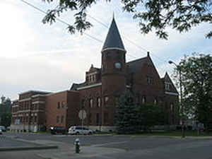
Fayette County is one of 92 counties in US state of Indiana located in the east central portion of the state. As of 2010, the population was 24,277. Fayette County was created on December 28, 1818. The county seat is Connersville. The county is named for Marquis de la Fayette, French noble who trained colonial soldiers in the American Revolutionary War.
Etymology - Origin of Fayette County Name
The county is named for the Marquis de la Fayette, a French hero of the Revolutionary War.
Demographics:
County QuickFacts: CensusBureau Quick Facts
Fayette County History
Fayette County was organized December 28, 1818, by an act of the Legislature, which became effective January 1, 1819. It was named for the Marquis de la Fayette, a French hero of the Revolutionary War.
Fayette County is divided into 9 Civil Townships as follows: Columbia, Connersville, Fairview, Harrison, Jackson, Jennings, Orange, Posey and Waterloo.
Geography: Land and Water
As reported by the Census Bureau, the county has a total area of 215 square miles (557 km2), of which 215 square miles (557 km2) is land and 0 square miles (0 km2) (0.07%) is water.
Fayette county is located in east Indiana. The major waterway in the county is the West Fork of the Whitewater River running north to south through the center of the county. The county is mainly flat with low, rolling hills. The county (and all of Indiana) is part of the Eastern (U.S.) Broadleaf Forest biome dominated by deciduous trees including over 175 native species of oak.
Neighboring Counties
Bordering counties are as follows:
- Northeast: Wayne County
- East: Union County
- Southeast: Franklin County
- West: Rush County
- Northwest: Henry County
Education
The county is served by the Fayette County School system including elementary, middle and high schools. There are also a few parochial elementary schools in Connersville. Both Ivy Tech Community College of Indiana and Indiana University East offer classes in Connersville


Click Image to Enlarge
