


Click Image to Enlarge
Indiana Counties
Indiana is divided into ninety-two counties. The oldest and newest Counties in Indiana are Knox County (created 1790) and Newton County (created 1857).Many Indiana counties are named for the US Founding Fathers and personalities of the American Revolutionary War, the War of 1812 and Battle of Tippecanoe; early leaders of Indiana Territory and Indiana, as well as surrounding states like Michigan and Kentucky; plus Native American tribes and geographical features.Knox County, Indiana
Knox County Education, Geography, and History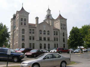
Knox County is a county located in Indiana in the United States. As of 2010, the population was 38,440. Knox County was created on June 20, 1790. The county seat is Vincennes. The county is named for United States Secretary of War Henry Knox.
Etymology - Origin of County Name
The county is named for General Henry Knox, first Secretary of War.
Demographics:
County QuickFacts: CensusBureau Quick Facts
County History
Knox County was organized by Secretary of the Northwest Territory Winthrop Sargent June 20, 1790, when Michigan
and Illinois were withdrawn from the Northwest Territory making it the oldest Indiana county. It was named for Major
General Henry Knox, US Secretary of War.
Knox County was one of the original counties of the Northwest Territory and was created prior to the formation of
the Indiana Territory. When it was created, Knox County extended to Canada and encompassed all or part of the
present states of Indiana, Michigan, Illinois, and Ohio. When the Illinois Territory was formed in 1809, the
portions of Knox County beyond the Wabash River became a part of Illinois.
Many of Knox Country townships and lots were surveyed with the French system, which goes towards non-cardinal
compass points. Knox is the only other Indiana county besides Clark County that was laid out in this fashion
Knox County is divided into 10 Civil Townships as follows: Busseron, Decker, Harrison, Johnson, Palmyra, Steen, Vigo, Vincennes, Washington and Widner.
Geography: Land and Water
As reported by the Census Bureau, the county has a total area of 524 square miles (1,357 km2), of which 516 square miles (1,336 km2) is land and 8 square miles (21 km2) (1.57%) is water.
Knox county is located in southwest Indiana. George Rogers Clark National Historical Park is located in this county.
Neighboring Counties
Bordering counties are as follows:
- North: Sullivan County
- Northeast: Greene County
- East: Daviess County
- Southeast: Pike County
- Southwest: Gibson County; Wabash County, Ill.
- West: Lawrence County, Ill.
- Northwest: Crawford County, Ill.
Education


Click Image to Enlarge
