


Click Image to Enlarge
Indiana Counties
Indiana is divided into ninety-two counties. The oldest and newest Counties in Indiana are Knox County (created 1790) and Newton County (created 1857).Many Indiana counties are named for the US Founding Fathers and personalities of the American Revolutionary War, the War of 1812 and Battle of Tippecanoe; early leaders of Indiana Territory and Indiana, as well as surrounding states like Michigan and Kentucky; plus Native American tribes and geographical features.Steuben County, Indiana
Steuben County Education, Geography, and History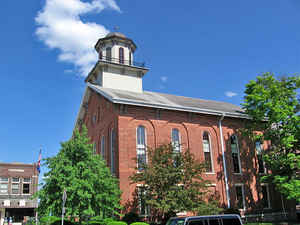
Steuben County is a county located in the northeast corner of the state of Indiana. As of the 2010 United States Census, the population was 34,185. Steuben County was created on May 1, 1837. The county seat is located in Angola. The county is named after Baron von Steuben, a Prussian military officer who helped train the Continental Army during the American Revolutionary War.
Etymology - Origin of Steuben County Name
The county is named in honor of Revolutionary War hero General Baron Von Steuben who trained troops for General Washington at Valley Forge.
Demographics:
County QuickFacts: CensusBureau Quick Facts
Steuben County History
Beginning in February 2, 1832, the territory of Steuben County was included in the organization of LaGrange County.
Steuben County was established May 1, 1837 from LaGrange County, and named for Baron Frederick von Steuben, an officer of the Revolutionary War.
Steuben County is divided into 12 Civil Townships named as follows: Mill Grove, Jamestown, Fremont, Clear Lake, Jackson, Pleasant, Scott, York, Salem, Steuben, Otsego and Richland
From the 1876 Illustrated Historical Atlas of the State of Indiana:
The smoke from the first permanent settler's cabin first arose within the present limits of Steuben County in the
spring of 1831. That settler was Gideon Langdon. His rude cabin was in the southwest quarter of Section 5, Jackson
Township, afterward known as the Town farm. Langdon, on the 17th of September, in the year following, made the first
entry of land recorded in the county, being the east half of the quarter named.
It was in what is now Jackson Township that the first settlers mostly located. Jackson Township contains
considerable prairie land, and the first immigrants, at a time when their choice was unrestricted, naturally
selected the rich, fertile soil there, because of the comparative ease with which it was brought under cultivation.
The next settlers were John and Jacob Stayner, and their families - twelve persons in all. The Stayners came from
Ohio, and arrived in Jackson Township on May 16, 1831. John built on the north side of the prairie, and entered the
west half of the southwest quarter of Section 5, September 27, 1832, being ten days after Langdon's entry, and the
second made in the present limits of the county.
The two brothers had been soldiers under Jackson in the War of 1812, and were both strong and hearty men. John
Stayner lived upon the land entered by him until his death in 1870. He was sent to the Legislature, and the township
in which he lived was, at his instance, named Jackson in honor of his old military chieftain.
The first white child born within the present limits of the county was Zephaniah Stayner. He is still a resident of
the township in which he first saw the light.
The first death was that of Mrs. Gideon Langdon, in 1832. The remains were interred in the prairie burying ground,
on land that has since passed into the possession of D. H. Roberts.
The first marriage was contracted between James Huntsman and Hannah Davis, in 1832, before the organization of the
county.
The first schoolhouse erected in the county was on the north side of Jackson Prairie. Hannah Davis, the first bride
in the little community, was the first teacher. The first schoolhouse was a rude tamarack cabin, erected at a cost
of about $50, by John Stayner and Adolphus Town. Eliza Eaton was the next teacher, and received $2 for each pupil,
that being the tax levied on those sending their children to the school.
Geography: Land and Water
As reported by the Census Bureau, the county has a total area of 322 square miles (835 km2), of which 309 square miles (800 km2) is land and 14 square miles (36 km2) (4.27%) is water.
Steuben county is located in northeast Indiana. The county contains a state park and 105 lakes of numerous sizes. Some of the larger lakes are Lake James, Lake George, Clear Lake, Jimmerson Lake, Lake Gage, and Crooked Lake.
Neighboring Counties
Bordering counties are as follows:
- North: Branch County, Mich.
- Northeast: Hillsdale County, Mich.
- Southeast: Williams County, Ohio
- South: DeKalb County
- Southwest: Noble County
- West: Lagrange County
Education
Colleges and universities
Trine University
School districts
Fremont Community Schools
Hamilton Community Schools
M S D of Steuben County
Prairie Heights Community School Corporation


Click Image to Enlarge
