


Click Image to Enlarge
Indiana Counties
Indiana is divided into ninety-two counties. The oldest and newest Counties in Indiana are Knox County (created 1790) and Newton County (created 1857).Many Indiana counties are named for the US Founding Fathers and personalities of the American Revolutionary War, the War of 1812 and Battle of Tippecanoe; early leaders of Indiana Territory and Indiana, as well as surrounding states like Michigan and Kentucky; plus Native American tribes and geographical features.Wayne County, Indiana
Wayne County Education, Geography, and History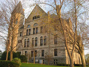
Wayne County is a county located in the state of Indiana. Based on the 2010 census, the population was 68,917. Wayne County was created on November 27, 1810. The county seat is Richmond. The county is named for General "Mad" Anthony Wayne, hero of the American Revolutionary War.
Etymology - Origin of Wayne County Name
The county is named for General Anthony Wayne, victor of the 1794 Battle of the Fallen Timbers. His death occurred December 15, 1796.
Demographics:
County QuickFacts: CensusBureau Quick Facts
WayneCounty History
Wayne County was organized under an act of the Legislature of November 27, 1810, made effective February 1, 1811. It was named for Gen. "Mad" Anthony Wayne, who was an officer during the Revolutionary War. Wayne is mainly remembered for his service in the 1790s in the Northwest Indian War, which included many actions in Indiana and Ohio.
Wayne County is divided into 15 Civil Townships as follows: Abington, Boston, Center, Clay, Dalton, Franklin, Green, Harrison, Jackson, Jefferson, New Garden, Perry, Washington, Wayne and Webster.
Geography: Land and Water
As reported by the Census Bureau, the county has a total area of 404 square miles (1,047 km2), of which 404 square miles (1,045 km2) is land and 1 square mile (2 km2) (0.19%) is water.
Wayne county is located in east Indiana. The county includes Indiana's highest natural elevation, Hoosier Hill, at 1,257 feet (383 meters).
Neighboring Counties
Bordering counties are as follows:
- North: Randolph County
- Northeast: Darke County, Ohio
- Southeast: Preble County, Ohio; Union County
- Southwest: Fayette County
- West: Henry County
Education


Click Image to Enlarge
