


Click Image to Enlarge
Indiana Counties
Indiana is divided into ninety-two counties. The oldest and newest Counties in Indiana are Knox County (created 1790) and Newton County (created 1857).Many Indiana counties are named for the US Founding Fathers and personalities of the American Revolutionary War, the War of 1812 and Battle of Tippecanoe; early leaders of Indiana Territory and Indiana, as well as surrounding states like Michigan and Kentucky; plus Native American tribes and geographical features.Wells County, Indiana
Wells County Education, Geography, and History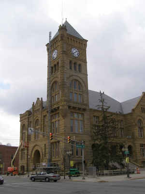
Wells County is a county located in the state of Indiana. Based on the 2010 census, the population was 27,636. Wells County was created on February 17, 1837. The county seat is Bluffton. The county is named for Captain William A. Wells, Native American who became a hero in the War of 1812.
Etymology - Origin of Wells County Name
The county is named for Captain William H. Wells, who was killed by Indians in the Ft. Dearborn Massacre of August 15, 1812, while attempting to escort the garrison of Fort Dearborn to Fort Wayne.
Demographics:
County QuickFacts: CensusBureau Quick Facts
Wells County History
Wells County was organized by an act of the Legislature February 17, 1837, which became effective May 1 of that same year. It was named for Capt. William A. Wells, who was captured by Native Americans as a young boy and adopted by the Miami chief Little Turtle. He eventually became a scout for Gen. "Mad Anthony" Wayne. Capt. Wells was killed by Potawatomi allied with the British at the Fort Dearborn Massacre at the outbreak of the War of 1812. The Potawatomi ate Capt. Wells' heart to gain part of his courage.
Wells County is divided into 9 Civil Townships as follows: Chester, Harrison, Jackson, Jefferson, Lancaster, Liberty, Nottingham, Rock Creek and Union.
Geography: Land and Water
As reported by the Census Bureau, the county has a total area of 370 square miles (959 km2), of which 370 square miles (958 km2) is land and 0 square miles (1 km2) (0.12%) is water.
Wells county is located in northeast Indiana.
Neighboring Counties
Bordering counties are as follows:
- Northeast: Allen County
- East: Adams County
- Southeast: Jay County
- Southwest: Blackford County; Grant County
- Northwest: Huntington County
Education


Click Image to Enlarge
