

Click Image to Enlarge
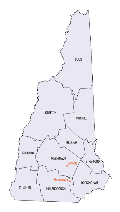
New Hampshire Counties
There are currently ten Counties in the state of New Hampshire. Five of the counties were created in 1769, when New Hampshire was still an English colony and not a state, during the first subdivision of the state into counties. The last counties created were Belknap County and Carroll County, in 1840.Rockingham County, New Hampshire
Rockingham County Education, Geography, and History
Rockingham County is a county located in the state of New Hampshire. Based on the 2010 census, the population was 295,223, making it the
second-most populous county in New Hampshire. The county seat is Brentwood.
Rockingham County is included in the Boston-Cambridge-Newton, MA-NH Metropolitan Statistical Area.
Etymology - Origin of Rockingham County Name
Named for Charles Watson-Wentworth, 2nd Marquess of Rockingham, KG, PC (13 May 1730 - 1 July 1782), styled The Hon. Charles Watson-Wentworth before 1733, Viscount Higham between 1733 and 1746, Earl of Malton between 1746 and 1750 and The Earl Malton in 1750, was a British Whig statesman, most notable for his two terms as Whig Prime Minister of Great Britain. He became the patron of many Whigs and served as a leading Whig Grandee. He served in only two high offices during his lifetime (Prime Minister and Leader of the House of Lords), but was nonetheless very influential during his one and a half years of service.
Demographics:
County QuickFacts: CensusBureau Quick Facts
Rockingham County History
Rockingham County was home to New Hampshire's first European settlements, Pannaway and Strawberry Banke (Portsmouth). In 1623, only three years after the landing of the pilgrims in Plymouth, Massachusetts, David Thomson first settled New Hampshire at
Odiorne Point in what is now known as the town of Rye. By the mid 1600s, the county included three of the four original New Hampshire towns and was the center for business, trade and government for the entire state. The state capital was located in Portsmouth first, and then later moved to Exeter
during the Revolutionary War. In 1808, the capital finally settled to its current location in Concord.
Rockingham County was eventually organized in 1771 as one of the five original counties and named for Charles Weston Wentworth, Second Marquis of Rockingham. Rockingham County is located in the southeastern portion of the state and contains all 18 miles of New Hampshire's coastline. The county is
bordered by Maine to the northeast and Massachusetts to the south. The overall land mass is 699 square miles with a population of 277,359. There are 37 towns in Rockingham County, the four largest of which are Derry with a population of 34,021, Salem with 28,112, Londonderry with 23,236 and
Portsmouth with 20,784. (2000 Census)
Agriculture continues to make an important contribution to the economy in Rockingham County. There are 445 farms covering 32, 000 acres, more than half of them run by part-time family operators. The market value of agricultural products is more than $17 million, about half of this coming from crop
sales and the rest, $3.5 million, from marketing of livestock. (2002 Census of Agriculture) The agriculture industry has a major influence on Rockingham County's character and quality of life.
Other important businesses and industries in the county include construction, electric, gas and sanitation services, retail trade, services and manufacturing. In addition, there are 80 public elementary and secondary schools, 9 post-secondary schools, and numerous human service and youth
organizations providing services to youth and families. There are three hospitals located in Rockingham County.
Private land conservation organizations, communities and key landowners have made great strides in permanently protecting land here over the last five years, yet Rockingham County continues to lose more land to development than it conserves.
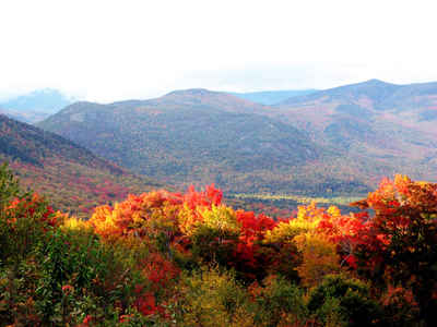
The seacoast area is popular to tourists from inland New Hampshire as well as other states. Because of the coastline in particular, there are several state parks in Rockingham County, including Odiorne Point State Park, Rye Harbor State Park, Wallis Sands State Park, Hampton Beach State Park,
Jenness Beach State Park, North Beach State Park, Kingston State Park and Pawtuckaway State Park. In addition to providing recreational opportunities, these state parks preserve considerable areas of land for future generations.
Geography: Land and Water
As reported by the Census Bureau, the county has a total area of 794 square miles (2,060 km2), of which 695 sq mi (1,800 km2) is land and 99 sq mi (260 km2) (12.47%) is water. The highest point in Rockingham County is Nottingham Mountain, at 1,340 feet (410 m), in the town of Deerfield.
Neighboring Counties
Bordering counties are as follows:
- Strafford County (north)
- York County, Maine (northeast)
- Essex County, Massachusetts (south)
- Hillsborough County (west)
- Merrimack County (northwest)
Education


Click Image to Enlarge
