


Click Image to Enlarge
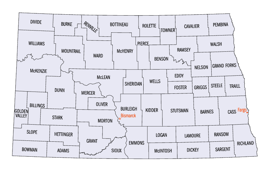
North Dakota Counties
There are fifty-three counties in the state of North Dakota. Pembina County was created by the 1866-1867 Dakota territorial legislature, and was organized on August 12, 1867. The city of Pembina, the oldest European-American settlement in the state, was the county seat from 1867 to 1911. The seat was relocated to Cavalier.Bottineau County, North Dakota
Bottineau County Education, Geography, and History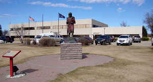
Bottineau County is a county located in the state of North Dakota. Based on the 2010 census, the population was 6,429.[1] Its county seat
is Bottineau.
The Territorial legislature identified Bottineau as one of the original counties of the territory in 1872 but it wasn't organized until July
17, 1884, at a meeting in Bottineau. It is named for Pierre Bottineau (c.1814-1895), a M?is pioneer, hunter, and trapper who became a
successful land speculator.
Etymology - Origin of Bottineau County Name
Named for Pierre Bottineau (ca. 1814-1895), a respected Metis guide, hunter, land speculator, and frontiersman.
Demographics:
County QuickFacts: CensusBureau Quick Facts
Bottineau County History
Bottineau County was created by act of Dakota Legislature, January 4, 1873. It was named for Pierre Bottineau, (ca. 1814-1895), probably
the first white child born in North Dakota, about 1812. He was born to a family of French voyageurs associated with the fur companies then
trading with the Indians at all points in North Dakota where furs were caught or accumulated, engaging often with the Indians on the buffalo
hunts. Charles Bottineau, a brother of Pierre, was the first considerable farmer in North Dakota, and as early as 1870 had a farm of about one
hundred acres under cultivation at Neche, where he had been engaged in farming long before any particular attention had been attracted to the
Red River Valley. Indeed the first settlement in the valley for agricultural purposes was in the fall of 1870 and spring of 1871, while the
census of 1870 shows about 1,200 halfbloods in North Dakota. They practically all originated from the voyageurs and traders connected with the
Hudson's Bay Company, occupying the lower Red River country, and the American Fur Company, occupying the upper Missouri River and its
tributaries as well as the James. Both classes occupied the Pembina and Turtle mountains and became associated with what is known as the
Turtle Mountain band of Indians now numbering about three thousand. Some of these were of Canadian origin and some of American, but whether
American or Canadian they roamed over the prairies hunting, now selling their catch to traders in the field or taking them to Fort Garry, now
Winnipeg, where churches and schools were built and they were taught in the ways of civilization.
Bottineau County was organized March 13, 1884, by the appointment by the governor of William F. Simerall, Albert C. Barnes and Lorenzo D. Dana
county commissioners.
Geography: Land and Water
As reported by the Census Bureau, the county has a total area of 1,697 square miles (4,400 km2), of which 1,668 square miles (4,320 km2)
is land and 29 square miles (75 km2) (1.7%) is water.
Part of the Turtle Mountain plateau lies in the northeastern corner of the county.
Neighboring Counties
Bordering counties are as follows:
- Argyle No. 1, Saskatchewan (north)
- Rural Municipality of Edward, Manitoba (north)
- Rural Municipality of Arthur, Manitoba (north)
- Rural Municipality of Brenda, Manitoba (north)
- Rural Municipality of Winchester, Manitoba (north)
- Rural Municipality of Morton, Manitoba (north)
- Rolette County (east)
- Pierce County (southeast)
- McHenry County (south)
- Renville County (west)
Education


Click Image to Enlarge
