


North Dakota Geography: The Land
Geography and Landforms of North Dakota
 Find an overview of North
Dakota geography, topography, geographic land regions, land areas, and major rivers.
Find an overview of North
Dakota geography, topography, geographic land regions, land areas, and major rivers.
Access North Dakota almanac furnishing more details on the state geography, geographical and land regions, climate and weather, elevation, land areas, bordering states, and other statistical data.
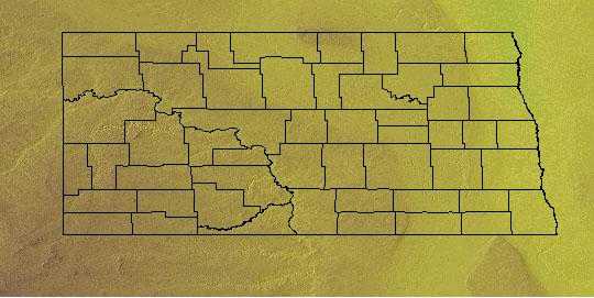
North Dakota is bordered by Canada on the north and by South Dakota on the south. On the east, North Dakota is bordered by Minnesota, and on the west, it is bordered by Montana. The highest point in North Dakota is White Butte at 3,506 feet above sea level. Major rivers include the James River, the Missouri River and the Red River.
North Dakota Highest, Lowest, & Mean Elevations |
|
|---|---|
| Mean Elevation | 1,900 ft. |
| Highest Point | White Butte 3,506 ft. |
| Lowest Point | Red River 750 ft. |
North Dakota Land Area (Square Miles) |
|
| Geographic Center | In Sheridan County, 5 mi. SW of McClusky Longitude: 100° 34.1'W Latitude: 47° 24.7'N |
| Total Area | 70,699.79 sq. mi. 19th |
| Land Area | 68,975.93 sq. mi. 77.57% |
| Water Area | 1,723.86 sq. mi. 2.43% |
| Forested Land Area | |
| Dimensions (Length - Width) |
340 miles - 211 miles |
North Dakota: Physiographic Regions
Red River Valley
This area, in the eastern part of the state, is flat, and is one of the most fertile areas in the world. This area of North Dakota is farm country and wheat and other crops cover the area along with livestock.
Drift Prairie
To the west of the Red River Valley is the Drift Prairie, marked by rolling hills, stream valleys and numerous lakes. To the north of this area are the Turtle Mountains.
Great Plains
The southwestern half of North Dakota is covered by the Great Plains, an area that is hilly and rich in mineral deposits. The Badlands is an area in southwestern North Dakota. This valley of stone and clay has been shaped by wind and water into strange but beautiful formations. White Butte, the highest point in the state, lies in the Badlands.
North Dakota Landscape and Landforms:
Northern Mixed-grass Prairie
The area includes almost all of the eastern half of South Dakota and central North Dakota from the Red River Valley on the east to the Missouri River and Montana border on the south and west. In Canada, it includes a small portion of southern Manitoba, and a swath that crosses Saskatchewan and extends into Alberta. The southern edge of this physiographic area is the terminus of a glacial moraine now marked by the course of the Missouri River. To the north, prairies give way to the Aspen Parklands. Precipitation declines from east-to-west across the northern plains, resulting in differences in the height of dominant grasses. To the east, the mixed-grass begins as topography rises out of the Tallgrass Prairie of the Red River Valley. In the United States, grass height gradually decreases beyond the western boundary of this physiographic area. Because of the glacial history of the Northern Mixed Grass and the relationship between precipitation and evapotranspiration, the area is dotted with thousands of depressions that range from permanently to periodically wet. This gives the area the name "Prairie Potholes." Internally, the various moraines (termed "coteaus") are particularly rugged and marked by potholes.
Northern Tallgrass Prairie
This is the easternmost and lushest region of the Great Plains at this latitude. It includes north-central Iowa, south- central and western Minnesota, the Red River Valley of North Dakota, and extends into south- central Manitoba. Tallgrass prairie grades into savannah on its eastern boundary. The transition zone has doubtlessly shifted over time with changes in the patterns of fire, drought, and herbivory that maintain the prairie. Similar forces affect the boundary with Aspen Parkland to the northeast and north. Drier conditions result in shorter grasses as the tallgrass gives way to the Mixed Grass Prairie at the western edge of the Red River Valley. The entire Northern Tallgrass was subjected to recent glaciation, resulting in a dense distribution of wetland depressions away from the geologically younger river valleys. The southernmost border of this glaciation created the boundary between this physiographic area and the Dissected Till Plains.
West River
West River is comprised of those areas west of the Missouri River in North Dakota and South Dakota, including the Black Hills, as well as a small portion of northwestern Nebraska. It is predominantly a grassland, with riparian woodlands along major waterways and coniferous forest in the Black Hills and other isolated highlands in the west. This area is a mixed grass prairie, but is considerably drier than either the Northern Mixed Grass Prairie physiographic area to the east or the Nebraska Sandhills of the Central Mixed Grass Prairie to the south. Because it was not recently glaciated, it lacks the prairie potholes so important to wetland birds. Large areas in the western portion of this area are highly dissected landscapes known as "badlands."

