


Click Image to Enlarge
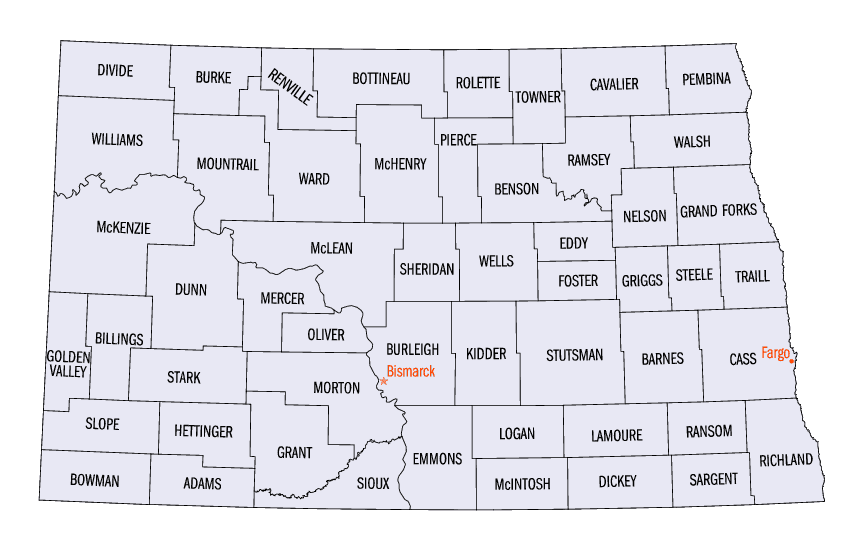
North Dakota Counties
There are fifty-three counties in the state of North Dakota. Pembina County was created by the 1866-1867 Dakota territorial legislature, and was organized on August 12, 1867. The city of Pembina, the oldest European-American settlement in the state, was the county seat from 1867 to 1911. The seat was relocated to Cavalier.McKenzie County, North Dakota
McKenzie County Education, Geography, and History
McKenzie County is a county located in the state of North Dakota. Based on the 2010 census, the population was 6,360. Its county seat is
Watford City.
McKenzie County was first created by the March 8, 1883 Dakota Territory legislature but eliminated in 1891 due to a lack of settlement. The
county was then recreated by the 1905 state legislature, with the county government first organizing on April 20, 1905. The name comes from
early North Dakota politician Alexander McKenzie. Before becoming Watford City, the county seat was Alexander from 1905 to 1907 and Schafer
from 1907 to 1941.
Etymology - Origin of McKenzie County Name
Named for Alexander McKenzie of Bismarck (1851-1922), credited with helping to engineer the removal of the capitol of Dakota Territory from Yankton to Bismarck that year and who later became one the North Dakota's most powerful political leaders.
Demographics:
County QuickFacts: CensusBureau Quick Facts
McKenzie County History
Original McKenzie County was created by the 1883 territorial legislature but eliminated in 1891 due to lack of settlement. Named for Alexander McKenzie of Bismarck (1851-1922), credited with helping to engineer the removal of the capitol of Dakota Territory from Yankton to Bismarck that year and who later became one the North Dakota's most powerful political leaders. The present county was created by the 1905 state legislature. Government organized: April 20, 1905. County Seat: Alexander, 1905-1907; Schafer, 1907-1941; Watford City, 1941-present.
Geography: Land and Water
As reported by the Census Bureau, the county has a total area of 2,861 square miles (7,410 km2), of which 2,760 square miles (7,100 km2)
is land and 100 square miles (260 km2) (3.5%) is water. It is the largest county in North Dakota by area.
The McKenzie County landscape features a wide diversity of physical features, ranging from sugarbeet fields bordering the Missouri River at
the northwest corner of the county to rugged badlands near the Little Missouri River in the south, where Theodore Roosevelt National Park and
the Little Missouri National Grassland are located. Between the two rivers is a large area of prairie, ranging from gentle rolling terrain to
rocky, rugged pastures. The southeast corner of the county, bordering on the Little Missouri badlands of neighboring Dunn County, is abundant
in wildlife, quaking aspen groves, and bur oak groves, interspersed in places with western red cedar on the north-facing slopes of the
badlands.
Neighboring Counties
Bordering counties are as follows:
- Williams County (north)
- Mountrail County (northeast)
- Dunn County (southeast)
- Billings County (south)
- Golden Valley County (southwest)
- Wibaux County, Montana (southwest)
- Richland County, Montana (west)
Education


Click Image to Enlarge
