


Click Image to Enlarge
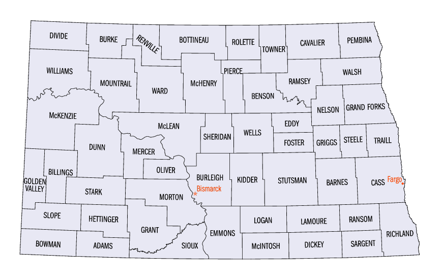
North Dakota Counties
There are fifty-three counties in the state of North Dakota. Pembina County was created by the 1866-1867 Dakota territorial legislature, and was organized on August 12, 1867. The city of Pembina, the oldest European-American settlement in the state, was the county seat from 1867 to 1911. The seat was relocated to Cavalier.Pembina County, North Dakota
Pembina County Education, Geography, and History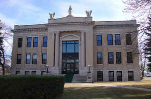
Pembina County is a county located in the state of North Dakota. At the 2010 Census its population was 7,413. The county seat is Cavalier.
Etymology - Origin of Pembina County Name
Named for the high bush cranberries which grew wild in the area.
Demographics:
County QuickFacts: CensusBureau Quick Facts
Pembina County History
Created by the 1866-67 territorial legislature and named for the high bush cranberries which grew wild in the area. Government organized: August 12, 1867. County Seat: Pembina, 1867-1911; Cavalier, 1911-present.
The area along the Pembina and Red rivers was long inhabited by various indigenous peoples. At the time of European contact, the dominant
tribe were the Assiniboine and the Lakota (or Sioux, as the French colonists called them). Later the Ojibwe (or Chippewa) migrated into the
area from the east and became the dominant tribe. The people had a long trading relationship with French colonists and supported them during
the Seven Years' War against Great Britain. By the time of the War of 1812, the Ojibwe were allied with the British against the United States,
hoping to forestall or slow European-American settlers' encroaching on their territory. During the first half of the nineteenth century,
continuing conflicts between the Lakota and Chippewa along the Red River slowed European-American settlement. The Chippewa pushed the Lakota
to the west and became dominant in the area.
The county was created by the 1866-1867 Dakota territorial legislature, and was organized on August 12, 1867. "Pembina" is derived from the
Chippewa term for high-bush cranberry, which grew in abundance along the Pembina River. The city of Pembina, the oldest European-American
settlement in the state, was the county seat from 1867 to 1911. The seat was relocated to Cavalier.
Cavalier Air Force Station and Icelandic State Park are both located in Pembina County. The first Icelandic immigrant settlement in
present-day North Dakota was in Pembina County in the late 1870s, when a colony of settlers from Iceland moved into the county from the New
Iceland homesteads near Lake Winnipeg.
Geography: Land and Water
As reported by the Census Bureau, the county has a total area of 1,121 square miles (2,900 km2), of which 1,119 square miles (2,900 km2) is land and 2.7 square miles (7.0 km2) (0.2%) is water. The lowest point in the state of North Dakota is located on the Red River of the North in Pembina Township in Pembina County, where it flows out of North Dakota and into the Canadian border of Manitoba
Neighboring Counties
Bordering counties are as follows:
- Rural Municipality of Stanley, Canada (north)
- Rural Municipality of Rhineland, Manitoba, Canada (north)
- Town of Gretna, Manitoba (north)
- Rural Municipality of Montcalm, Manitoba, Canada (north)
- Town of Emerson, Manitoba (north)
- Kittson County, Minnesota (east)
- Walsh County (south)
- Cavalier County (west)
Education


Click Image to Enlarge
