


Click Image to Enlarge
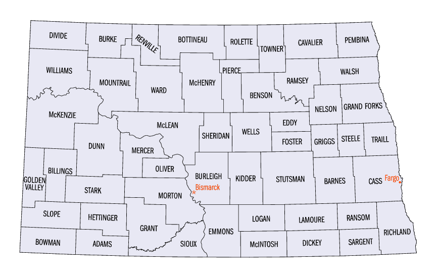
North Dakota Counties
There are fifty-three counties in the state of North Dakota. Pembina County was created by the 1866-1867 Dakota territorial legislature, and was organized on August 12, 1867. The city of Pembina, the oldest European-American settlement in the state, was the county seat from 1867 to 1911. The seat was relocated to Cavalier.Stark County, North Dakota
Stark County Education, Geography, and History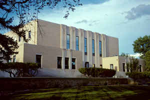
Stark County is a county located in the state of North Dakota. Based on the 2010 census, the population was 24,199. Its county seat is
Dickinson. The county was formed in 1879 and organized in 1883.
Stark County is part of the Dickinson, ND Micropolitan Statistical Area.
Etymology - Origin of Stark County Name
Named for George Stark, vice president of the Northern Pacific Railroad, 1875-1879.
Demographics:
County QuickFacts: CensusBureau Quick Facts
Stark County History
Created by the 1879 territorial legislature and named for George Stark, vice president of the Northern Pacific Railroad, 1875-1879. Government organized: May 30, 1883. County Seat: Dickinson, 1883-present.
Stark County was created February 10, 1879, as a county within Dakota Territory from parts of Howard County and Williams County. The county
organized on May 25, 1883, and became a county in the state of North Dakota on November 2, 1889.
In 1891, the North Dakota Legislature enacted legislation annexing Dunn County, Hettinger County, and parts of Billings, Bowman, McKenzie,
Wallace, and Williams Counties into Stark. However, the act was vetoed by Governor Eli C. D. Shortridge.
Additional annexation legislation was enacted in 1895, affecting the boundaries of Stark, Billings, and Mercer Counties, subject to approval
by the counties' voters. The annexation went into effect November 3, 1896, but Wilson L. Richards, a local cattle rancher, sued to overturn
the annexation because he and other landowners in the area were now subject to taxation by Stark County. The case went to the North Dakota
Supreme Court, which ruled the law unconstitutional on May 18, 1899. The annexation remained in effect, however, due to a replacement law
approved by the legislature March 9, 1899, in anticipation of the court's decision.
Geography: Land and Water
As reported by the Census Bureau, the county has a total area of 1,340 square miles (3,500 km2), of which 1,335 square miles (3,460 km2) is land and 5.5 square miles (14 km2) (0.4%) is water.
Neighboring Counties
Bordering counties are as follows:
- Dunn County (north/CST Border in the north part of the county)
- Mercer County (northeast/CST Border)
- Morton County (east/CST Border)
- Grant County (southeast/CST Border)
- Hettinger County (south)
- Slope County (southwest)
- Billings County (west)
Education


Click Image to Enlarge
