


Click Image to Enlarge
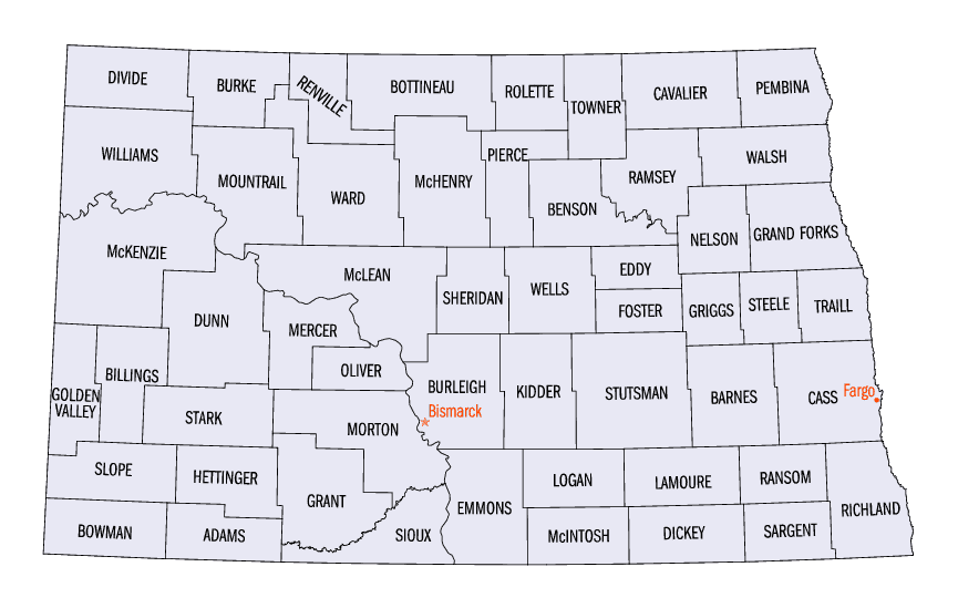
North Dakota Counties
There are fifty-three counties in the state of North Dakota. Pembina County was created by the 1866-1867 Dakota territorial legislature, and was organized on August 12, 1867. The city of Pembina, the oldest European-American settlement in the state, was the county seat from 1867 to 1911. The seat was relocated to Cavalier.Williams County, North Dakota
Williams County Education, Geography, and History
Williams County is a county located in the state of North Dakota. Based on the 2010 census, the population was 22,398. Its county seat is
Williston. As of 2013 Williams County is the fastest-growing county in the United States.
The Williston Micropolitan Statistical Area includes all of Williams County.
Etymology - Origin of Williams County Name
Named for Erastus Appelman Williams of Bismarck (1850-1930), an outstanding figure in the political history of Dakota Territory and North Dakota who served during ten legislative sessions, including one at which Williams County was originally created.
Demographics:
County QuickFacts: CensusBureau Quick Facts
Williams County History
There have been two Williams counties in the history of North Dakota. The first, created in 1873, was located south of the Missouri River near where Dunn and Mercer counties are today. The second Williams County was established by the 1891 state legislature and consists of the contemporary Williams and Divide counties.
Named for Erastus Appelman Williams of Bismarck (1850-1930), an outstanding figure in the political history of Dakota Territory and North Dakota who served during ten legislative sessions, including one at which Williams County was originally created. Government organized: December 8, 1891. County Seat: Williston, 1891-present.
Geography: Land and Water
As reported by the Census Bureau, the county has a total area of 2,148 square miles (5,560 km2), of which 2,077 square miles (5,380 km2)
is land and 70 square miles (180 km2) (3.3%) is water. It is the fourth-largest county in North Dakota by area.
Lake Sakakawea, a reservoir on the Missouri River, is situated on the southern boundary of the county. Little Muddy Creek is entirely within
Williams County. The confluence of the Yellowstone River with the Missouri is west of Williston.
Williams County is one of several western North Dakota counties with significant exposure to the Bakken formation in the Williston Basin.
Neighboring Counties
Bordering counties are as follows:
- Divide County (north)
- Burke County (northeast)
- Mountrail County (east)
- McKenzie County (south)
- Roosevelt County, Montana (southwest)
- Sheridan County, Montana (west)
Education


Click Image to Enlarge
