


Click Image to Enlarge
Ohio Counties
There is eighty-eight counties in the state of Ohio. Washington County the oldest in the state established on July 27, 1788. Noble County was formed on March 11, 1851 from portions of Guernsey, Morgan, Monroe and Washington counties. It was the last county to be formed in Ohio and, therefore, represents the youngest county in the state.Clark County, Ohio
Clark County Education, Geography, and History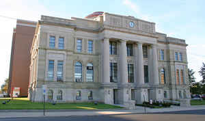
Clark County is a county located in the state of Ohio. Based on the 2010 census, the population was 138,333. Its county seat is
Springfield. The county was created on March 1, 1818, and was named for General George Rogers Clark, a hero of the American Revolution.
Clark County comprises the Springfield, OH Metropolitan Statistical Area, which is also included in the Dayton-Springfield-Sidney-OH Combined
Statistical Area.
Etymology - Origin of Clark County Name
The county was named in honor of George Rogers Clark, a hero of the American Revolution.
Demographics:
County QuickFacts: CensusBureau Quick Facts
Clark County History
On December 26, 1817, the Ohio government authorized the
creation of Clark County. The county was named in honor of George Rogers Clark,
a hero of the American Revolution. It was originally parts of Greene, Champaign,
and Madison Counties. The county began to flourish during the 1830s, with the
completion of the National Road through Ohio.
Clark County is located in west central Ohio. It is predominantly rural, with
less than one percent of the county's four hundred square miles consisting of
urban areas. The county seat is Springfield. With a population of 65,358 people,
Springfield was the county's largest community in 2000. The next largest urban
area, New Carlisle, had only 5,735 residents that same year. Like most of Ohio's
predominantly rural counties, Clark County experienced a drop in population -
roughly two percent - between 1990 and 2000, reducing the total number of
residents to 144,742 people. Many residents of Ohio's rural communities are
seeking better lives and more opportunities in the state's cities. Clark County
averages almost 362 people per square mile.
The largest employer in Clark County is sales positions, followed closely by
service industries, such as health care and communications. Manufacturing jobs
are a close third, with government positions a distant fourth. Many residents
found employment in the printing industry during the 1930s and 1940s, with the
Crowell-Collier Publishing Company publishing several national magazines in
Springfield. During this same time period, Springfield was the largest grower of
rosebushes for sale in the nation. In 1999, the per capita income in the county
was almost twenty-five thousand dollars, with 12.5 percent of the people living
in poverty.
Most voters in Clark County claim to be independents, yet in recent years, they
have supported by very slim margins Democratic Party candidates at the national
level. Among Clark County's more prominent residents was A.B. Graham, who
founded 4-H Clubs. The county is also home to Wittenberg University. Ohio
Governor Asa S. Bushnell was also a resident of Springfield. Backwoodsmen Simon
Kenton lived in Springfield for a period of time, and his wife supposedly named
the city of Springfield. Simon Kenton is buried in Urbana's Oakdale Cemetery, in
nearby Champaign County.
Sources
Clark County, Ohio History Central, July 23,
2008,
http://www.ohiohistorycentral.org/entry.php?rec=1912&nm=Clark-County
Geography: Land and Water
As reported by the Census Bureau, the county has a total area of 403 square miles (1,040 km2), of which 397 square miles (1,030 km2) is land and 5.1 square miles (13 km2) (1.3%) is water. It is the third-smallest county in Ohio by total area.
Neighboring Counties
Bordering counties are as follows:
- Champaign County (north)
- Madison County (east)
- Greene County (south)
- Montgomery County (southwest)
- Miami County (west)
Education
Public school districts
Clark - Shawnee Local School District
Greenon Local School District
Northeastern Local School District
Northwestern Local School District
Southeastern Local Schools
Springfield City School District
Tecumseh Local School District


Click Image to Enlarge
