


Ohio State Almanac: Facts and Figures
Quick Facts, Figures, and Overview of the State of Ohio
Ohio is one of the East North Central states of the US. Ohio's southern border is defined by the Ohio River (with the border being at the 1793 low-water mark on the north side of the river), and much of the northern border is defined by Lake Erie. Ohio's neighbors are Pennsylvania to the east, Michigan to the northwest, Ontario Canada, to the north, Indiana to the west, Kentucky on the south, and West Virginia on the southeast. In addition, the state controls around 3,457 sq. km of Lake Erie, which borders the state in the north. Ohio is the name that the Iroquois Indians used when referring to the river and means "large" or "beautiful river."
Ohio has been a major manufacturing state since the 19th century and in the early 1990s was especially associated with the production of transportation equipment, iron and steel, and rubber items. Today, Ohio is one of the nation's industrial leaders, ranking third in manufacturing employment nationwide. Important manufacturing centers are located in or near Ohio's major cities. Akron is known for rubber; Canton for roller bearings; Cincinnati for jet engines and machine tools; Cleveland for auto assembly, auto parts, and steel; Dayton for office machines, refrigeration, and heating and auto equipment; Youngstown and Steubenville for steel; and Toledo for glass and auto parts. The state's fertile soil produces soybeans, corn, oats, greenhouse and nursery products, wheat, hay, and fruit, including apples, peaches, strawberries, and grapes. More than half of Ohio's farm receipts come from dairy farming and sheep and hog raising. Ohio ranks fourth among the states in lime production and also ranks high in sand and gravel and crushed stone production.
Ohio Almanac: Fast Facts and Figures on the State of Ohio |
||
|---|---|---|
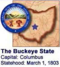
| Official Name | Ohio | |
| Capital | Columbus | |
| Nicknames | Buckeye State ... and more | |
| Motto | With God, all things are possible | |
| Location Region |
39.98893 N, 082.98738 W Midwest Northeastern Appalachia |
|
| Constitution Ratified | 1851 | |
| Statehood | March 01, 1803 17th state |
|
| Population | 11,536,504 (2010) 277.22 sq. mi. 7th |
|
| Largest City (by population) |
10 largest cities (2010 est.):Columbus, 787,033; Cleveland, 396,8158; Cincinnati, 296,943; Toledo, 287,208; Akron, 199,110; Dayton, 141,527; Parma, 81,601; Youngstown, 66,982; Canton, 73,007; Lorain, 64,097 | |
| Bordering States | North: Michigan and Ontario, Canada (Lake Erie forms most of the North boundary)
East: Pennsylvania and West Virginia (Ohio River forms much of the Eastern and all of the Southern boundaries) South: West Virginia and Kentucky West: Indiana |
|
| Major Industry | manufacturing (steel, cars, airplanes, rubber products, chemicals, plastics), farming, mining (coal) | |
| Major Rivers | Ohio River, Cuyahoga River, Miami River, Sandusky River | |
| Major Lakes | Lake Erie, Grand Lake | |
| Ohio Counties | 88 Counties in Ohio | |
| Largest County (by population) |
Cuyahoga County 1,280,122 (2010) 358 sq. mi. |
|
| Largest County (by area) |
Ashtabula County 703 sq. mi. |
|
| State forests | 20 (more than 183,000 ac.) | |
| State parks | 74 (more than 204,000 ac.) | |
| Presidential Birthplaces |
Ulysses Simpson Grant was born in Point Pleasant on April 27, 1822 (he was the 18th US President, serving from 1869 to 1877). Rutherford Birchard Hayes was born in Delaware on October 4, 1822 (he was the 19th US President, serving from 1877 to 1881). James Abram Garfield was born in Orange on November 19, 1831 (he was the 20th US President, serving in 1881). Benjamin Harrison was born in North Bend on August 20, 1833 (he was the 23th US President, serving from 1889 to 1893). William McKinley was born in Niles on January 29, 1843 (he was the 25th US President, serving from 1897 to 1901). William Howard Taft was born in Cincinnati on September 15, 1857 (he was the 27th US President, serving from 1909 to 1913). Warren Gamaliel Harding was born in Corsica (now Blooming Grove) on November 2, 1865 (he was the 29th US President, serving from 1921 to 1923). |
|
| Electoral Votes | 20 (as of the 2004 Presidential Election) | |
| US Congress | 2 Senators; 18 Representatives | |
| Time Zone | Eastern Standard Time | |
| Zip Codes | NANPA | |
| State Quick Facts | Census Bureau Quick Facts | |
Ohio Climate and Weather |
|
|---|---|
| Ohio's summer is warm, with most areas seeing 90 F/32 C temperatures for at least a few days. Humidity can be uncomfortable at high temperatures, though generally not excessively so. Expect more rain in late spring and early summer, including thunderstorms and the possibility of tornadoes. Temperatures range 37-70 F/3-21 C in the northeast and 41-72 F/5-22 C in the southwest during April and May. Fall is the sunniest season, with warm September days running 52-81 F/11-21 C. A jacket will be useful for evenings, especially in October, when temperatures drop into the low 40s F/4-6 C at night. Winters are cold (17 to 43 F/-8 to -6 C), with plenty of snow, especially in the snow belt near Lake Erie. Winter visitors to the state should be prepared for hazardous driving and flight delays caused by the snow. | |
| Highest Temperature | 113 degrees July 21, 1934 - Gallipolis |
| Lowest Temperature | -39 degrees February 10, 1899 - Milligan |
| Avg. Temp: High - Low |
85.8 degrees 15.5 degrees |
Ohio Points of Interest |
|
|
Ohio offers all travelers
a diverse array of activities, attractions and events. Some of its most popular tourist destinations include Amish Country; Cleveland and the Rock and Roll Hall of Fame; Indian burial grounds at Mound City Group National Monument; historic homes of seven U. S. Presidents; Lake Erie shoreline and the Bass Islands; Pro Football Hall of Fame, and the Thomas Edison birthplace museum. |
|
Ohio Highest, Lowest, and Mean Elevations (Feet) |
|
| Mean Elevation: 850 feet | |
|
Highest Point: Campbell Hill: 1,549 feet
|
|
| Lowest Point: | Ohio River 455 feet |
Ohio Land Area (Square Miles) |
|
| Geographic Center | In Delaware County, 25 mi. NNE of Columbus Longitude: 82°44.5'W Latitude: 40°21.7'N |
| Total Area | 44,824.90 sq.mi. 34th |
| Land Area | 40,948.38 sq.mi. 91.36% |
| Water Area | 3,876.53 sq.mi. 8.64% |
| Forested Land Area | 30% |
| Dimensions (Length - Width) |
220 miles - 220 miles |
 Also known as Mount Campbell,
Campbell Hill is the highest point in Ohio at 1549 feet above sea level. It is located two miles east of Bellefountaine on Rt. 540. During the 1950s,
the 664th Aircraft Control and Warning Squadron was stationed on Mount Campbell. Today the Ohio Hi-Point Career Center, a joint-vocational school,
is located on the site.
Also known as Mount Campbell,
Campbell Hill is the highest point in Ohio at 1549 feet above sea level. It is located two miles east of Bellefountaine on Rt. 540. During the 1950s,
the 664th Aircraft Control and Warning Squadron was stationed on Mount Campbell. Today the Ohio Hi-Point Career Center, a joint-vocational school,
is located on the site.Adams, Allen, Ashland, Ashtabula, Athens, Auglaize, Belmont, Brown, Butler, Carroll, Champaign, Clark, Clermont, Clinton, Columbiana, Coshocton, Crawford, Cuyahoga, Darke, Defiance, Delaware, Erie, Fairfield, Fayette, Franklin, Fulton, Gallia, Geauga, Greene, Guernsey, Hamilton, Hancock, Hardin, Harrison, Henry, Highland, Hocking, Holmes, Huron, Jackson, Jefferson, Knox, Lake, Lawrence, Licking, Logan, Lorain, Lucas, Madison, Mahoning, Marion, Medina, Meigs, Mercer, Miami, Monroe, Montgomery, Morgan, Morrow, Muskingum, Noble, Ottawa, Paulding, Perry, Pickaway, Pike, Portage, Preble, Putnam, Richland, Ross, Sandusky, Scioto, Seneca, Shelby, Stark, Summit, Trumbull, Tuscarawas, Union, Van Wert, Vinton, Warren, Washington, Wayne, Williams, Wood, Wyandot

