


Click Image to Enlarge
Ohio Counties
There is eighty-eight counties in the state of Ohio. Washington County the oldest in the state established on July 27, 1788. Noble County was formed on March 11, 1851 from portions of Guernsey, Morgan, Monroe and Washington counties. It was the last county to be formed in Ohio and, therefore, represents the youngest county in the state.Defiance County, Ohio
Defiance County Education, Geography, and History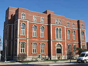
Defiance County is a county located in the state of Ohio. Based on the 2010 census, the population was 39,037. Its county seat is
Defiance. The county was named after an early Army fortification, Fort Defiance, which was so named by Mad Anthony Wayne to signify the
settlers' "defiance" of the Indians.
The Defiance, OH Micropolitan Statistical Area includes all of Defiance County.
Etymology - Origin of Defiance County Name
Residents named the county after Fort Defiance, a fortification constructed by General Anthony Wayne's men prior to the Battle of Fallen Timbers in 1794.
Demographics:
County QuickFacts: CensusBureau Quick Facts
Defiance County History
On March 4, 1845, the Ohio government authorized the creation of Defiance County. The county was originally parts of Williams, Henry, and Paulding Counties. Residents named the county after Fort Defiance, a fortification constructed by General Anthony Wayne's men prior to the Battle of Fallen
Timbers in 1794. Fort Defiance was also important to defending Ohio from invasion by British soldiers and their native allies during the War of 1812.
Defiance County is located in northwestern Ohio. The county's western boundary helps to form the border between Indiana and Ohio. Defiance County is predominantly rural, with only one percent of the county's 411 square miles consisting of urban areas. The county seat is Defiance, site of Fort
Defiance. With a population of 16,465 people, Defiance was the county's largest community in 2000. The next largest urban area was Hicksville, with a population of 3,649 people in 2000. Like most of Ohio's predominantly rural counties, Defiance County experienced a decline in population between 1990
and 2000, reducing the number of residents to 39,500 people down from 40,115. The migrants typically leave the rural areas, seeking more social and economic opportunities in Ohio's larger cities. The county averages ninety-six people per square mile.
The largest employers in Defiance County are manufacturing businesses, especially a General Motors powertrain assembly plant that hires 2,550 workers. Sales positions, service industries, farming, and government careers rank second, third, fourth and fifth respectively. In 1999, the per capita
income in the county was almost twenty-five thousand dollars, with 7.1 percent of the people living in poverty.
Most voters in Defiance County claim to be independents, yet in recent years, they have supported Republican Party candidates at the national level.
Among Defiance County's more prominent residents was Pontiac, the Ottawa chieftain that led Pontiac's Rebellion following the French and Indian War. The county also is home to Defiance College
Sources
Defiance County, Ohio History Central, July 23, 2008,
http://www.ohiohistorycentral.org/entry.php?rec=1920&nm=Defiance-County
Geography: Land and Water
As reported by the Census Bureau, the county has a total area of 414 square miles (1,070 km2), of which 411 square miles (1,060 km2) is land and 2.7 square miles (7.0 km2) (0.7%) is water
Neighboring Counties
Bordering counties are as follows:
- Williams County (north)
- Henry County (east)
- Putnam County (southeast)
- Paulding County (south)
- Allen County, Indiana (southwest)
- DeKalb County, Indiana (west)
Education


Click Image to Enlarge
