


Click Image to Enlarge
Ohio Counties
There is eighty-eight counties in the state of Ohio. Washington County the oldest in the state established on July 27, 1788. Noble County was formed on March 11, 1851 from portions of Guernsey, Morgan, Monroe and Washington counties. It was the last county to be formed in Ohio and, therefore, represents the youngest county in the state.Erie County, Ohio
Erie County Education, Geography, and History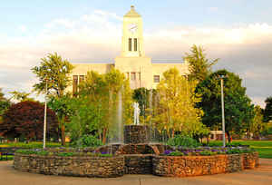
Erie County is a county located in the state of Ohio. Based on the 2010 census, the population was 77,079. Its county seat is Sandusky.
The county is named for the Erie tribe, whose name was their word for "wildcat". It was formed in 1838 from the northern third of Huron
County, and a portion of Sandusky County.
Erie County comprises the Sandusky, OH Micropolitan Statistical Area, which is also included in the Cleveland-Akron-Canton, OH Combined
Statistical Area
Etymology - Origin of Erie County Name
Residents named the county after the Erie Indians.
Demographics:
County QuickFacts: CensusBureau Quick Facts
Erie County History
On March 15, 1838, the Ohio government authorized the creation of Erie County. The county was originally parts of Huron and Sandusky Counties. Residents named the county after the Erie Indians. The county was originally a portion of the Connecticut Western Reserve and was part of the Fire Lands.
Located on Lake Erie, the county and its residents played an important role in the Underground Railroad during the first part of the nineteenth century. Residents commonly ferried runaway slaves across Lake Erie to Canada. Sandusky and Huron were once busy ports, allowing Ohio farmers and businesses
to ship their products all over the world.
Erie County is located in the north-central portion of Ohio. The county seat is Sandusky, which is the county's largest population center, with almost twenty-eight thousand residents in 2000. The county's next largest community is Huron, with a population of approximately eight thousand people in
2000. The county experienced almost a four percent increase in population between 1990 and 2000, raising the number of residents to 79,551 people. An average of 312 people live in each of Erie County's 255 square miles.
Erie County is heavily rural, with urban areas comprising six percent of the county's land mass. Most residents find employment in service industries, with manufacturing establishments and sales positions coming in second and third respectively. The county is a major tourist destination, with Cedar
Point Amusement Park residing within its borders. Lake Erie also attracts a large number of visitors, who participate in boating and fishing. The Ohio Historical Society also operates two sites in the county, Inscription Rock, where Indians left pictographs, and Glacial Grooves, which provides
visitors with the opportunity to see gouges made by glaciers. The county's average income was approximately twenty-eight thousand dollars per person in 1999, with just over nine percent of the population living in poverty.
Most voters in Erie County claim to be independents, yet in recent years, they have supported by slim majorities Democratic Party candidates at the national level.
Erie County's most famous resident was inventor Thomas Alva Edison, who was born in Milan, Ohio
Sources
Erie County, Ohio History Central, July 23, 2008,
http://www.ohiohistorycentral.org/entry.php?rec=1925&nm=Erie-County
Geography: Land and Water
As reported by the Census Bureau, the county has a total area of 626 square miles (1,620 km2), of which 252 square miles (650 km2) is
land and 374 square miles (970 km2) (60%) is water. It is the second-smallest county in Ohio by land area. The county borders Canada to the
north across Lake Erie.
It is drained by Huron and Vermilion rivers. Near Huron River are several ancient mounds and enclosures, and at Sandusky are extensive
quarries of valuable limestone. The surface is generally level, the soil alluvial and exceedingly fertile.
Neighboring Counties
Bordering counties are as follows:
- Across Lake Erie lies Essex County and Chatham-Kent, Ontario, Canada (north)
- Lorain County (east)
- Huron County (south)
- Sandusky County (west)
- Ottawa County (northwest, connected by the Thomas A. Edison Memorial Bridge)
Education
All or part of eleven school districts serve Erie County and its residents:
- Bellevue City School District: includes parts of Bellevue and Groton Township.
- Berlin-Milan Local School District: includes parts of Berlin Heights and Milan, and Berlin, Florence, Huron, Milan, Oxford, Perkins, and Vermilion Townships.
- Firelands Local School District: includes parts of Florence Township.
- Huron City School District: includes parts of Huron and Berlin, Huron, and Milan Townships.
- Kelleys Island Local School District: includes all of Kelleys Island.
- Margaretta Local School District: includes parts of Bay View and Castalia, and Groton and Margaretta Townships.
- Monroeville Local School District: includes parts of Oxford Township.
- Perkins Local School District: includes parts of Groton, Huron, Margaretta, Milan, Oxford, and Perkins Townships.
- Sandusky Central Catholic Schools: includes Sandusky's three Parishes (St. Mary, Ss. Peter & Paul, and Holy Angels).
- St. Peter's School: a private catholic elementary school in Huron
- Sandusky City School District: includes all of Sandusky.
- Vermilion Local School District: includes parts of Vermilion and Florence and Vermilion Townships.
- Western Reserve Local School District: including parts of Florence Township.


Click Image to Enlarge
