


Click Image to Enlarge
Ohio Counties
There is eighty-eight counties in the state of Ohio. Washington County the oldest in the state established on July 27, 1788. Noble County was formed on March 11, 1851 from portions of Guernsey, Morgan, Monroe and Washington counties. It was the last county to be formed in Ohio and, therefore, represents the youngest county in the state.Fairfield County, Ohio
Fairfield County Education, Geography, and History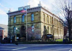
Fairfield County is a county located in the state of Ohio. Based on the 2010 census, the population was 146,156. Its county seat is
Lancaster. Its name is a reference to the Fairfield area of the original Lancaster.
Fairfield County is part of the Columbus, OH Metropolitan Statistical Area.
Etymology - Origin of Fairfield County Name
Residents named the county after the area's "fair fields."
Demographics:
County QuickFacts: CensusBureau Quick Facts
Fairfield County History
On December 9, 1800, the government of the Northwest Territory authorized the creation of Fairfield County. Residents named the county after the area's "fair fields." Zane's Trace passed through the county. The population grew as people moved westward into the Northwest Territory.
Fairfield County is located in east central Ohio. It is predominantly rural, with less than two percent of the county's 505 square miles consisting of urban areas. The county seat is Lancaster. With a population of 35,335 people, Lancaster was the county's largest community in 2000. The next largest
urban area, Pickerington, had 9,737 residents in that same year. Fairfield County experienced a significant increase in population - roughly 18.6 percent - between 1990 and 2000. The total population of the county in 2000 was 122,759 people. Many of these new people were residents of Columbus or
other parts of central Ohio. The county averages 243 people per square mile.
The largest employers in Fairfield County are sales establishments, with health care, communications, and other service industries a distant second. Government and manufacturing positions finish third and fourth respectively. Farming is a distant fifth. During the late nineteenth and the early
twentieth centuries, the county became a major producer of glass products. Anchor-Hocking Glass Company originated in Fairfield County. In 1999, the per capita income in the county was approximately 26,700 dollars, with almost seven percent of the people living in poverty.
Most voters in Fairfield County claim to be independents.
Among Fairfield County's more prominent residents was William Tecumseh Sherman, a general in the Union Army during the American Civil War. His brother, John Sherman, was a United States senator and author of the Sherman Anti-Trust Act. General Sherman's former home in Lancaster is now a museum. Ohio
Governor William Medill was from Fairfield County. Tarlton Indian Mound, the only known cross-shaped earthworks, is in this county.
Sources
Fairfield County, Ohio History Central, July 23, 2008,
http://www.ohiohistorycentral.org/entry.php?rec=1926&nm=Fairfield-County
Geography: Land and Water
As reported by the Census Bureau, the county has a total area of 509 square miles (1,320 km2), of which 504 square miles (1,310 km2) is
land and 4.2 square miles (11 km2) (0.8%) is water.
Fairfield County sits just on the edge of Ohio's Appalachian region. While the once-glaciated northern portion of the county is fairly flat,
as one travels south along US 33 one can easily recognize the foothills of a mountainous region beginning around the village of Carroll.
Although not officially part of the state or federal definition of Appalachia, certain areas of Fairfield County—particularly south of US
22—bear a distinctly Appalachian feel in both physical geography and demographics.
The scenic Hocking Hills region lies immediately to the south, mostly in neighboring Hocking County. A large portion of Buckeye Lake is
located in northeastern Fairfield County.
Neighboring Counties
Bordering counties are as follows:
- Licking County (north)
- Perry County (east)
- Hocking County (south)
- Pickaway County (southwest)
- Franklin County (northwest)
Education
School districts
Amanda Clearcreek Local School District
Berne Union Local School District
Bloom-Carroll Local School District
Canal Winchester Local School District (Franklin & Fairfield)
Fairfield Union Local School District
Lancaster City Schools
Liberty Union-Thurston Local School District
Northern Local School District
Pickerington Local School District
Reynoldsburg Local School District
Southwest Local School District
Teays Valley Local School District (Almost entirely Pickaway)
Walnut Township Local School District


Click Image to Enlarge
