


Click Image to Enlarge
Ohio Counties
There is eighty-eight counties in the state of Ohio. Washington County the oldest in the state established on July 27, 1788. Noble County was formed on March 11, 1851 from portions of Guernsey, Morgan, Monroe and Washington counties. It was the last county to be formed in Ohio and, therefore, represents the youngest county in the state.Hamilton County, Ohio
Hamilton County Education, Geography, and History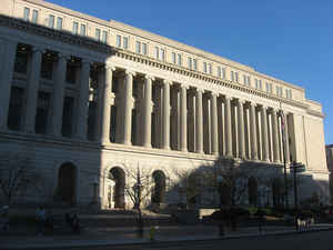
Hamilton County is a county located in the southwest corner of the state of Ohio. Based on the 2010 census, the population was 802,374.
making it the third-most populous county in Ohio. The county seat is Cincinnati. The county is named for the first Secretary of the Treasury,
Alexander Hamilton.
Hamilton County is part of the Cincinnati-Middletown, OH-KY-IN Metropolitan Statistical Area.
Etymology - Origin of Hamilton County Name
Residents named the county in honor of Alexander Hamilton, who was the first Secretary of the Treasury of the United States and a founder of the Federalist Party.
Demographics:
County QuickFacts: CensusBureau Quick Facts
Hamilton County History
Hamilton County, Ohio, was established on January 2, 1790. It was the second county formed in the Northwest Territory. Residents named the county in honor of Alexander Hamilton, who was the first Secretary of the Treasury of the United States and a founder of the Federalist Party. The county
consists of 407.4 square miles, with an average of 2,075 residents per square mile in 2000. Located in the southwestern corner of Ohio, the county's southern border helps form Ohio's boundary with Kentucky, while its western border helps form the state's boundary with Indiana. Cincinnati is the
county's largest city and the county seat.
In 1788, Israel Ludlow, Matthias Denman, and Robert Patterson purchased eight hundred acres in Ohio from John Cleves Symmes across the Ohio River from the mouth of the Licking River. Symmes had purchased two million acres of land from the United States in 1787 and now hoped to become rich by selling
parts of the Symmes Purchase to others. Denman provided the necessary cash; Patterson found settlers; and Ludlow surveyed the land to make sales and also to establish a town. By early January 1789, Ludlow had platted the town, dividing it into two types of lots. Near the town's center, lots were
one-half acre in size. Outlying lots were four acres. Ludlow, Denman, and Patterson provided the first thirty settlers with two free lots, one of each type. The three men named the town Losantiville. The name of the town was a concoction of terms loosely meaning that this was a 'city across from the
mouth of the Licking River'.
The town and the surrounding countryside grew slowly. One month after the men established the settlement, only three log cabins existed in Losantiville. On the outlying lots, settlers had constructed twenty cabins and one frame house. Eleven families and two dozen single men lived on the land. In
August 1789, the village began to grow quickly. In that month, Josiah Harmar authorized the construction of Fort Washington to protect settlers in both the Symmes Purchase and the Miami Purchase, as well as in northern Kentucky. The fort was located just west of Denman's, Ludlow's, and Patterson's
eight hundred acres of land. When completed in December 1789, Harmar made Fort Washington his headquarters. Usually three hundred soldiers lived in the fort, increasing Losantiville's population to nearly five hundred people. In 1790, the governor of the Northwest Territory, Arthur St. Clair,
proceeded to establish Hamilton County and made Losantiville the county seat. St. Clair disliked the name Losantiville and changed the town's name to Cincinnati. An additional 250 families arrived later that year, swelling the town's population to nearly seven hundred people.
Law and order remained absent from Hamilton County during its early years. The settlers organized a court and hired a sheriff, but the soldiers routinely had to establish martial law in the area. This became especially common as tensions increased with local Native Americans, especially the Shawnee
Indians. Contributing to the lawlessness, many residents grew corn, which they distilled into alcohol and sold to the soldiers. During 1790 and 1791, thousands of militiamen from Kentucky and Pennsylvania flooded Cincinnati as Harmar and eventually St. Clair planned expeditions against the Indians.
St. Clair faced such a difficult time maintaining control of his men in Cincinnati, with its three taverns, that he moved his men to nearby Ludlow's Station.
After St. Clair's Defeat, at the hands of the Indians in 1791, many settlers fled Hamilton County, fearing that the natives would descend upon them. Despite the lack of order and the various safety concerns, hundreds of settlers continued to come to the region. They believed that they could make
their fortunes providing the soldiers and people traveling down the Ohio River with supplies. By the summer of 1792, thirty warehouses existed in Cincinnati to meet these needs. With the success of Anthony Wayne against the Indians at the Battle of Fallen Timbers in 1794, more settlers arrived in
Hamilton County. In 1803, the year that the United States Army abandoned Fort Washington, the county had roughly two thousand civilian residents. It continued to grow, reaching nearly fifteen thousand people by 1820.
During the nineteenth century, Hamilton County villages, especially Cincinnati, continued to grow. The Ohio River provided residents with numerous business opportunities. Hotels, restaurants, and taverns quickly opened to meet the needs of settlers traveling westward on the Ohio River. Steamboats
were manufactured and repaired in Cincinnati. Farmers brought their crops to Hamilton County to send down the Ohio and Mississippi Rivers to New Orleans, Louisiana, one of Ohio's major markets. The Miami and Erie Canal made the trip from western Ohio to the Ohio River much easier and less expensive
for local farmers. In the early 1800s, Cincinnati developed into an important meatpacking center. Farmers brought their livestock to the city, where it was then slaughtered, processed, and sold to western settlers or shipped to various markets. Because of Cincinnati's association with meatpacking,
the city became known as the "Porkopolis" of the United States.
Hamilton County also played an important role in the intellectual and cultural development of Ohio during the first half of the nineteenth century. In 1819, Daniel Drake established the Medical College of Ohio, hoping to improve medical care on the frontier. Numerous literary figures, including
Harriet Beecher Stowe, the author of Uncle Tom's Cabin, called the county home for at least part of their lives. Americans from both the North and the South settled in the community, creating a very diverse and worldly population.
Some residents opposed the activities of other people in the county and actively campaigned to reform their neighbors. The temperance movement targeted the Germans and the Irish, who were alleged to be well known for their supposedly heavy drinking. Ohio abolitionists campaigned against slavery.
Located directly across the Ohio River from Kentucky, a slaveholding state, Hamilton County abolitionists published newspapers and anti-slavery tracts, hoping to convince their slaveholding neighbors to free their slaves. Participants in the Underground Railroad also smuggled runaway slaves across
the Ohio River to possible freedom in the North. Not all white Ohioans supported the abolitionists. Many of these people feared that, if slavery ended, they would face competition from the freed African Americans. Race riots sometimes occurred, especially if whites feared that African Americans were
gaining too much power or were infringing upon white opportunities. In 1829, one such riot occurred in Cincinnati, because Irish immigrants disliked competition from the African-American community.
During the Civil War, most residents supported the United States, but a sizable number of people went to the South to fight for the Confederacy. Hamilton County served as a major recruiting and training center for the United States military during the Civil War. Businesses and farmers thrived, as
they provided supplies to the soldiers and housing for both the soldiers and their families.
By the late 1880s, Cincinnati was the largest city in Ohio, with almost 300,000 people. Cincinnati had the densest population of any city in the United States, with an average of 37,143 people per square mile. More than fifteen railroads connected Cincinnati to other parts of the United States. The
major industry in Hamilton County was iron production, followed closely by meatpacking, cloth production, and woodworking. Cincinnati's industries employed 103,325 people in 1887, and produced more than 200 million dollars in goods. Roughly 130 newspapers and magazines met the literary needs of
Hamilton County residents. The public library consisted of more than eighty thousand books. An art museum and art academy existed in Cincinnati, as well as an opera house and the Music Hall and Exposition Building. The University of Cincinnati provided residents with access to a college education.
Hamilton County also played a major role in Ohio government as well. By the end of the 1880s, the city had provided Ohio with thirteen governors, including Othniel Looker, Ethan Allen Brown, Salmon Chase, William Dennison, John Brough, Charles Anderson, Jacob Cox, Rutherford Hayes, Edward Noyes,
Richard Bishop, George Hoadley, Thomas Young, and Joseph Foraker. President of the United States William Henry Harrison was also from the county. By 1890, Hamilton County had become an important industrial, political, literary, and educational center in both Ohio and the United States.
For most of the twentieth century, Hamilton County has experienced continued growth both culturally and economically. Surprisingly, Cincinnati's population remained relatively constant since the 1880s with its population in 2000 at 365,000 people. Hamilton County contained 845,303 people. This
marked a 2.4 percent decline between 1990 and 2000. Many of the people who left the county had simply moved to neighboring counties.
Today, many major corporations operate in the city, including Procter & Gamble, Kroger, Federated Department Stores, Ashland, Inc, CINergy, and American Financial Group. Several of these businesses and many others have their national or regional headquarters located in Cincinnati, including
Chiquita, Star-Kist, Kroger, Federated Department Stores, Scripps-Howard, Totes, and Kenner. County residents enjoy diverse employment opportunities. This diversity has helped these people to weather economic downturns comparatively easily, as no single business employs more than three percent of
the county's workforce. Illustrating the area's strong economy, the county's per capita income in 1999 was almost thirty-four thousand dollars, one of the highest averages in Ohio.
In the early 2000s, Hamilton County remains the cultural center of southwestern Ohio, northern Kentucky, and southern Indiana. The county boasts two major professional sports franchises, the Cincinnati Reds and the Cincinnati Bengals. Numerous theaters operate in the county, including the Aronoff
Center for the Arts - home of the Cincinnati Ballet and the Cincinnati Opera - the Emery Theater, the Taft Theater, the Showboat Majestic, the Playhouse in the Park, the University of Cincinnati College Conservatory of Music, and Music Hall. More than one hundred art galleries exist in Cincinnati
and the surrounding area. The most prominent ones are the Cincinnati Art Museum, the Contemporary Arts Center, and the Taft Museum. The Cincinnati Zoo and Botanical Garden is known for its successful breeding programs.
Despite this tremendous cultural and economic growth, not all residents are able to enjoy the benefits of living within Hamilton County's borders. In 1997, 11.4 percent of the county's inhabitants lived in poverty. Many of these people lived in Cincinnati. Some residents enjoy life in upscale
communities, but many residents live in lower-income areas, including Over-the-Rhine and the Laurel Homes, the largest public housing project in the United States. Many downtown businesses moved from Cincinnati to the suburbs beginning in the 1950s, and wealthier residents went with them. Residents
who could not afford to move with the companies experienced a shortage of jobs. This made it difficult for some people to experience the county's numerous benefits. In recent years, Cincinnati officials have made dramatic efforts to revitalize the downtown area, providing local residents with
additional opportunities.
Most voters in Hamilton County claim to be Independents. The county has been the home of many prominent political figures during the twentieth century. Among them were President William Howard Taft and Ohio Governors Judson Harmon, Myers Cooper, John J. Gilligan, and Bob Taft.
Sources
Hamilton County, Ohio History Central, July 23, 2008,
http://www.ohiohistorycentral.org/entry.php?rec=1937&nm=Hamilton-County
Geography: Land and Water
Cincinnati, Ohio viewed from the SW, across the Ohio River, in Kentucky.
As reported by the Census Bureau, the county has a total area of 413 square miles (1,070 km2), of which 406 square miles (1,050 km2) is
land and 6.7 square miles (17 km2) (1.6%) is water.
The county lies in a region of gentle hills formed by the slopes of the Ohio River valley and its tributaries. The Great Miami River, the
Little Miami River, and the Mill Creek also contribute to this system of hillsides and valleys.
The county boundaries include the lowest point in Ohio, located in Miami Township, where the Ohio River flows out of Ohio and into Indiana.
This is the upper pool elevation behind the Markland Dam, 455 feet (139 m) above sea level.
The highest land elevation in Hamilton County is the Rumpke Sanitary Landfill at 1,045 feet (319 m) above sea level in Colerain Township.
Neighboring Counties
Bordering counties are as follows:
- Butler County, Ohio - north
- Warren County, Ohio - northeast
- Clermont County, Ohio - east
- Boone County, Kentucky - southwest
- Kenton County, Kentucky - south
- Campbell County, Kentucky - southeast
- Dearborn County, Indiana - west
Education
Public elementary and secondary education is provided by a number of independent school districts, supplemented by a county vocational school district, the Great Oaks Institute of Technology and Career Development. The parochial schools of various denominations add to this base. Among these the Roman Catholic Archdiocese of Cincinnati maintains a system of 108 elementary and 22 secondary schools, the ninth largest private system in the United States. Cincinnati public schools are 71% African American while most suburban school districts are predominantly White.
Colleges and universities
Art Academy of Cincinnati
Art Institute of Ohio-Cincinnati
Athenaeum of Ohio
College of Mount St. Joseph
Chatfield College
Cincinnati Christian University
Cincinnati College of Mortuary Science
Cincinnati State Technical and Community College
God's Bible School and College


Click Image to Enlarge
