


Click Image to Enlarge
Ohio Counties
There is eighty-eight counties in the state of Ohio. Washington County the oldest in the state established on July 27, 1788. Noble County was formed on March 11, 1851 from portions of Guernsey, Morgan, Monroe and Washington counties. It was the last county to be formed in Ohio and, therefore, represents the youngest county in the state.Henry County, Ohio
Henry County Education, Geography, and History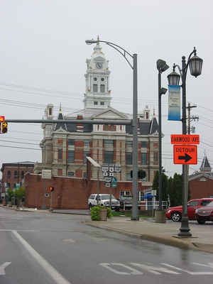
Henry County is a county located in the state of Ohio. Based on the 2010 census, the population was 28,215. Its county seat is Napoleon.
The county was created in 1820 and later organized in 1834. It is named for Patrick Henry, the Virginian famous for his "give me liberty or
give me death" speech.
Etymology - Origin of Henry County Name
Residents named the county in honor of Patrick Henry, a hero of the American Revolution.
Demographics:
County QuickFacts: CensusBureau Quick Facts
Henry County History
On February 12, 1820, the Ohio government authorized the creation of Henry County, although the county remained a part of Wood County until 1824 and a portion of Williams County until 1834. Residents named the county in honor of Patrick Henry, a hero of the American Revolution. Previously, the
county had been part of land reserved to Ohio's Indian people, under the Treaty of Greeneville.
Henry County is located in northwestern Ohio in what used to be the Great Black Swamp. It is predominantly rural, with less than one percent of the county's 417 square miles consisting of urban areas. The county seat is Napoleon. With a population of 9,318 people, Napoleon was the county's largest
community in 2000. Many residents of Ohio's rural communities are seeking better lives and more opportunities in the state's cities, but Henry County's population seems to be remaining stable. The county experienced a less than one percent decline in population between 1990 and 2000, leaving the
total number of residents at 29,210. The county averages seventy people per square mile.
Farming is the largest employer in Henry County, with ninety-one percent of the county as farm fields. Henry County farmers are Ohio's third largest producers of wheat. Manufacturing businesses and retail positions are the second and third largest employers in the county, following well behind
farming in the number of people employed. A Campbell Soup plant is the primary manufacturing establishment in the county. In 1999, the per capita income in the county was almost nineteen thousand dollars, with 6.4 percent of the people living in poverty.
Most voters in Henry County claim to be independents, yet in recent years, they have overwhelmingly supported Republican Party candidates at the national level.
Among the county's most notorious residents was backwoodsmen Simon Girty.
Sources
Henry County, Ohio History Central, July 23, 2008,
http://www.ohiohistorycentral.org/entry.php?rec=1942&nm=Henry-County
Geography: Land and Water
As reported by the Census Bureau, the county has a total area of 420 square miles (1,100 km2), of which 416 square miles (1,080 km2) is land and 3.7 square miles (9.6 km2) (0.9%) is water.
Neighboring Counties
Bordering counties are as follows:
- Fulton County (north)
- Lucas County (northeast)
- Wood County (east)
- Putnam County (south)
- Defiance County (west)
- Williams County (northwest)
- Hancock County (southeast corner)
Education


Click Image to Enlarge
