


Click Image to Enlarge
Ohio Counties
There is eighty-eight counties in the state of Ohio. Washington County the oldest in the state established on July 27, 1788. Noble County was formed on March 11, 1851 from portions of Guernsey, Morgan, Monroe and Washington counties. It was the last county to be formed in Ohio and, therefore, represents the youngest county in the state.Knox County, Ohio
Knox County Education, Geography, and History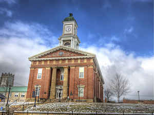
Knox County is a county located in the state of Ohio. Based on the 2010 census, the population was 60,921. Its county seat is Mount
Vernon. The county is named for Henry Knox, an officer in the American Revolutionary War who was later the first Secretary of War.
Knox County comprises the Mount Vernon, OH Micropolitan Statistical Area, which is also included in the Columbus-Marion-Zanesville, OH
Combined Statistical Area.
Etymology - Origin of Knox County Name
Resident named the county in honor of Henry Knox, a hero from the War of 1812 and the first United States Secretary of War.
Demographics:
County QuickFacts: CensusBureau Quick Facts
Knox County History
On January 30, 1808, the Ohio government authorized the creation of Knox County. Resident named the county in honor of Henry Knox, a hero from the War of 1812 and the first United States Secretary of War. Knox County was originally part of Fairfield County.
Knox County is located in the northeastern part of central Ohio. It is predominantly rural, with less than one percent of the county's 527 square miles consisting of urban areas. The county seat is Mount Vernon, which, with a population of 14,375 people, was the county's largest community in 2000.
Knox County experienced a significant increase in population- roughly 14.8 percent- between 1990 and 2000, raising the total number of residents to 54,500 people. Many residents of Ohio's rural communities are seeking better lives and more opportunities in the state's cities, but Knox County is
increasing in population. The county averages 103 people per square mile.
Farming is the largest employer in Knox County, with sixty percent of the county's acreage under cultivation. Within Ohio, Knox County farmers rank first in sheep raising. Manufacturing positions and service industries finish a close second and third behind agriculture. In 1999, the per capita
income in the county was 20,850 dollars, with just over ten percent of the people living in poverty.
Most voters in Knox County claim to be independents, yet in recent years, they have overwhelmingly supported Republican Party candidates at the national level.
Composer Daniel Emmett and Civil War nurse Mary Ann Ball Bickerdyke were among Knox County's more prominent residents. The county also is home to Kenyon College, established by Episcopalian Philander Chase in 1824.
Sources
Knox County, Ohio History Central, July 24, 2008,
http://www.ohiohistorycentral.org/entry.php?rec=1954&nm=Knox-County
Geography: Land and Water
As reported by the Census Bureau, the county has a total area of 530 square miles (1,400 km2), of which 525 square miles (1,360 km2) is land and 4.1 square miles (11 km2) (0.8%) is water.Approximately 58% of the county is farmland and 28% is forested. Most of the county lies in the Glaciated Allegheny Plateau with rolling hills and valleys. Although the relief is not sharp, some elevations in the county reach over 1400 feet above sea level.
Neighboring Counties
Bordering counties are as follows:
- Richland County (north)
- Ashland County (far northeast)
- Holmes County (northeast)
- Coshocton County (east)
- Licking County (south)
- Delaware County (southwest)
- Morrow County (northwest)
Education
Kenyon College
Mount Vernon Nazarene University
Central Ohio Technical College


Click Image to Enlarge
