


Click Image to Enlarge
Ohio Counties
There is eighty-eight counties in the state of Ohio. Washington County the oldest in the state established on July 27, 1788. Noble County was formed on March 11, 1851 from portions of Guernsey, Morgan, Monroe and Washington counties. It was the last county to be formed in Ohio and, therefore, represents the youngest county in the state.Meigs County, Ohio
Meigs County Education, Geography, and History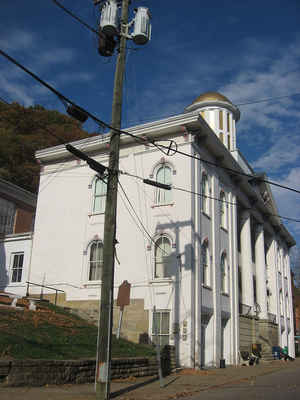
Meigs County is a county located in the state of Ohio. Based on the 2010 census, the population was 23,770. Its county seat is Pomeroy. The county is named for Return J. Meigs, Jr., the fourth Governor of Ohio
Etymology - Origin of Meigs County Name
Residents named the county in honor of Return Jonathan Meigs, Jr., a former governor of Ohio.
Demographics:
County QuickFacts: CensusBureau Quick Facts
Meigs County History
On January 21, 1819, the Ohio government authorized the creation of Meigs County. Residents named the county in honor of Return Jonathan Meigs, Jr., a former governor of Ohio. The county used to be parts of Gallia and Athens Counties. During the American Civil War, the Battle of Buffington Island
took place in Meigs County. This was the only battle to occur in Ohio. The Ohio Historical Society maintains a monument to the Battle of Buffington Island in Meigs County.
Meigs County is located in southeastern Ohio. The county's southern border lies along the Ohio River. It is predominantly rural, with less than one percent of the county's 429 square miles consisting of urban areas. The county is also in the heart of Appalachia. The county seat is Pomeroy. With a
population of 1,966 people, Pomeroy was the county's third largest community in 2000, ranking behind Middleport (2,525 residents) and Chester Township (2,332 residents). Unlike many of Ohio's more rural counties, Meigs County's population has remained relatively steady, with the total number of
residents at 23,072 people in 2000. The county averages fifty-four people per square mile.
The largest employers in Meigs County are farms, government positions and retail businesses. During the nineteenth century, county residents earned money especially through coal mining, iron ore excavation, and salt processing. In 1999, the per capita income in the county was 16,436 dollars, with
20.4 percent of the people living in poverty. This is one of the lowest per capita income averages and highest poverty rates in Ohio.
Most voters in Meigs County claim to be independents, yet in recent years, they have overwhelmingly supported Republican Party candidates at the national level.
Sources
Meigs County, Ohio History Central, July 24, 2008,
http://www.ohiohistorycentral.org/entry.php?rec=1976&nm=Meigs-County
Geography: Land and Water
As reported by the Census Bureau, the county has a total area of 433 square miles (1,120 km2), of which 430 square miles (1,100 km2) is
land and 2.9 square miles (7.5 km2) (0.7%) is water. The Ohio River forms the eastern and southern boundaries of the county, the other side of
which is located in West Virginia.
Meigs County lies in the Appalachian Plateau physiographic region of the Appalachian Mountains. The landscape is considered to be anywhere
from gently rolling to rugged, typical of a dissected plateau. Elevations range from 1,020 feet (310 m) asl (above sea level) in the southwest
to about 535 feet (163 m) asl in the far south central part of the county along the Ohio River. The majority of Meigs County is drained by two
subwatersheds of the Ohio River, Shade River and Leading Creek. Another stream of note is Raccoon Creek, which flows through a small area of
the northwestern corner of the county.
Neighboring Counties
Bordering counties are as follows:
- Athens County (north)
- Wood County, West Virginia (northeast)
- Jackson County, West Virginia (east)
- Mason County, West Virginia (southeast)
- Gallia County (southwest)
- Vinton County (west)
Education
Meigs county schools include:
Meigs Elementary School
Meigs Middle School
Meigs High School
Eastern High School
Southern High School


Click Image to Enlarge
