


Click Image to Enlarge
Ohio Counties
There is eighty-eight counties in the state of Ohio. Washington County the oldest in the state established on July 27, 1788. Noble County was formed on March 11, 1851 from portions of Guernsey, Morgan, Monroe and Washington counties. It was the last county to be formed in Ohio and, therefore, represents the youngest county in the state.Monroe County, Ohio
Monroe County Education, Geography, and History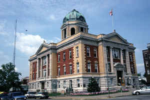
Monroe County is a county located in the state of Ohio. Based on the 2010 census, the population was 14,642, making it the second-least populous county in Ohio. Its county seat is Woodsfield. The county was created in 1813 and later organized in 1815.
Etymology - Origin of Monroe County Name
Residents named the county in honor of James Monroe, the current United States Secretary of State and eventually the fourth president of the United States.
Demographics:
County QuickFacts: CensusBureau Quick Facts
Monroe County History
On January 29, 1813, the Ohio government authorized the creation of Monroe County. Residents named the county in honor of James Monroe, the current United States Secretary of State and eventually the fourth president of the United States. The county used to be parts of Belmont, Guernsey, and
Washington Counties.
Monroe County is located in eastern Ohio. The county's eastern border lies along the Ohio River. It is predominantly rural, with less than one percent of the county's 456 square miles consisting of urban areas. The county is also in the heart of Appalachia. The county seat is Woodsfield. With a
population of 2,598 people, Woodsfield was the county's largest community in 2000. Like many of Ohio's more rural counties, Monroe County's population has declined in recent years. Between 1990 and 2000, the county's population declined by two percent, reducing the total number of residents to
15,180 people in 2000. The county averages thirty-three people per square mile, making it one of Ohio's least populous counties.
Agriculture is the largest employer in Monroe County, with manufacturing a close second. No other occupation draws more than one thousand workers. During the nineteenth century, county residents earned money especially through oil and gas drilling and coal mining. In 1999, the per capita income in
the county was 17,702 dollars, with 16.9 percent of the people living in poverty.
Most voters in Monroe County claim to be independents, yet in recent years, they have supported Democratic Party candidates by slim margins at the national level.
Frontiersman Lewis Wetzel ranks as one of the county's more famous residents
Sources
Monroe County, Ohio History Central, July 24, 2008,
http://www.ohiohistorycentral.org/entry.php?rec=1980&nm=Monroe-County
Geography: Land and Water
As reported by the Census Bureau, the county has a total area of 457 square miles (1,180 km2), of which 456 square miles (1,180 km2) is land and 1.7 square miles (4.4 km2) (0.4%) is water.
Neighboring Counties
Bordering counties are as follows:
- Belmont County (north)
- Marshall County, West Virginia (northeast)
- Wetzel County, West Virginia (east)
- Tyler County, West Virginia (southeast)
- Washington County (south)
- Noble County (west)
Education


Click Image to Enlarge
