


Click Image to Enlarge
Ohio Counties
There is eighty-eight counties in the state of Ohio. Washington County the oldest in the state established on July 27, 1788. Noble County was formed on March 11, 1851 from portions of Guernsey, Morgan, Monroe and Washington counties. It was the last county to be formed in Ohio and, therefore, represents the youngest county in the state.Ottawa County, Ohio
Ottawa County Education, Geography, and History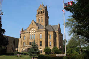
Ottawa County is a county located in the state of Ohio. Based on the 2010 census, the population was 41,428. Its county seat is Port
Clinton. The county is named either for the Ottawa Indians who lived there, or for an Indian word meaning "trader".
Ottawa County comprises the Port Clinton, OH Micropolitan Statistical Area, which is also included in the Toledo-Port Clinton, OH Combined
Statistical Area.
Etymology - Origin of Ottawa County Name
Residents took the Indian word for "trader" as the county's name.
Demographics:
County QuickFacts: CensusBureau Quick Facts
Ottawa County History
On March 6, 1840, the State of Ohio authorized the creation of Ottawa County. Residents took the Indian word for "trader" as the county's name. Ottawa County was originally part of territory set aside for Ohio's Indian people by the Treaty of Greeneville. During the War of 1812, the Battle of
Lake Erie occurred off the coastline of Ottawa County. The county's Johnson's Island served as a prisoner of war camp during the American Civil War.
Ottawa County is located in the northwestern portion of Ohio. The county seat is Port Clinton. It is the county's largest population center, with 6,391 residents in 2000. The county experienced a 2.4 percent increase in population between 1990 and 2000. This raised the number of residents to 40,985
people. Many of these new residents had left nearby Toledo. An average of 161 people lives in each of Ottawa County's 255 square miles. The county's average income was 27,370 dollars per person in 1999, with almost seven percent of the population living in poverty.
Ottawa County is primarily rural, with urban areas comprising five percent of the county's land area. Most residents find employment in retail businesses, with manufacturing establishments and service industries coming in second and third respectively. The county is a major tourist destination.
Middle Bass Island and other various resorts along Lake Erie attract thousands of visitors each year. The oldest lighthouse in Ohio, Marblehead Lighthouse is located in the county as well. A large number of people visit the county to take part in boating, fishing, and other recreational activities
along or on Lake Erie.
Ottawa County is the home of Camp Perry, the Ohio National Guard's primary training base.
Most voters in Ottawa County claim to be independents, yet in recent years, they have supported by slim margins Republican Party candidates at the national level.
Sources
Ottawa County, Ohio History Central, July 24, 2008,
http://www.ohiohistorycentral.org/entry.php?rec=1992&nm=Ottawa-County
Geography: Land and Water
As reported by the Census Bureau, the county has a total area of 585 square miles (1,520 km2), of which 255 square miles (660 km2) is land and 330 square miles (850 km2) (56%) is water. It is the third-smallest county in Ohio by land area. It borders Ontario across Lake Erie
Neighboring Counties
Bordering counties are as follows:
- Across Lake Erie lies Essex County, Ontario, Canada (north and east)
- Erie County (southeast)
- Sandusky County (south)
- Wood County (west)
- Lucas County (northwest)
Education


Click Image to Enlarge
