


Click Image to Enlarge
Ohio Counties
There is eighty-eight counties in the state of Ohio. Washington County the oldest in the state established on July 27, 1788. Noble County was formed on March 11, 1851 from portions of Guernsey, Morgan, Monroe and Washington counties. It was the last county to be formed in Ohio and, therefore, represents the youngest county in the state.Preble County, Ohio
Preble County Education, Geography, and History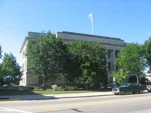
Preble County is a county located in the state of Ohio. Based on the 2010 census, the population was 42,270. Its county seat is Eaton. The county was formed on February 15, 1808 from portions of Butler and Montgomery Counties. It is named for Edward Preble, a naval officer who fought in the American Revolutionary War and against the Barbary Pirates.
Etymology - Origin of Preble County Name
Residents named the county in honor of Edward Preble, a hero of the American Revolution.
Demographics:
County QuickFacts: CensusBureau Quick Facts
Preble County History
On February 15, 1808, the Ohio government authorized the creation of Preble County. Residents named the county in honor of Edward Preble, a hero of the American Revolution.
Preble County is located in the western part of Ohio. Its western border helps form the boundary between Ohio and Indiana. The county seat is Eaton, which is the largest city in the county with a population of 8,133 people in 2000. Approximately seventy-three percent of Preble County's 425 square
miles are covered in farms. Only 1.4 percent of the county is deemed urban. The county averages almost one hundred people living in each square mile. Between 1990 and 2000, the county experienced a 5.5 percent increase in population, as many residents of Cincinnati, in nearby Hamilton County, sought
to escape the larger city's busyness. In 2000, the county's residents numbered 42,337 people.
Most of Preble County's residents find employment in agricultural positions. In the state, the county ranks fifth in hog raising and seventh in corn production. Manufacturing, retail, and government positions finish second, third, and fourth respectively. In 1999, the per capita income was 22,272
dollars, with eight percent of the county's residents living below the poverty level.
Most voters in Preble County claim to be independents, yet in recent years, they have overwhelmingly supported Republican Party candidates at the national level.
The county is home to the only remaining double-barreled cover bridge in Ohio. Known as the Roberts Covered Bridge, the structure has stood since 1829. Songwriter Benjamin Hanby ranks among Preble County's more prominent residents.
Sources
Preble County, Ohio History Central, July 24, 2008,
http://www.ohiohistorycentral.org/entry.php?rec=2003&nm=Preble-County
Geography: Land and Water
As reported by the Census Bureau, the county has a total area of 426 square miles (1,100 km2), of which 424 square miles (1,100 km2) is land and 2.3 square miles (6.0 km2) (0.5%) is water.
Neighboring Counties
Bordering counties are as follows:
- Darke County (north)
- Montgomery County (east)
- Butler County (south)
- Union County, Indiana (southwest)
- Wayne County, Indiana (northwest)
Education
Public school districts
Eaton Community Schools
National Trail Local School District
Preble Shawnee Local School District
Tri-County North Local School District
Twin Valley Community Local School District
Union County College Corner Joint School District
Higher education
Sinclair Community College
Preble County Learning Center, Eaton


Click Image to Enlarge
