


Click Image to Enlarge
Ohio Counties
There is eighty-eight counties in the state of Ohio. Washington County the oldest in the state established on July 27, 1788. Noble County was formed on March 11, 1851 from portions of Guernsey, Morgan, Monroe and Washington counties. It was the last county to be formed in Ohio and, therefore, represents the youngest county in the state.Richland County, Ohio
Richland County Education, Geography, and History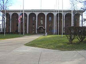
Richland County is a county located in the state of Ohio. Based on the 2010 census, the population was 124,475. Its county seat is
Mansfield. The county was created in 1808 and later organized in 1813.It is named for the fertile soil found there.
Richland County is included in the Mansfield, OH Metropolitan Statistical Area as well as the Mansfield-Ashland-Bucyrus, OH Combined
Statistical Area. The county is part of Northeast Ohio.
Etymology - Origin of Richland County Name
Residents named the county after its rich soil.
Demographics:
County QuickFacts: CensusBureau Quick Facts
Richland County History
On January 7, 1813, the Ohio government authorized the creation of Richland County. Residents named the county after its rich soil. During the early nineteenth century, the county was home to John Chapman (Johnny Appleseed).
Richland County is located in northern Ohio. The county seat is Mansfield, which is the county's largest population center, with 49,346 residents in 2000. The county experienced a 2.2 percent increase in population between 1990 and 2000, raising the number of residents to 128,852 people. An average
of 259 people live in each of Richland County's 497 square miles.
Richland County is heavily rural, with urban areas comprising just three percent of the county's land mass. With more than one thousand farms existing in the county, many residents find employment in agriculture, with manufacturing establishments, sales positions, and service industries also
employing a large number of residents. Richland County also has a ski industry. It also is home to the Mansfield Correctional Facility. The county's average income was 22,721 dollars per person in 1999, with 11.5 percent of the population living in poverty.
Most voters in Richland County claim to be independents, yet in recent years, they have overwhelmingly supported Republican Party candidates at the national level.
In addition to Johnny Appleseed, the county also was home to United States Senator John Sherman, who practiced law in the area for a few years. Author and conservationist Louis Bromfield lived just south of Mansfield. His former home, Malabar Farm, is now a state park.
Sources
Richland County, Ohio History Central, July 24, 2008,
http://www.ohiohistorycentral.org/entry.php?rec=2006&nm=Richland-County
Geography: Land and Water
As reported by the Census Bureau, the county has a total area of 500 square miles (1,300 km2), of which 495 square miles (1,280 km2) is land and 4.8 square miles (12 km2) (1.0%) is water
Neighboring Counties
Bordering counties are as follows:
- Huron County (north)
- Ashland County (east)
- Knox County (south)
- Morrow County (southwest)
- Crawford County (west)
Education


Click Image to Enlarge
